Owens Topo Map Wyoming
To zoom in, hover over the map of Owens
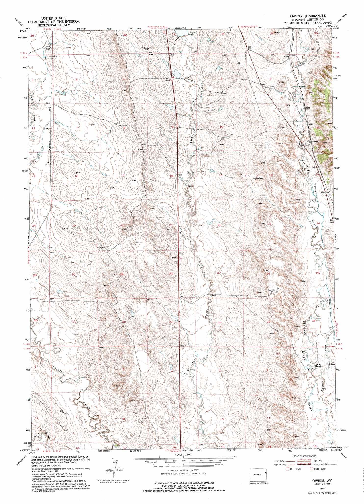
USGS Topo Quad 43104f2 - 1:24,000 scale
| Topo Map Name: | Owens |
| USGS Topo Quad ID: | 43104f2 |
| Print Size: | ca. 21 1/4" wide x 27" high |
| Southeast Coordinates: | 43.625° N latitude / 104.125° W longitude |
| Map Center Coordinates: | 43.6875° N latitude / 104.1875° W longitude |
| U.S. State: | WY |
| Filename: | o43104f2.jpg |
| Download Map JPG Image: | Owens topo map 1:24,000 scale |
| Map Type: | Topographic |
| Topo Series: | 7.5´ |
| Map Scale: | 1:24,000 |
| Source of Map Images: | United States Geological Survey (USGS) |
| Alternate Map Versions: |
Owens WY 1951, updated 1953 Download PDF Buy paper map Owens WY 1951, updated 1958 Download PDF Buy paper map Owens WY 1951, updated 1995 Download PDF Buy paper map Owens WY 2012 Download PDF Buy paper map Owens WY 2015 Download PDF Buy paper map |
1:24,000 Topo Quads surrounding Owens
Osage |
Pedro |
Cambria |
Moon |
Preacher Spring |
Klodt Reservoir |
Osage Se |
Newcastle |
Fanny Peak |
Dead Horse Flats |
Timber Creek |
Morrisey Ne |
Owens |
Clifton |
Jewel Cave Nw |
Morrisey |
Morrisey Se |
Dewey Sw |
Dewey |
Jewel Cave Sw |
Threemile Butte |
Little Alkali Creek |
Riverview |
Twentyone Divide |
Burdock |
> Back to 43104e1 at 1:100,000 scale
> Back to 43104a1 at 1:250,000 scale
> Back to U.S. Topo Maps home
Owens topo map: Gazetteer
Owens: Dams
Howell Dam elevation 1224m 4015′Rosean Dam elevation 1235m 4051′
Owens: Reservoirs
Howell Reservoir elevation 1224m 4015′Rosean Reservoir elevation 1235m 4051′
Owens: Streams
Whoopup Creek elevation 1172m 3845′Owens digital topo map on disk
Buy this Owens topo map showing relief, roads, GPS coordinates and other geographical features, as a high-resolution digital map file on DVD:
Eastern Wyoming & Western South Dakota
Buy digital topo maps: Eastern Wyoming & Western South Dakota