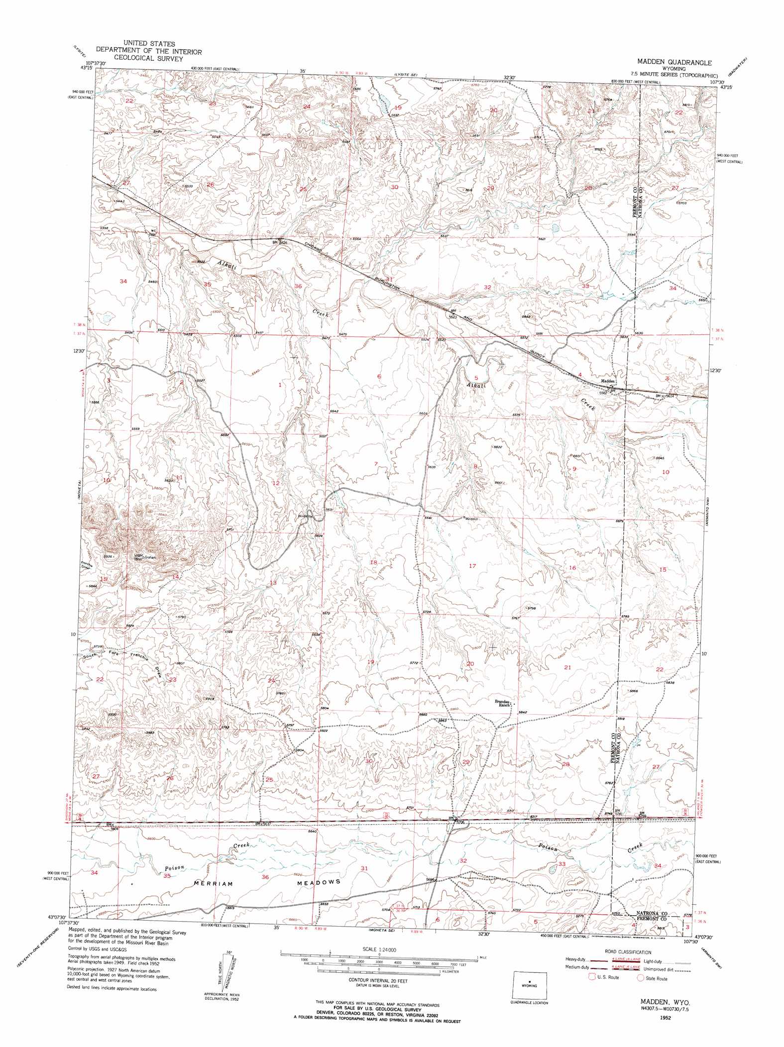
Madden Topo Map Wyoming
To zoom in, hover over the map of Madden
USGS Topo Quad 43107b5 - 1:24,000 scale
| Topo Map Name: | Madden |
| USGS Topo Quad ID: | 43107b5 |
| Print Size: | ca. 21 1/4" wide x 27" high |
| Southeast Coordinates: | 43.125° N latitude / 107.5° W longitude |
| Map Center Coordinates: | 43.1875° N latitude / 107.5625° W longitude |
| U.S. State: | WY |
| Filename: | o43107b5.jpg |
| Download Map JPG Image: | Madden topo map 1:24,000 scale |
| Map Type: | Topographic |
| Topo Series: | 7.5´ |
| Map Scale: | 1:24,000 |
| Source of Map Images: | United States Geological Survey (USGS) |
| Alternate Map Versions: |
Madden WY 1952, updated 1953 Download PDF Buy paper map Madden WY 2012 Download PDF Buy paper map Madden WY 2015 Download PDF Buy paper map |
1:24,000 Topo Quads surrounding Madden
De Pass |
Arapahoe Butte |
Cottonwood Pass |
Sioux Pass |
Badwater Ne |
Gates Butte |
Lysite |
Lysite Se |
Badwater |
Badwater Se |
Squaw Butte Ne |
Moneta |
Madden |
Arminto Nw |
Arminto |
Squaw Butte |
Seventy One Reservoir |
Moneta Se |
Arminto Sw |
Hiland |
Butte Well |
Love Ranch |
Miles Ranch |
Ervay Basin |
Mcrae Gap |
> Back to 43107a1 at 1:100,000 scale
> Back to 43106a1 at 1:250,000 scale
> Back to U.S. Topo Maps home
Madden topo map: Gazetteer
Madden: Dams
Alkali Dam elevation 1686m 5531′Madden: Flats
Merriam Meadows elevation 1715m 5626′Madden: Mines
Lux Number Four Mine elevation 1709m 5606′Madden: Populated Places
Madden elevation 1702m 5583′Madden: Reservoirs
Alkali Reservoir elevation 1686m 5531′Madden digital topo map on disk
Buy this Madden topo map showing relief, roads, GPS coordinates and other geographical features, as a high-resolution digital map file on DVD:
Eastern Wyoming & Western South Dakota
Buy digital topo maps: Eastern Wyoming & Western South Dakota