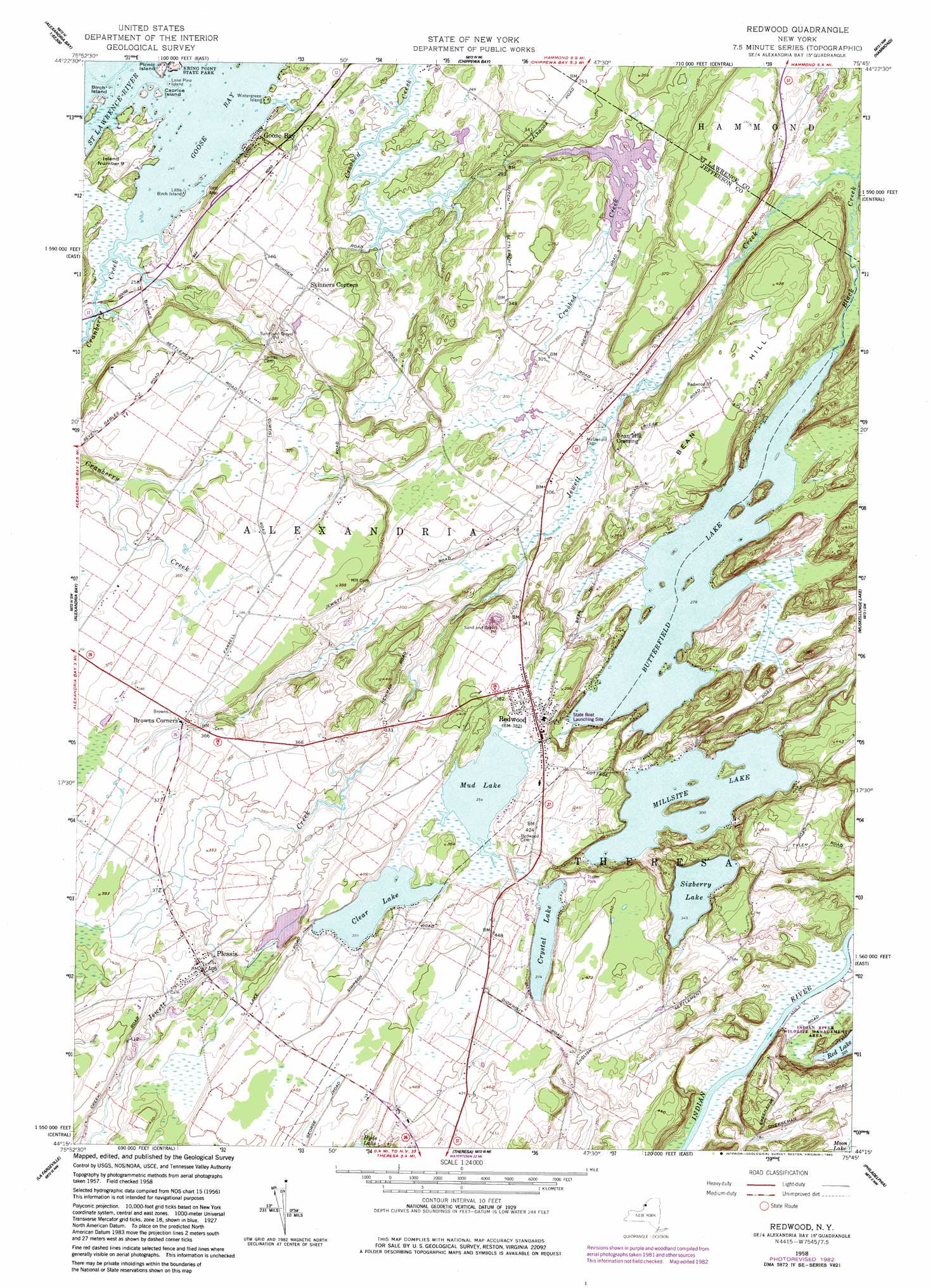
Redwood Topo Map New York
To zoom in, hover over the map of Redwood
USGS Topo Quad 44075c7 - 1:24,000 scale
| Topo Map Name: | Redwood |
| USGS Topo Quad ID: | 44075c7 |
| Print Size: | ca. 21 1/4" wide x 27" high |
| Southeast Coordinates: | 44.25° N latitude / 75.75° W longitude |
| Map Center Coordinates: | 44.3125° N latitude / 75.8125° W longitude |
| U.S. State: | NY |
| Filename: | o44075c7.jpg |
| Download Map JPG Image: | Redwood topo map 1:24,000 scale |
| Map Type: | Topographic |
| Topo Series: | 7.5´ |
| Map Scale: | 1:24,000 |
| Source of Map Images: | United States Geological Survey (USGS) |
| Alternate Map Versions: |
Redwood NY 1958, updated 1960 Download PDF Buy paper map Redwood NY 1958, updated 1960 Download PDF Buy paper map Redwood NY 1958, updated 1983 Download PDF Buy paper map Redwood NY 2010 Download PDF Buy paper map Redwood NY 2013 Download PDF Buy paper map Redwood NY 2016 Download PDF Buy paper map |
1:24,000 Topo Quads surrounding Redwood
Morristown |
Edwardsville |
|||
Chippewa Bay |
Hammond |
Pope Mills |
||
Thousand Island Park |
Alexandria Bay |
Redwood |
Muskellunge Lake |
Natural Dam |
Clayton |
La Fargeville |
Theresa |
Philadelphia |
Antwerp |
Dexter |
Brownville |
Black River |
Deferiet |
North Wilna |
> Back to 44075a1 at 1:100,000 scale
> Back to 44074a1 at 1:250,000 scale
> Back to U.S. Topo Maps home
Redwood topo map: Gazetteer
Redwood: Bays
Goose Bay elevation 74m 242′Redwood: Islands
Birch Island elevation 78m 255′Caprice Island elevation 74m 242′
Cork Island elevation 76m 249′
Island Number Nine elevation 78m 255′
Little Birch Island elevation 75m 246′
Lone Pine Island elevation 74m 242′
Picnic Island elevation 78m 255′
Portage Island elevation 76m 249′
Three Sisters elevation 75m 246′
Wintergreen Island elevation 76m 249′
Redwood: Lakes
Butterfield Lake elevation 85m 278′Clear Lake elevation 108m 354′
Crystal Lake elevation 114m 374′
Millsite Lake elevation 91m 298′
Mud Lake elevation 108m 354′
Sixberry Lake elevation 105m 344′
Redwood: Parks
Indian River Wildlife Management Area elevation 99m 324′Redwood: Populated Places
Bean Hill Crossing elevation 107m 351′Browns Corners elevation 113m 370′
Goose Bay elevation 78m 255′
Plessis elevation 123m 403′
Redwood elevation 112m 367′
Redwood: Streams
Cranberry Creek elevation 76m 249′Jewett Creek elevation 84m 275′
Redwood: Summits
Bean Hill elevation 130m 426′Redwood digital topo map on disk
Buy this Redwood topo map showing relief, roads, GPS coordinates and other geographical features, as a high-resolution digital map file on DVD:
New York, Vermont, Connecticut & Western Massachusetts
Buy digital topo maps: New York, Vermont, Connecticut & Western Massachusetts