Brownville Topo Map New York
To zoom in, hover over the map of Brownville
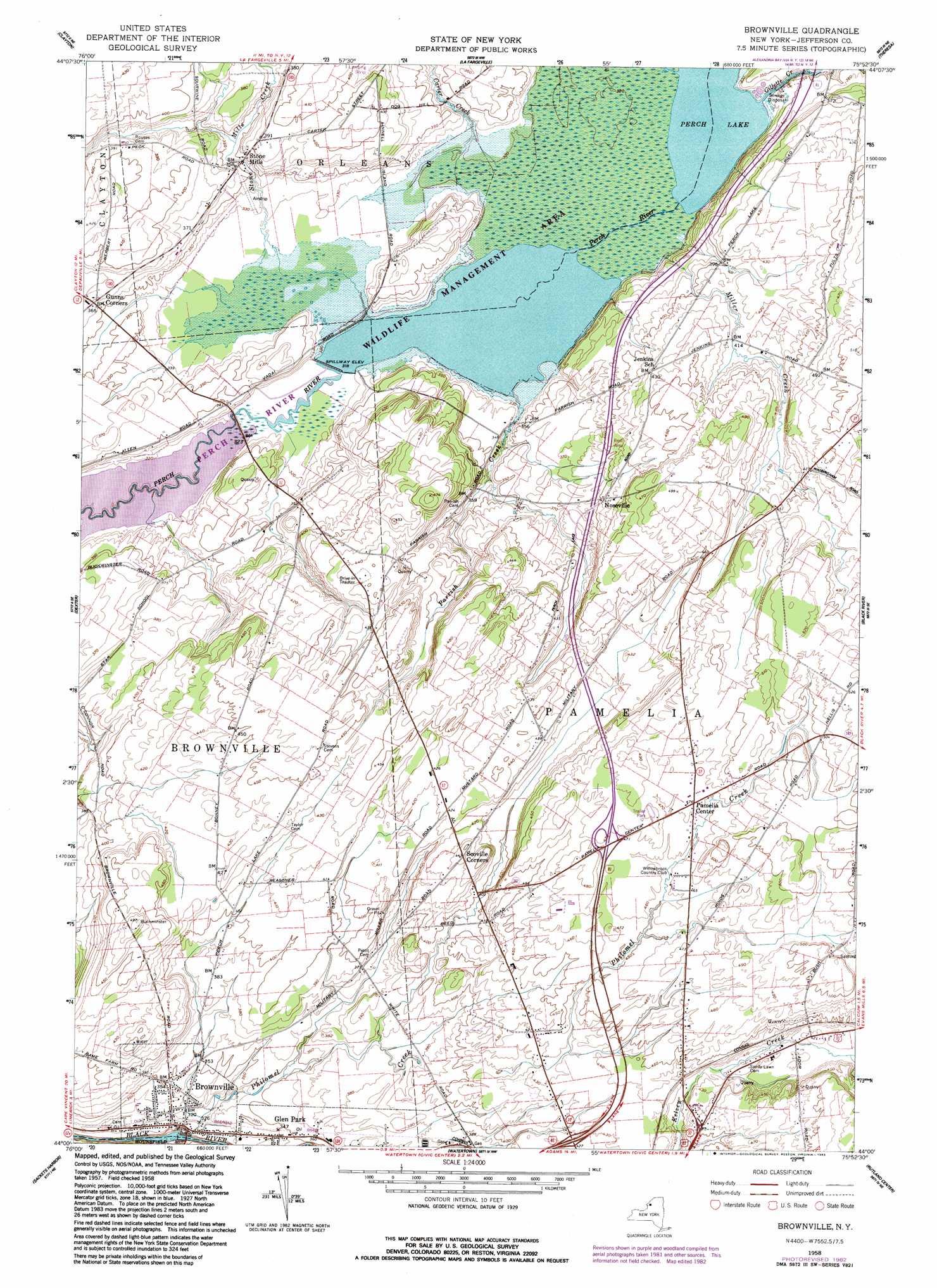
USGS Topo Quad 44075a8 - 1:24,000 scale
| Topo Map Name: | Brownville |
| USGS Topo Quad ID: | 44075a8 |
| Print Size: | ca. 21 1/4" wide x 27" high |
| Southeast Coordinates: | 44° N latitude / 75.875° W longitude |
| Map Center Coordinates: | 44.0625° N latitude / 75.9375° W longitude |
| U.S. State: | NY |
| Filename: | o44075a8.jpg |
| Download Map JPG Image: | Brownville topo map 1:24,000 scale |
| Map Type: | Topographic |
| Topo Series: | 7.5´ |
| Map Scale: | 1:24,000 |
| Source of Map Images: | United States Geological Survey (USGS) |
| Alternate Map Versions: |
Brownville NY 1958, updated 1960 Download PDF Buy paper map Brownville NY 1958, updated 1976 Download PDF Buy paper map Brownville NY 1958, updated 1983 Download PDF Buy paper map Brownville NY 2011 Download PDF Buy paper map Brownville NY 2013 Download PDF Buy paper map Brownville NY 2016 Download PDF Buy paper map |
1:24,000 Topo Quads surrounding Brownville
Gananoque |
Thousand Island Park |
Alexandria Bay |
Redwood |
Muskellunge Lake |
Saint Lawrence |
Clayton |
La Fargeville |
Theresa |
Philadelphia |
Chaumont |
Dexter |
Brownville |
Black River |
Deferiet |
Henderson Bay |
Sackets Harbor |
Watertown |
Rutland Center |
Copenhagen |
Henderson |
Adams |
Rodman |
Barnes Corners |
New Boston |
> Back to 44075a1 at 1:100,000 scale
> Back to 44074a1 at 1:250,000 scale
> Back to U.S. Topo Maps home
Brownville topo map: Gazetteer
Brownville: Parks
Perch River State Game Management Area elevation 97m 318′Brownville: Populated Places
Brownville elevation 106m 347′Glen Park elevation 104m 341′
Noseville elevation 126m 413′
Stone Mills elevation 110m 360′
Brownville: Reservoirs
Perch Lake elevation 97m 318′Brownville: Streams
Carter Creek elevation 97m 318′Gillette Creek elevation 97m 318′
Miller Creek elevation 97m 318′
Parrish Creek elevation 97m 318′
Philomel Creek elevation 87m 285′
Stone Mills Creek elevation 97m 318′
Willow Creek elevation 127m 416′
Brownville digital topo map on disk
Buy this Brownville topo map showing relief, roads, GPS coordinates and other geographical features, as a high-resolution digital map file on DVD:
New York, Vermont, Connecticut & Western Massachusetts
Buy digital topo maps: New York, Vermont, Connecticut & Western Massachusetts