Four Bar J Ranch Topo Map Wyoming
To zoom in, hover over the map of Four Bar J Ranch
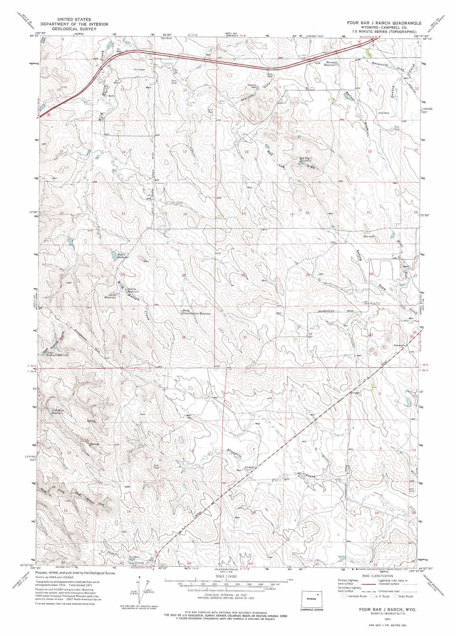
USGS Topo Quad 44105b6 - 1:24,000 scale
| Topo Map Name: | Four Bar J Ranch |
| USGS Topo Quad ID: | 44105b6 |
| Print Size: | ca. 21 1/4" wide x 27" high |
| Southeast Coordinates: | 44.125° N latitude / 105.625° W longitude |
| Map Center Coordinates: | 44.1875° N latitude / 105.6875° W longitude |
| U.S. State: | WY |
| Filename: | o44105b6.jpg |
| Download Map JPG Image: | Four Bar J Ranch topo map 1:24,000 scale |
| Map Type: | Topographic |
| Topo Series: | 7.5´ |
| Map Scale: | 1:24,000 |
| Source of Map Images: | United States Geological Survey (USGS) |
| Alternate Map Versions: |
Four Bar J Ranch WY 1971, updated 1975 Download PDF Buy paper map Four Bar J Ranch WY 1971, updated 1975 Download PDF Buy paper map Four Bar J Ranch WY 2012 Download PDF Buy paper map Four Bar J Ranch WY 2015 Download PDF Buy paper map |
1:24,000 Topo Quads surrounding Four Bar J Ranch
Echeta |
Twentymile Butte |
Oriva Nw |
Rawhide School |
Moyer Springs |
Carr Draw |
Jeffers Draw |
Oriva |
Gillette West |
Gillette East |
Morgan Draw |
Scott Dam |
Four Bar J Ranch |
Appel Butte |
The Gap |
Bogie Draw |
Double Tanks |
Pleasantdale |
Scaper Reservoir |
The Gap Sw |
Fats Draw |
Wags Pinnacle |
Pepsson Draw |
Threemile Creek Reservoir |
Eagle Rock |
> Back to 44105a1 at 1:100,000 scale
> Back to 44104a1 at 1:250,000 scale
> Back to U.S. Topo Maps home
Four Bar J Ranch topo map: Gazetteer
Four Bar J Ranch: Dams
Myrtle Dam elevation 1464m 4803′Pearson Dam elevation 1442m 4730′
Four Bar J Ranch: Reservoirs
Bennor Reservoir elevation 1452m 4763′Coat Mine Reservoir elevation 1472m 4829′
Denton Reservoir elevation 1466m 4809′
Mrytle Reservoir elevation 1464m 4803′
Myrtle Reservoir elevation 1445m 4740′
North School Section Reservoir elevation 1464m 4803′
Red Top Reservoir elevation 1459m 4786′
Smith Reservoir elevation 1464m 4803′
Upper Bushnell Reservoir elevation 1473m 4832′
Four Bar J Ranch: Valleys
Pearson Draw elevation 1430m 4691′Red Top Draw elevation 1443m 4734′
Spring Draw elevation 1458m 4783′
Waterhole Draw elevation 1445m 4740′
Four Bar J Ranch digital topo map on disk
Buy this Four Bar J Ranch topo map showing relief, roads, GPS coordinates and other geographical features, as a high-resolution digital map file on DVD:
Eastern Wyoming & Western South Dakota
Buy digital topo maps: Eastern Wyoming & Western South Dakota