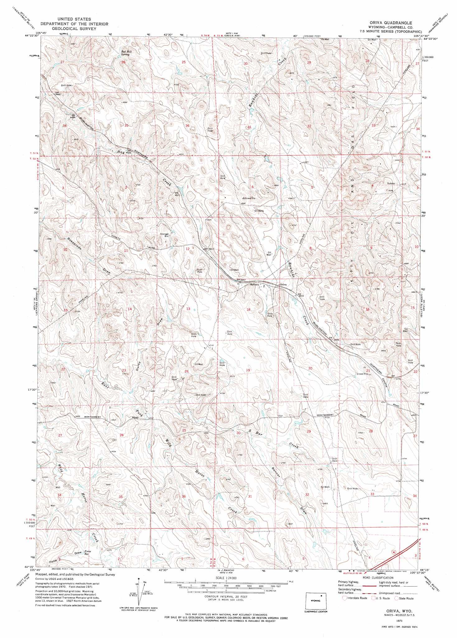
Oriva Topo Map Wyoming
To zoom in, hover over the map of Oriva
USGS Topo Quad 44105c6 - 1:24,000 scale
| Topo Map Name: | Oriva |
| USGS Topo Quad ID: | 44105c6 |
| Print Size: | ca. 21 1/4" wide x 27" high |
| Southeast Coordinates: | 44.25° N latitude / 105.625° W longitude |
| Map Center Coordinates: | 44.3125° N latitude / 105.6875° W longitude |
| U.S. State: | WY |
| Filename: | o44105c6.jpg |
| Download Map JPG Image: | Oriva topo map 1:24,000 scale |
| Map Type: | Topographic |
| Topo Series: | 7.5´ |
| Map Scale: | 1:24,000 |
| Source of Map Images: | United States Geological Survey (USGS) |
| Alternate Map Versions: |
Oriva WY 1971, updated 1974 Download PDF Buy paper map Oriva WY 2012 Download PDF Buy paper map Oriva WY 2015 Download PDF Buy paper map |
1:24,000 Topo Quads surrounding Oriva
Croton |
Truman Draw |
Wildcat |
Calf Creek |
Weston Sw |
Echeta |
Twentymile Butte |
Oriva Nw |
Rawhide School |
Moyer Springs |
Carr Draw |
Jeffers Draw |
Oriva |
Gillette West |
Gillette East |
Morgan Draw |
Scott Dam |
Four Bar J Ranch |
Appel Butte |
The Gap |
Bogie Draw |
Double Tanks |
Pleasantdale |
Scaper Reservoir |
The Gap Sw |
> Back to 44105a1 at 1:100,000 scale
> Back to 44104a1 at 1:250,000 scale
> Back to U.S. Topo Maps home
Oriva topo map: Gazetteer
Oriva: Oilfields
Kitty Oil and Gas Field elevation 1398m 4586′Oriva: Reservoirs
Force Reservoir elevation 1391m 4563′Oriva: Springs
Red Hill Spring elevation 1385m 4543′Oriva: Streams
South Bar Creek elevation 1380m 4527′Oriva: Valleys
Bennor Draw elevation 1415m 4642′Durky Draw elevation 1381m 4530′
Force Draw elevation 1384m 4540′
Oriva digital topo map on disk
Buy this Oriva topo map showing relief, roads, GPS coordinates and other geographical features, as a high-resolution digital map file on DVD:
Eastern Wyoming & Western South Dakota
Buy digital topo maps: Eastern Wyoming & Western South Dakota