Earthquake Lake Topo Map Montana
To zoom in, hover over the map of Earthquake Lake
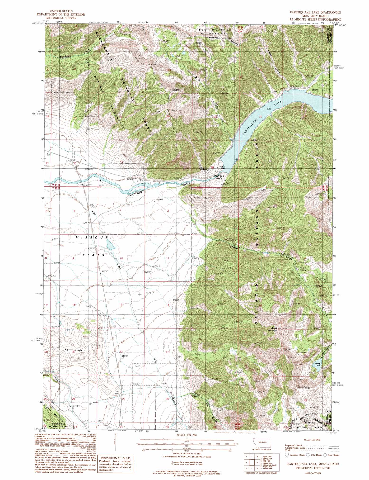
USGS Topo Quad 44111g4 - 1:24,000 scale
| Topo Map Name: | Earthquake Lake |
| USGS Topo Quad ID: | 44111g4 |
| Print Size: | ca. 21 1/4" wide x 27" high |
| Southeast Coordinates: | 44.75° N latitude / 111.375° W longitude |
| Map Center Coordinates: | 44.8125° N latitude / 111.4375° W longitude |
| U.S. States: | MT, ID |
| Filename: | o44111g4.jpg |
| Download Map JPG Image: | Earthquake Lake topo map 1:24,000 scale |
| Map Type: | Topographic |
| Topo Series: | 7.5´ |
| Map Scale: | 1:24,000 |
| Source of Map Images: | United States Geological Survey (USGS) |
| Alternate Map Versions: |
Earthquake Lake MT 1988, updated 1988 Download PDF Buy paper map Earthquake Lake MT 2000, updated 2005 Download PDF Buy paper map Earthquake Lake MT 2011 Download PDF Buy paper map Earthquake Lake MT 2014 Download PDF Buy paper map |
| FStopo: | US Forest Service topo Earthquake Lake is available: Download FStopo PDF Download FStopo TIF |
1:24,000 Topo Quads surrounding Earthquake Lake
Bucks Nest |
No Man Peak |
Koch Peak |
Lincoln Mountain |
Sunshine Point |
Granite Mountain |
Squaw Creek |
Hilgard Peak |
Pika Point |
Upper Tepee Basin |
Freezeout Mountain |
Cliff Lake |
Earthquake Lake |
Hebgen Dam |
Mount Hebgen |
Elk Springs |
Hidden Lake Bench |
Targhee Peak |
Targhee Pass |
Madison Arm |
Upper Red Rock Lake |
Mount Jefferson |
Sawtell Peak |
Big Springs |
Reas Pass |
> Back to 44111e1 at 1:100,000 scale
> Back to 44110a1 at 1:250,000 scale
> Back to U.S. Topo Maps home
Earthquake Lake topo map: Gazetteer
Earthquake Lake: Dams
Earthquake Lake Dam elevation 1977m 6486′Earthquake Lake: Lakes
Earthquake Lake elevation 1966m 6450′Sheep Lake elevation 2766m 9074′
Earthquake Lake: Post Offices
Montbestos Post Office (historical) elevation 2279m 7477′Earthquake Lake: Ranges
Henrys Lake Mountains elevation 3093m 10147′Earthquake Lake: Slopes
Madison Side elevation 1989m 6525′Madison Slide elevation 1962m 6437′
Earthquake Lake: Streams
Eagle Creek elevation 1948m 6391′Little Mile Creek elevation 2096m 6876′
Mile Creek elevation 1867m 6125′
Rock Creek elevation 1948m 6391′
Sheep Creek elevation 1889m 6197′
Earthquake Lake: Summits
Sheep Mountain elevation 3109m 10200′The Horn elevation 2077m 6814′
Earthquake Lake: Wells
12S02E03ABDB01 Well elevation 1892m 6207′Earthquake Lake digital topo map on disk
Buy this Earthquake Lake topo map showing relief, roads, GPS coordinates and other geographical features, as a high-resolution digital map file on DVD: