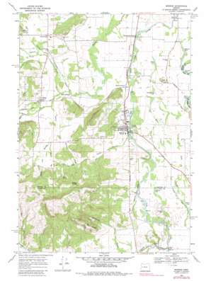
Monroe Topo Map Oregon
To zoom in, hover over the map of Monroe
USGS Topo Quad 44123c3 - 1:24,000 scale
| Topo Map Name: | Monroe |
| USGS Topo Quad ID: | 44123c3 |
| Print Size: | ca. 21 1/4" wide x 27" high |
| Southeast Coordinates: | 44.25° N latitude / 123.25° W longitude |
| Map Center Coordinates: | 44.3125° N latitude / 123.3125° W longitude |
| U.S. State: | OR |
| Filename: | o44123c3.jpg |
| Download Map JPG Image: | Monroe topo map 1:24,000 scale |
| Map Type: | Topographic |
| Topo Series: | 7.5´ |
| Map Scale: | 1:24,000 |
| Source of Map Images: | United States Geological Survey (USGS) |
| Alternate Map Versions: |
Monroe OR 1969, updated 1971 Download PDF Buy paper map Monroe OR 1969, updated 1983 Download PDF Buy paper map Monroe OR 2011 Download PDF Buy paper map Monroe OR 2014 Download PDF Buy paper map |
1:24,000 Topo Quads surrounding Monroe
> Back to 44123a1 at 1:100,000 scale
> Back to 44122a1 at 1:250,000 scale
> Back to U.S. Topo Maps home
Monroe topo map: Gazetteer
Monroe: Bridges
Bundy Bridge elevation 80m 262′Ferguson Bridge elevation 92m 301′
Monroe: Dams
Herman Nusbaum Dam elevation 102m 334′Monroe: Gaps
Coffee Gap elevation 117m 383′Monroe: Guts
Lake Slough elevation 89m 291′Monroe: Lakes
Garlinghouse Lake elevation 83m 272′Goodman Lake elevation 89m 291′
Graham Lake elevation 91m 298′
Hulbert Lake elevation 91m 298′
Martins Lake elevation 82m 269′
Oliver Lake elevation 83m 272′
Monroe: Populated Places
Alpine elevation 96m 314′Bellfountain elevation 101m 331′
Monroe elevation 87m 285′
Starrs Point (historical) elevation 104m 341′
Monroe: Post Offices
Alpine Post Office (historical) elevation 96m 314′Bellfountain Post Office (historical) elevation 101m 331′
Forks of Marys River Post Office (historical) elevation 94m 308′
Monroe Post Office elevation 87m 285′
Starrs Point Post Office (historical) elevation 104m 341′
Monroe: Reservoirs
Kinsey Reservoir elevation 107m 351′Nusbaum Farms Reservoir elevation 102m 334′
Monroe: Ridges
Win Ridge elevation 334m 1095′Monroe: Springs
Belknap Spring elevation 251m 823′Hewitt Spring elevation 168m 551′
Kyle Spring elevation 198m 649′
Monroe: Streams
Belknap Creek elevation 89m 291′Cherry Creek elevation 95m 311′
Eber Creek elevation 113m 370′
Ferguson Creek elevation 91m 298′
Hammer Creek elevation 87m 285′
Hawley Creek elevation 88m 288′
Kyle Creek elevation 91m 298′
Larsen Creek elevation 93m 305′
Miller Creek elevation 82m 269′
Nichols Creek elevation 92m 301′
Oliver Creek elevation 86m 282′
Reese Creek elevation 89m 291′
Shafer Creek elevation 85m 278′
South Fork Ferguson Creek elevation 111m 364′
Monroe: Summits
Oliver Butte elevation 112m 367′Monroe digital topo map on disk
Buy this Monroe topo map showing relief, roads, GPS coordinates and other geographical features, as a high-resolution digital map file on DVD:


