Greasy Hill Topo Map Montana
To zoom in, hover over the map of Greasy Hill
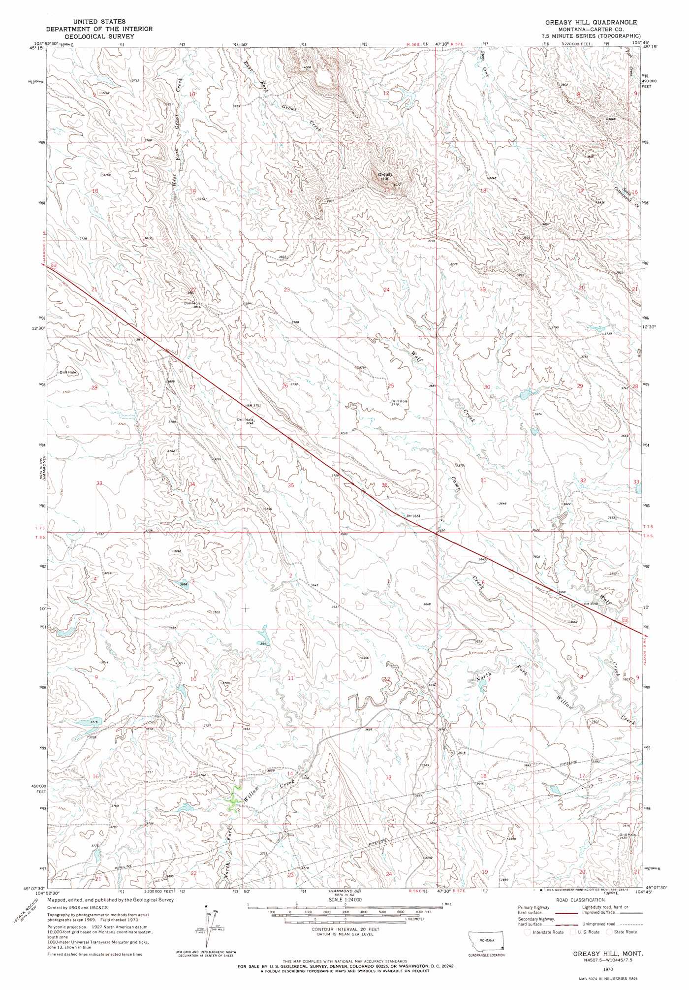
USGS Topo Quad 45104b7 - 1:24,000 scale
| Topo Map Name: | Greasy Hill |
| USGS Topo Quad ID: | 45104b7 |
| Print Size: | ca. 21 1/4" wide x 27" high |
| Southeast Coordinates: | 45.125° N latitude / 104.75° W longitude |
| Map Center Coordinates: | 45.1875° N latitude / 104.8125° W longitude |
| U.S. State: | MT |
| Filename: | o45104b7.jpg |
| Download Map JPG Image: | Greasy Hill topo map 1:24,000 scale |
| Map Type: | Topographic |
| Topo Series: | 7.5´ |
| Map Scale: | 1:24,000 |
| Source of Map Images: | United States Geological Survey (USGS) |
| Alternate Map Versions: |
Greasy Hill MT 1970, updated 1973 Download PDF Buy paper map Greasy Hill MT 2011 Download PDF Buy paper map Greasy Hill MT 2014 Download PDF Buy paper map |
1:24,000 Topo Quads surrounding Greasy Hill
Lightning Butte |
Pentecost Reservoir |
Knudson Draw Ne |
Whitetail Creek |
Ridgway |
Boyes |
Knudson Draw |
Phillipi Reservoir |
Tip Top Butte |
Potato Buttes |
Belle Creek North |
Hammond |
Greasy Hill |
Black Point |
Black Point Ne |
Belle Creek South |
Stack Rocks |
Hammond Se |
Cochran Reservoir |
Gomer Draw |
Rockypoint |
Moulton Creek |
Storm Draw |
Page Draw |
Gaff Creek |
> Back to 45104a1 at 1:100,000 scale
> Back to 45104a1 at 1:250,000 scale
> Back to U.S. Topo Maps home
Greasy Hill topo map: Gazetteer
Greasy Hill: Dams
Baby Willow Dam elevation 1113m 3651′Gardner Number 1 Dam elevation 1122m 3681′
Gerald Craft Number 1 Dam elevation 1139m 3736′
Gerald Craft Number 2 Dam elevation 1146m 3759′
Greasy Hill: Streams
Camp Creek elevation 1086m 3562′Wolf Creek elevation 1086m 3562′
Greasy Hill: Summits
Greasy Hill elevation 1238m 4061′Greasy Hill: Wells
08S56E14CACA01 Well elevation 1116m 3661′Greasy Hill digital topo map on disk
Buy this Greasy Hill topo map showing relief, roads, GPS coordinates and other geographical features, as a high-resolution digital map file on DVD:
Eastern Montana & Western North Dakota
Buy digital topo maps: Eastern Montana & Western North Dakota