Spring Gulch Topo Map Montana
To zoom in, hover over the map of Spring Gulch
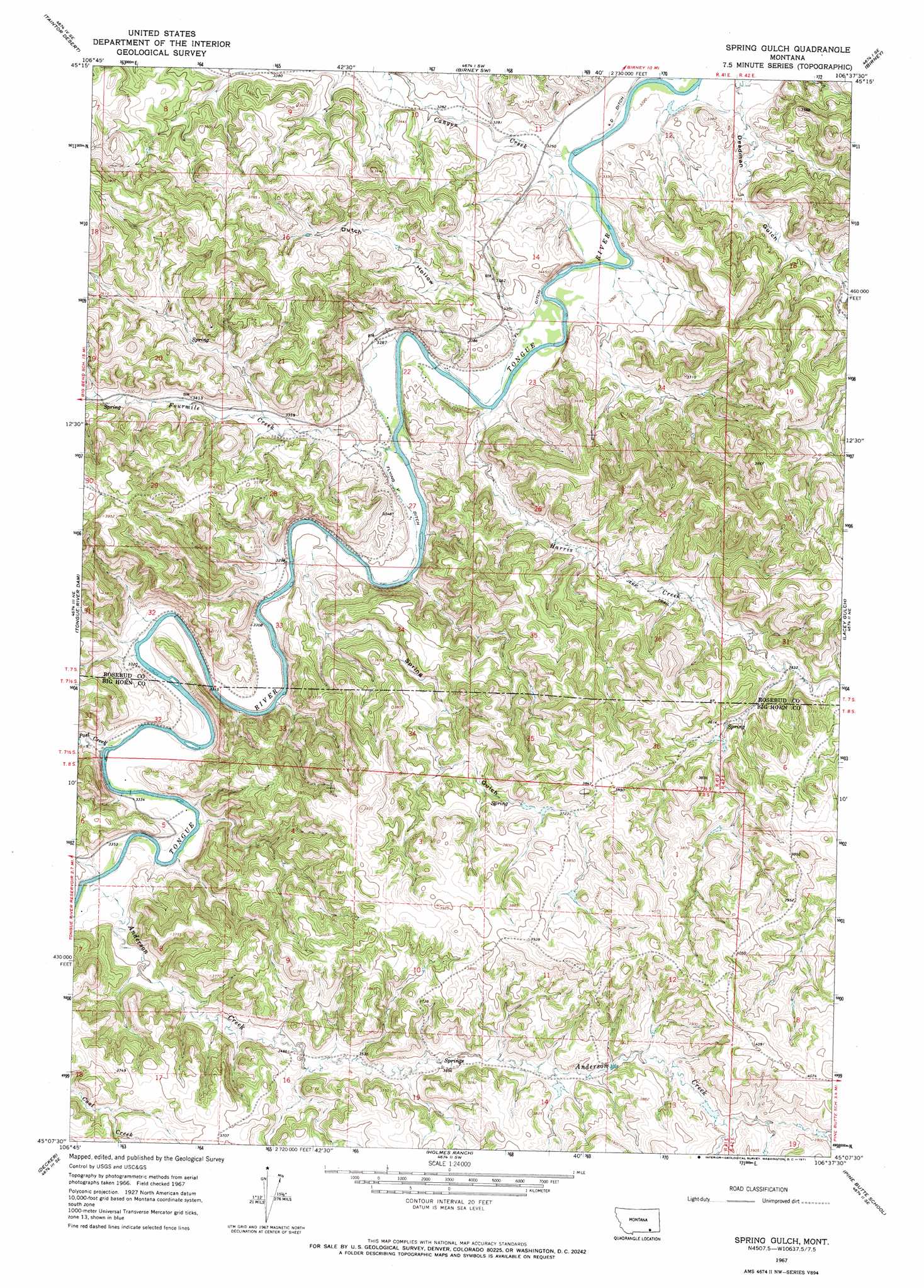
USGS Topo Quad 45106b6 - 1:24,000 scale
| Topo Map Name: | Spring Gulch |
| USGS Topo Quad ID: | 45106b6 |
| Print Size: | ca. 21 1/4" wide x 27" high |
| Southeast Coordinates: | 45.125° N latitude / 106.625° W longitude |
| Map Center Coordinates: | 45.1875° N latitude / 106.6875° W longitude |
| U.S. State: | MT |
| Filename: | o45106b6.jpg |
| Download Map JPG Image: | Spring Gulch topo map 1:24,000 scale |
| Map Type: | Topographic |
| Topo Series: | 7.5´ |
| Map Scale: | 1:24,000 |
| Source of Map Images: | United States Geological Survey (USGS) |
| Alternate Map Versions: |
Spring Gulch MT 1967, updated 1971 Download PDF Buy paper map Spring Gulch MT 2011 Download PDF Buy paper map Spring Gulch MT 2014 Download PDF Buy paper map |
1:24,000 Topo Quads surrounding Spring Gulch
Birdseye Spring |
Bull Creek Lookout |
Cook Creek Butte |
Clubfoot Creek |
Birney Day School |
Kirby |
Taintor Desert |
Birney Sw |
Birney |
Browns Mountain |
Half Moon Hill |
Tongue River Dam |
Spring Gulch |
Lacey Gulch |
Stroud Creek |
Pearl School |
Decker |
Holmes Ranch |
Pine Butte School |
Forks Ranch |
Acme |
Bar N Draw |
Cedar Canyon |
O T O Ranch |
Roundup Draw |
> Back to 45106a1 at 1:100,000 scale
> Back to 45106a1 at 1:250,000 scale
> Back to U.S. Topo Maps home
Spring Gulch topo map: Gazetteer
Spring Gulch: Canals
FL Ditch elevation 994m 3261′Flying V Ditch elevation 999m 3277′
Spring Gulch: Streams
Anderson Creek elevation 1019m 3343′Canyon Creek elevation 983m 3225′
Fourmile Creek elevation 994m 3261′
Harris Creek elevation 993m 3257′
Post Creek elevation 1013m 3323′
Spring Gulch: Valleys
Deadman Gulch elevation 988m 3241′Dutch Hollow elevation 1000m 3280′
Spring Gulch elevation 1031m 3382′
Spring Gulch: Wells
07S41E11____01 Well elevation 993m 3257′07S41E22ACDC01 Well elevation 995m 3264′
07S41E22CDCD01 Well elevation 1003m 3290′
07S41E27DBBD01 Well elevation 998m 3274′
07S41E27DBCB01 Well elevation 997m 3270′
07S41E28DDAD01 Well elevation 1002m 3287′
07S41E33CAAB01 Well elevation 1010m 3313′
07S41E34BAAD01 Well elevation 1001m 3284′
08S42E06ADBA01 Well elevation 1136m 3727′
Spring Gulch digital topo map on disk
Buy this Spring Gulch topo map showing relief, roads, GPS coordinates and other geographical features, as a high-resolution digital map file on DVD:
Eastern Montana & Western North Dakota
Buy digital topo maps: Eastern Montana & Western North Dakota