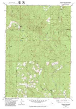
Niagara Creek Topo Map Oregon
To zoom in, hover over the map of Niagara Creek
USGS Topo Quad 45123b6 - 1:24,000 scale
| Topo Map Name: | Niagara Creek |
| USGS Topo Quad ID: | 45123b6 |
| Print Size: | ca. 21 1/4" wide x 27" high |
| Southeast Coordinates: | 45.125° N latitude / 123.625° W longitude |
| Map Center Coordinates: | 45.1875° N latitude / 123.6875° W longitude |
| U.S. State: | OR |
| Filename: | o45123b6.jpg |
| Download Map JPG Image: | Niagara Creek topo map 1:24,000 scale |
| Map Type: | Topographic |
| Topo Series: | 7.5´ |
| Map Scale: | 1:24,000 |
| Source of Map Images: | United States Geological Survey (USGS) |
| Alternate Map Versions: |
Niagara Creek OR 1979, updated 1979 Download PDF Buy paper map Niagara Creek OR 2011 Download PDF Buy paper map Niagara Creek OR 2014 Download PDF Buy paper map |
| FStopo: | US Forest Service topo Niagara Creek is available: Download FStopo PDF Download FStopo TIF |
1:24,000 Topo Quads surrounding Niagara Creek
> Back to 45123a1 at 1:100,000 scale
> Back to 45122a1 at 1:250,000 scale
> Back to U.S. Topo Maps home
Niagara Creek topo map: Gazetteer
Niagara Creek: Bridges
Asinine Bridge elevation 213m 698′Niagara Creek: Lakes
South Lake elevation 718m 2355′Niagara Creek: Mines
Agency Creek Quarry elevation 215m 705′Niagara Creek: Reservoirs
North Lake elevation 740m 2427′Niagara Creek: Ridges
Burnt Ridge elevation 848m 2782′Niagara Creek: Streams
Buelah Creek elevation 188m 616′Dahl Fork elevation 242m 793′
Left Branch Powder Creek elevation 180m 590′
Niagara Creek elevation 133m 436′
Pheasant Creek elevation 206m 675′
Shueble Creek elevation 175m 574′
West Fork Agency Creek elevation 236m 774′
West Fork Yoncalla Creek elevation 296m 971′
Yoncalla Creek elevation 171m 561′
Niagara Creek: Summits
Tetons elevation 396m 1299′Niagara Creek digital topo map on disk
Buy this Niagara Creek topo map showing relief, roads, GPS coordinates and other geographical features, as a high-resolution digital map file on DVD:


