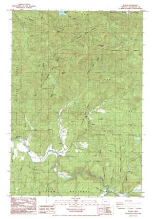
Blaine Topo Map Oregon
To zoom in, hover over the map of Blaine
USGS Topo Quad 45123c6 - 1:24,000 scale
| Topo Map Name: | Blaine |
| USGS Topo Quad ID: | 45123c6 |
| Print Size: | ca. 21 1/4" wide x 27" high |
| Southeast Coordinates: | 45.25° N latitude / 123.625° W longitude |
| Map Center Coordinates: | 45.3125° N latitude / 123.6875° W longitude |
| U.S. State: | OR |
| Filename: | o45123c6.jpg |
| Download Map JPG Image: | Blaine topo map 1:24,000 scale |
| Map Type: | Topographic |
| Topo Series: | 7.5´ |
| Map Scale: | 1:24,000 |
| Source of Map Images: | United States Geological Survey (USGS) |
| Alternate Map Versions: |
Blaine OR 1984, updated 1984 Download PDF Buy paper map Blaine OR 2011 Download PDF Buy paper map Blaine OR 2014 Download PDF Buy paper map |
| FStopo: | US Forest Service topo Blaine is available: Download FStopo PDF Download FStopo TIF |
1:24,000 Topo Quads surrounding Blaine
> Back to 45123a1 at 1:100,000 scale
> Back to 45122a1 at 1:250,000 scale
> Back to U.S. Topo Maps home
Blaine topo map: Gazetteer
Blaine: Cliffs
Camelback Bluff elevation 212m 695′Blaine: Dams
Skookum Lake Dam elevation 443m 1453′Blaine: Populated Places
Blaine elevation 85m 278′Blaine: Post Offices
Blaine Post Office (historical) elevation 85m 278′Blaine: Reservoirs
Skookum Lake elevation 374m 1227′Blaine: Streams
Alder Creek elevation 59m 193′Bays Creek elevation 60m 196′
Clarence Creek elevation 133m 436′
East Creek elevation 78m 255′
Hatinger Creek elevation 144m 472′
Limestone Creek elevation 90m 295′
Moon Creek elevation 75m 246′
Norris Creek elevation 123m 403′
Powder Creek elevation 124m 406′
Wake Creek elevation 128m 419′
Blaine: Summits
Beaver Point elevation 857m 2811′Grindstone Mountain elevation 870m 2854′
Hardscrabble Mountain elevation 572m 1876′
High Peak elevation 850m 2788′
Square Top elevation 641m 2103′
Blaine: Trails
Powder Creek Trail elevation 360m 1181′Blaine digital topo map on disk
Buy this Blaine topo map showing relief, roads, GPS coordinates and other geographical features, as a high-resolution digital map file on DVD:


