Cuyuna Topo Map Minnesota
To zoom in, hover over the map of Cuyuna
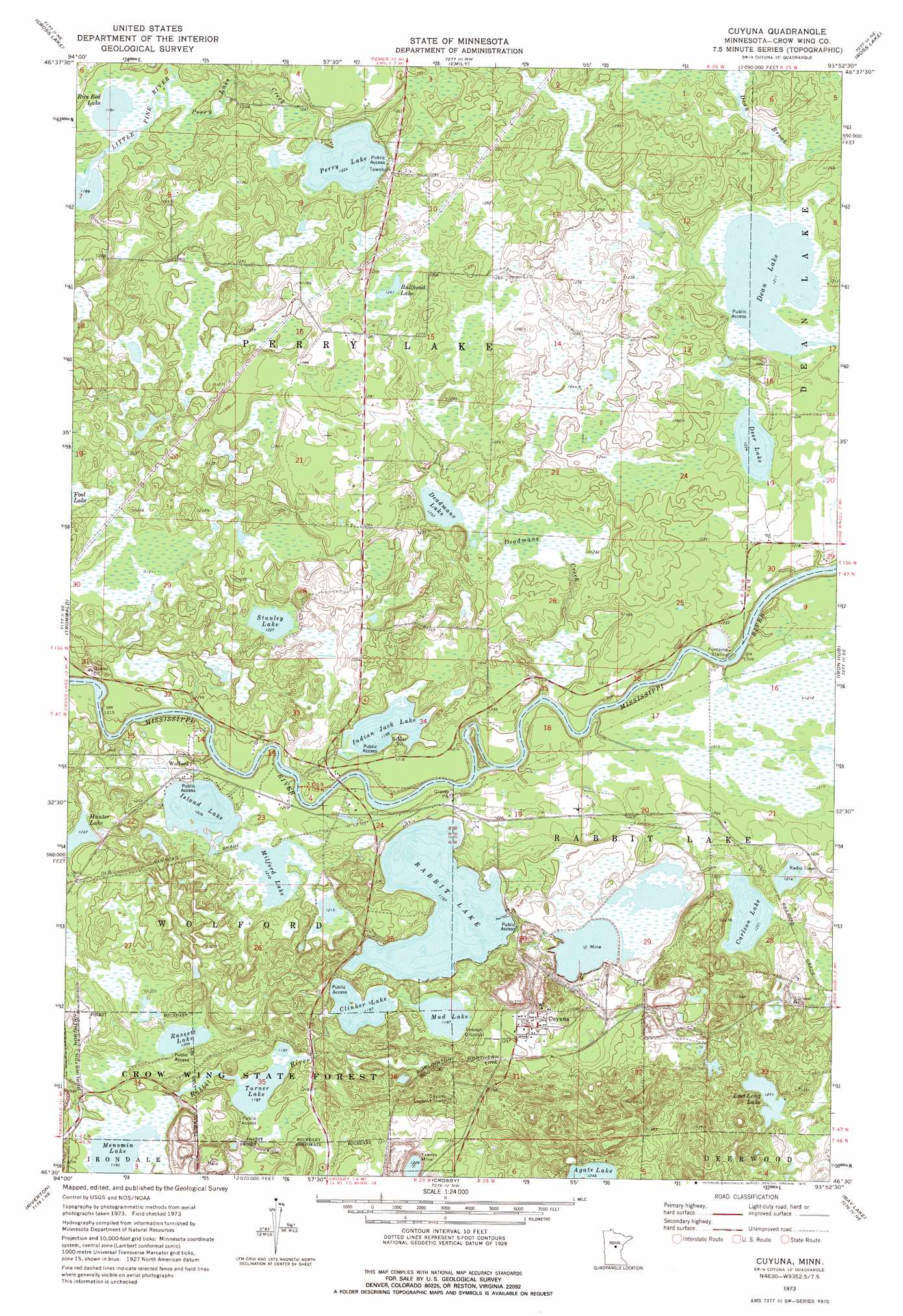
USGS Topo Quad 46093e8 - 1:24,000 scale
| Topo Map Name: | Cuyuna |
| USGS Topo Quad ID: | 46093e8 |
| Print Size: | ca. 21 1/4" wide x 27" high |
| Southeast Coordinates: | 46.5° N latitude / 93.875° W longitude |
| Map Center Coordinates: | 46.5625° N latitude / 93.9375° W longitude |
| U.S. State: | MN |
| Filename: | o46093e8.jpg |
| Download Map JPG Image: | Cuyuna topo map 1:24,000 scale |
| Map Type: | Topographic |
| Topo Series: | 7.5´ |
| Map Scale: | 1:24,000 |
| Source of Map Images: | United States Geological Survey (USGS) |
| Alternate Map Versions: |
Cuyuna MN 1973, updated 1975 Download PDF Buy paper map Cuyuna MN 2010 Download PDF Buy paper map Cuyuna MN 2013 Download PDF Buy paper map Cuyuna MN 2016 Download PDF Buy paper map |
1:24,000 Topo Quads surrounding Cuyuna
Stewart Lake |
Mitchell Lake |
Roosevelt Lake |
Edna Lake |
White Elk Lake |
Lower Whitefish Lake |
Cross Lake |
Emily |
Ross Lake |
Esquagamah Lake |
Pelican Lake |
Trommald |
Cuyuna |
Iron Hub |
Aitkin |
Merrifield |
Riverton |
Crosby |
Bay Lake |
Spirit Lake |
Brainerd |
South Long Lake |
Grave Lake |
Garrison |
Wealthwood |
> Back to 46093e1 at 1:100,000 scale
> Back to 46092a1 at 1:250,000 scale
> Back to U.S. Topo Maps home
Cuyuna topo map: Gazetteer
Cuyuna: Lakes
Bullhead Lake elevation 385m 1263′Carlson Lake elevation 366m 1200′
Clinker Lake elevation 364m 1194′
Deadmans Lake elevation 375m 1230′
Dean Lake elevation 369m 1210′
Deer Lake elevation 373m 1223′
Hunter Lake elevation 377m 1236′
Indian Jack Lake elevation 365m 1197′
Island Lake elevation 368m 1207′
Lost Long Lake elevation 387m 1269′
Milford Lake elevation 369m 1210′
Mud Lake elevation 364m 1194′
Perry Lake elevation 373m 1223′
Rabbit Lake elevation 364m 1194′
Rassett Lake elevation 366m 1200′
Rice Bed Lake elevation 363m 1190′
Stanley Lake elevation 374m 1227′
Turner Lake elevation 364m 1194′
Cuyuna: Mines
Yawkey Mine elevation 374m 1227′Cuyuna: Populated Places
Cuyuna elevation 382m 1253′Wolford elevation 370m 1213′
Cuyuna: Post Offices
Cuyuna Post Office (historical) elevation 382m 1253′Wolford Post Office (historical) elevation 370m 1213′
Cuyuna: Streams
Deadmans Creek elevation 361m 1184′Perry Lake Creek elevation 367m 1204′
Cuyuna digital topo map on disk
Buy this Cuyuna topo map showing relief, roads, GPS coordinates and other geographical features, as a high-resolution digital map file on DVD: