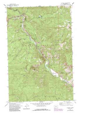
Cliffdell Topo Map Washington
To zoom in, hover over the map of Cliffdell
USGS Topo Quad 46121h1 - 1:24,000 scale
| Topo Map Name: | Cliffdell |
| USGS Topo Quad ID: | 46121h1 |
| Print Size: | ca. 21 1/4" wide x 27" high |
| Southeast Coordinates: | 46.875° N latitude / 121° W longitude |
| Map Center Coordinates: | 46.9375° N latitude / 121.0625° W longitude |
| U.S. State: | WA |
| Filename: | o46121h1.jpg |
| Download Map JPG Image: | Cliffdell topo map 1:24,000 scale |
| Map Type: | Topographic |
| Topo Series: | 7.5´ |
| Map Scale: | 1:24,000 |
| Source of Map Images: | United States Geological Survey (USGS) |
| Alternate Map Versions: |
Cliffdell WA 1971, updated 1973 Download PDF Buy paper map Cliffdell WA 1971, updated 1987 Download PDF Buy paper map Cliffdell WA 1992, updated 1996 Download PDF Buy paper map Cliffdell WA 2000, updated 2001 Download PDF Buy paper map Cliffdell WA 2011 Download PDF Buy paper map Cliffdell WA 2014 Download PDF Buy paper map |
| FStopo: | US Forest Service topo Cliffdell is available: Download FStopo PDF Download FStopo TIF |
1:24,000 Topo Quads surrounding Cliffdell
> Back to 46121e1 at 1:100,000 scale
> Back to 46120a1 at 1:250,000 scale
> Back to U.S. Topo Maps home
Cliffdell topo map: Gazetteer
Cliffdell: Cliffs
Edgar Rock elevation 893m 2929′Cliffdell: Dams
Milk Pond Dam elevation 919m 3015′Cliffdell: Falls
Devil Creek Falls elevation 867m 2844′Horsetail Falls elevation 800m 2624′
Cliffdell: Flats
Sawmill Flat elevation 764m 2506′Cliffdell: Lakes
Devils Slide Lake elevation 1341m 4399′Milk Pond elevation 919m 3015′
Cliffdell: Pillars
Haystack Rock elevation 1141m 3743′Cliffdell: Populated Places
Cliffdell elevation 759m 2490′Pinecliff elevation 678m 2224′
Cliffdell: Springs
Cedar Spring elevation 767m 2516′Cliffdell: Streams
Bumping River elevation 781m 2562′Catchup Creek elevation 781m 2562′
Devil Creek elevation 745m 2444′
Gold Creek elevation 706m 2316′
Little Naches River elevation 779m 2555′
Lost Creek elevation 702m 2303′
Milk Creek elevation 773m 2536′
North Fork Gold Creek elevation 868m 2847′
Pine Creek elevation 745m 2444′
Spring Creek elevation 747m 2450′
Swamp Creek elevation 737m 2417′
Cliffdell: Summits
Deadhorse Hill elevation 1099m 3605′Cliffdell digital topo map on disk
Buy this Cliffdell topo map showing relief, roads, GPS coordinates and other geographical features, as a high-resolution digital map file on DVD:


