Ashford Topo Map Washington
To zoom in, hover over the map of Ashford
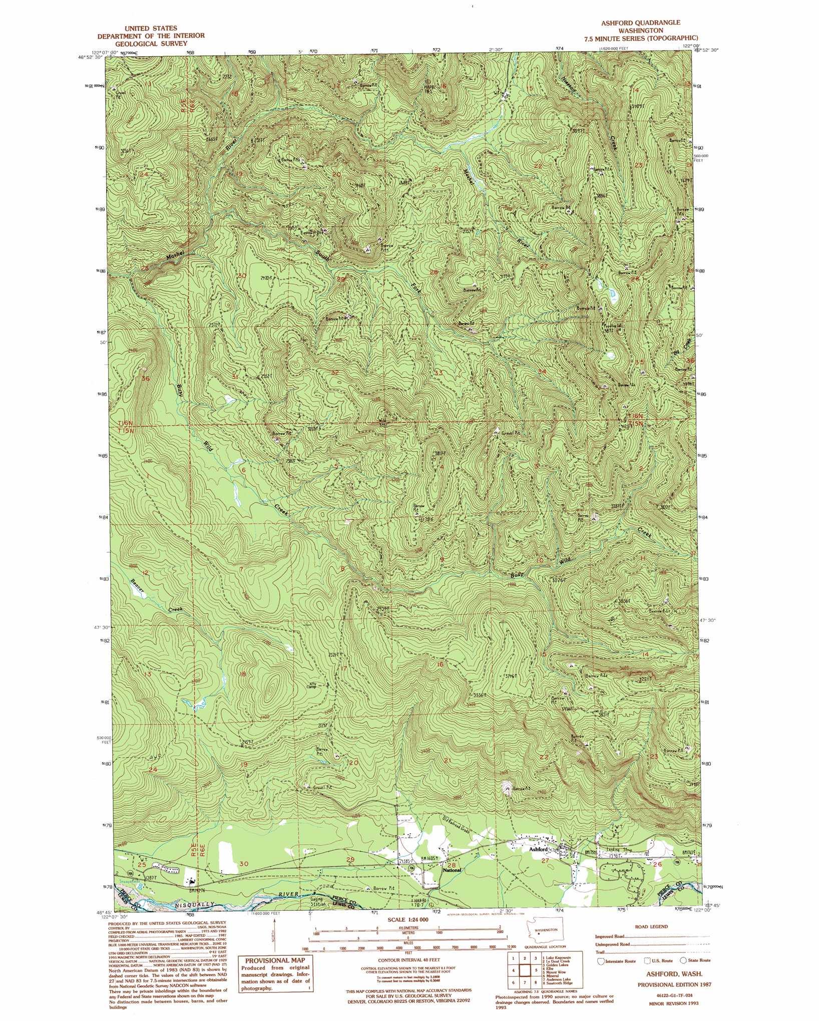
USGS Topo Quad 46122g1 - 1:24,000 scale
| Topo Map Name: | Ashford |
| USGS Topo Quad ID: | 46122g1 |
| Print Size: | ca. 21 1/4" wide x 27" high |
| Southeast Coordinates: | 46.75° N latitude / 122° W longitude |
| Map Center Coordinates: | 46.8125° N latitude / 122.0625° W longitude |
| U.S. State: | WA |
| Filename: | o46122g1.jpg |
| Download Map JPG Image: | Ashford topo map 1:24,000 scale |
| Map Type: | Topographic |
| Topo Series: | 7.5´ |
| Map Scale: | 1:24,000 |
| Source of Map Images: | United States Geological Survey (USGS) |
| Alternate Map Versions: |
Ashford WA 1987, updated 1987 Download PDF Buy paper map Ashford WA 1987, updated 1994 Download PDF Buy paper map Ashford WA 2011 Download PDF Buy paper map Ashford WA 2014 Download PDF Buy paper map |
1:24,000 Topo Quads surrounding Ashford
Frederickson |
Orting |
Wilkeson |
Old Baldy Mountain |
Bearhead Mountain |
Tanwax Lake |
Lake Kapowsin |
Le Dout Creek |
Golden Lakes |
Mowich Lake |
Eatonville |
Elbe |
Ashford |
Mount Wow |
Mount Rainier West |
The Rockies |
Mineral |
Anderson Lake |
Sawtooth Ridge |
Wahpenayo Peak |
Morton |
Glenoma |
Kiona Peak |
Randle |
Purcell Mountain |
> Back to 46122e1 at 1:100,000 scale
> Back to 46122a1 at 1:250,000 scale
> Back to U.S. Topo Maps home
Ashford topo map: Gazetteer
Ashford: Airports
Hewitt Landing Strip elevation 545m 1788′Ashford: Populated Places
Ashford elevation 537m 1761′National elevation 498m 1633′
Ashford: Streams
Busy Wild Creek elevation 502m 1646′Ashford digital topo map on disk
Buy this Ashford topo map showing relief, roads, GPS coordinates and other geographical features, as a high-resolution digital map file on DVD: