South Bend Topo Map Washington
To zoom in, hover over the map of South Bend
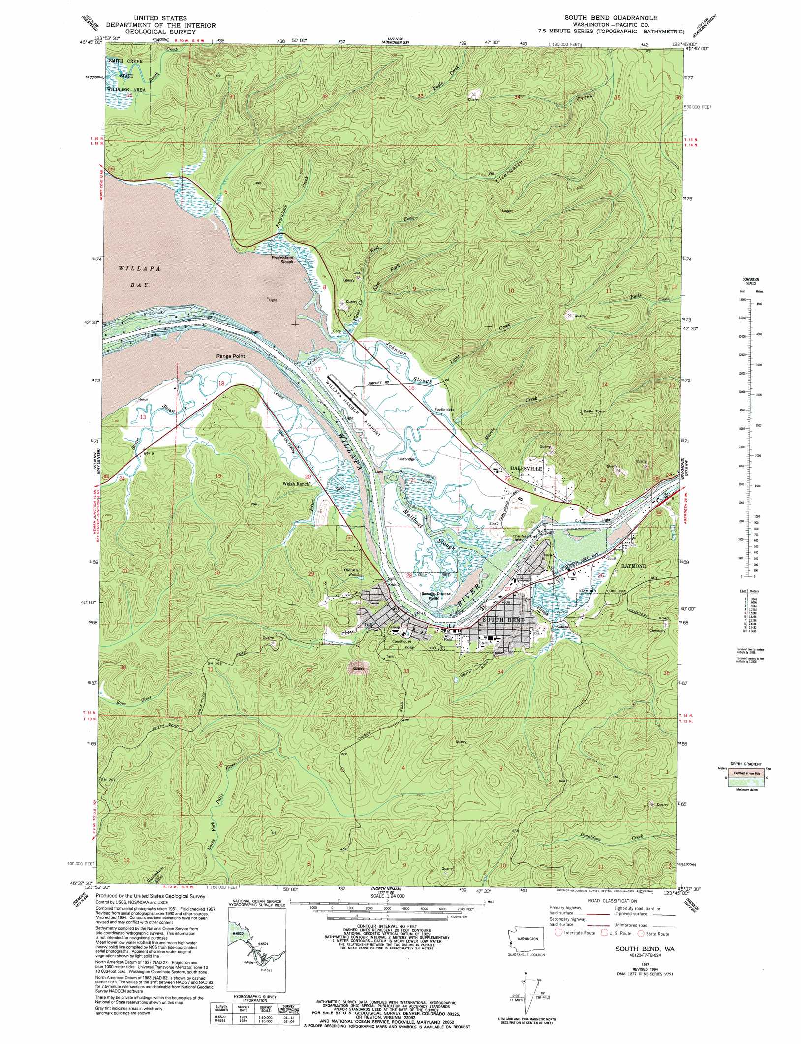
USGS Topo Quad 46123f7 - 1:24,000 scale
| Topo Map Name: | South Bend |
| USGS Topo Quad ID: | 46123f7 |
| Print Size: | ca. 21 1/4" wide x 27" high |
| Southeast Coordinates: | 46.625° N latitude / 123.75° W longitude |
| Map Center Coordinates: | 46.6875° N latitude / 123.8125° W longitude |
| U.S. State: | WA |
| Filename: | o46123f7.jpg |
| Download Map JPG Image: | South Bend topo map 1:24,000 scale |
| Map Type: | Topographic |
| Topo Series: | 7.5´ |
| Map Scale: | 1:24,000 |
| Source of Map Images: | United States Geological Survey (USGS) |
| Alternate Map Versions: |
South Bend WA 1957, updated 1960 Download PDF Buy paper map South Bend WA 1957, updated 1985 Download PDF Buy paper map South Bend WA 1957, updated 1992 Download PDF Buy paper map South Bend WA 1957, updated 1995 Download PDF Buy paper map South Bend WA 2011 Download PDF Buy paper map South Bend WA 2014 Download PDF Buy paper map |
1:24,000 Topo Quads surrounding South Bend
Westport |
Hoquiam |
Aberdeen |
Central Park |
Montesano |
Grayland |
Western |
Aberdeen Se |
Elkhorn Creek |
Brooklyn |
North Cove |
Bay Center |
South Bend |
Raymond |
East Of Raymond |
Oysterville |
Nemah |
North Nemah |
Menlo |
Lebam |
Ocean Park |
Long Island |
Oman Ranch |
Upper Naselle River |
Sweigiler Creek |
> Back to 46123e1 at 1:100,000 scale
> Back to 46122a1 at 1:250,000 scale
> Back to U.S. Topo Maps home
South Bend topo map: Gazetteer
South Bend: Airports
Willapa Harbor Airport elevation 4m 13′Willapa Harbor Heliport elevation 43m 141′
South Bend: Capes
Range Point elevation 4m 13′South Bend: Channels
The Narrows elevation 2m 6′South Bend: Dams
Bale Dam Number One elevation 7m 22′Bale Dam Number Two elevation 13m 42′
Electric Creek Dam elevation 111m 364′
Martin Creek Dam elevation 181m 593′
Old Mill Pond Dam elevation 30m 98′
South Bend City Reservoir Dam elevation 76m 249′
South Bend: Parks
Smith Creek State Wildlife Recreation Area elevation 27m 88′South Bend: Populated Places
Seahaven (historical) elevation 3m 9′South Bend elevation 17m 55′
South Bend: Reservoirs
Old Mill Pond elevation 30m 98′South Bend City Reservoir elevation 76m 249′
South Bend: Streams
Fredrickson Slough elevation 0m 0′I I Slough elevation 0m 0′
Johnson Slough elevation 0m 0′
Kellogg Slough elevation 0m 0′
Mailboat Slough elevation 0m 0′
Potter Slu elevation 0m 0′
Skidmore Slough elevation 4m 13′
Stuart Slough elevation 6m 19′
Willapa River elevation 0m 0′
South Bend digital topo map on disk
Buy this South Bend topo map showing relief, roads, GPS coordinates and other geographical features, as a high-resolution digital map file on DVD: