Hoquiam Topo Map Washington
To zoom in, hover over the map of Hoquiam
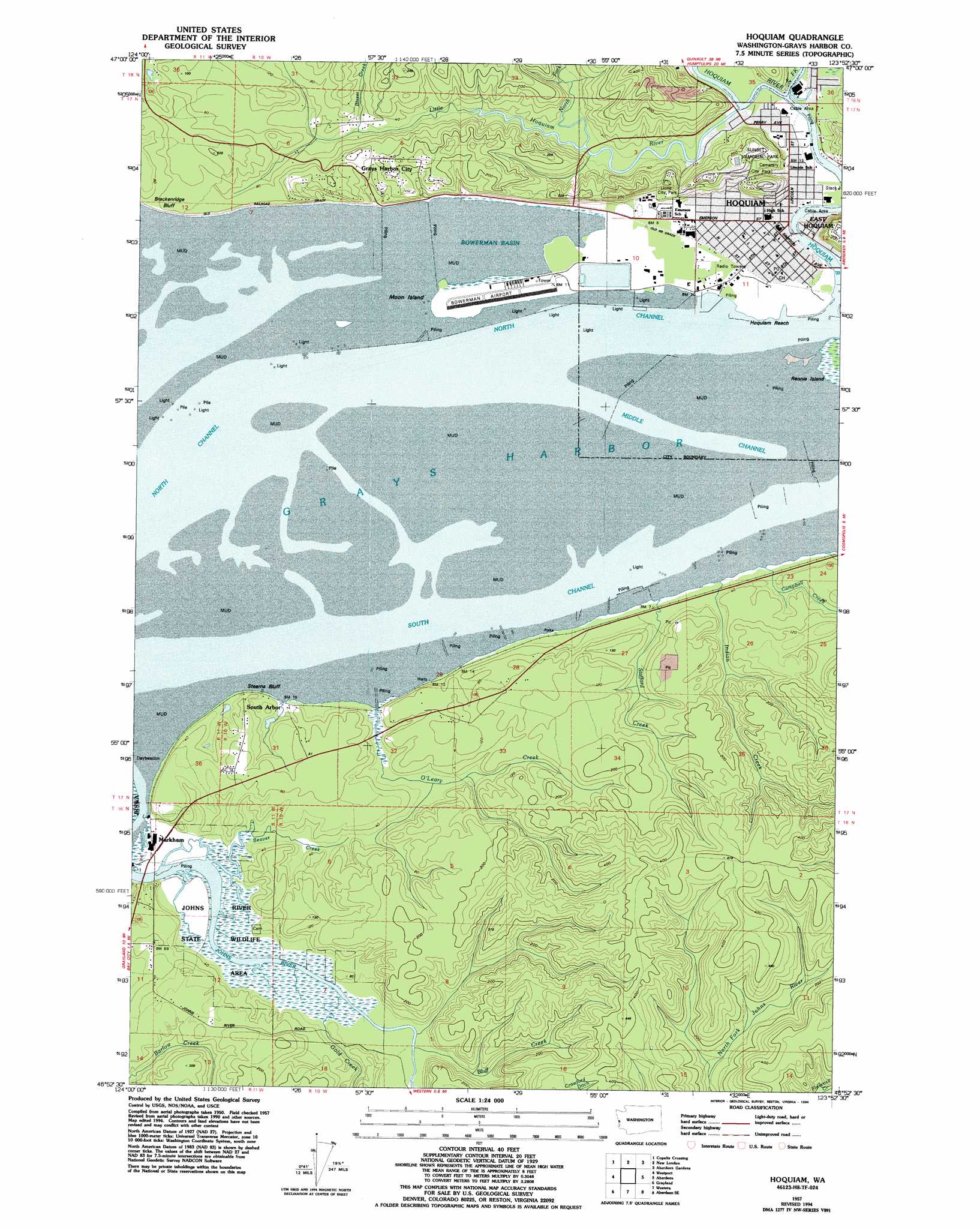
USGS Topo Quad 46123h8 - 1:24,000 scale
| Topo Map Name: | Hoquiam |
| USGS Topo Quad ID: | 46123h8 |
| Print Size: | ca. 21 1/4" wide x 27" high |
| Southeast Coordinates: | 46.875° N latitude / 123.875° W longitude |
| Map Center Coordinates: | 46.9375° N latitude / 123.9375° W longitude |
| U.S. State: | WA |
| Filename: | o46123h8.jpg |
| Download Map JPG Image: | Hoquiam topo map 1:24,000 scale |
| Map Type: | Topographic |
| Topo Series: | 7.5´ |
| Map Scale: | 1:24,000 |
| Source of Map Images: | United States Geological Survey (USGS) |
| Alternate Map Versions: |
Hoquiam WA 1957, updated 1960 Download PDF Buy paper map Hoquiam WA 1957, updated 1977 Download PDF Buy paper map Hoquiam WA 1957, updated 1984 Download PDF Buy paper map Hoquiam WA 1957, updated 1994 Download PDF Buy paper map Hoquiam WA 2011 Download PDF Buy paper map Hoquiam WA 2014 Download PDF Buy paper map |
1:24,000 Topo Quads surrounding Hoquiam
Moclips |
Carlisle |
Humptulips |
Railroad Camp |
Wynoochee Valley Nw |
Copalis Beach |
Copalis Crossing |
New London |
Aberdeen Gardens |
Wynoochee Valley Sw |
Point Brown |
Westport |
Hoquiam |
Aberdeen |
Central Park |
Grayland |
Western |
Aberdeen Se |
Elkhorn Creek |
|
North Cove |
Bay Center |
South Bend |
Raymond |
> Back to 46123e1 at 1:100,000 scale
> Back to 46122a1 at 1:250,000 scale
> Back to U.S. Topo Maps home
Hoquiam topo map: Gazetteer
Hoquiam: Airports
Bowerman Airport elevation 10m 32′Hoquiam: Bays
Bowerman Basin elevation 0m 0′Traitors Inlet elevation 0m 0′
Hoquiam: Capes
Spar Point (historical) elevation 10m 32′Hoquiam: Channels
Middle Channel elevation 0m 0′North Channel elevation 0m 0′
South Channel elevation 0m 0′
Hoquiam: Cliffs
Stearns Bluff elevation 7m 22′Hoquiam: Islands
Moon Island elevation 10m 32′Hoquiam: Parks
Beacon Hill Park elevation 78m 255′Elton Bennett Park elevation 25m 82′
John Gable Community Park elevation 7m 22′
Johns River State Wildlife Recreation Area elevation 3m 9′
Last Spur Park elevation 6m 19′
Lincoln Park elevation 6m 19′
Lions City Park elevation 21m 68′
Riverside Dike Park elevation 1m 3′
Hoquiam: Populated Places
Grays Harbor City elevation 25m 82′Hoquiam elevation 7m 22′
Markham elevation 7m 22′
South Arbor elevation 18m 59′
Hoquiam: Streams
Beaver Creek elevation 0m 0′Blazer Creek elevation 5m 16′
Bluff Creek elevation 3m 9′
Campbell Creek elevation 7m 22′
Chapin Creek elevation 7m 22′
East Fork Hoquiam River elevation 0m 0′
Gold Creek elevation 0m 0′
Hoquiam River elevation 0m 0′
Indian Creek elevation 7m 22′
Little Hoquiam River elevation 0m 0′
North Fork Little Hoquiam River elevation 4m 13′
O'Leary Creek elevation 8m 26′
Stafford Creek elevation 3m 9′
Hoquiam digital topo map on disk
Buy this Hoquiam topo map showing relief, roads, GPS coordinates and other geographical features, as a high-resolution digital map file on DVD: