Second Lake Topo Map Maine
To zoom in, hover over the map of Second Lake
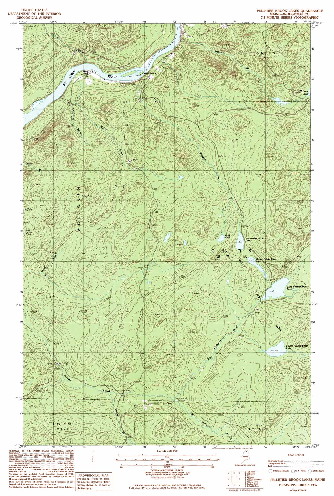
USGS Topo Quad 47068a8 - 1:24,000 scale
| Topo Map Name: | Second Lake |
| USGS Topo Quad ID: | 47068a8 |
| Print Size: | ca. 21 1/4" wide x 27" high |
| Southeast Coordinates: | 47° N latitude / 68.875° W longitude |
| Map Center Coordinates: | 47.0625° N latitude / 68.9375° W longitude |
| U.S. State: | ME |
| Filename: | o47068a8.jpg |
| Download Map JPG Image: | Second Lake topo map 1:24,000 scale |
| Map Type: | Topographic |
| Topo Series: | 7.5´ |
| Map Scale: | 1:24,000 |
| Source of Map Images: | United States Geological Survey (USGS) |
| Alternate Map Versions: |
St Francis SW ME 1975, updated 1981 Download PDF Buy paper map Pelletier Brook Lakes ME 1985, updated 1986 Download PDF Buy paper map Pelletier Brook Lakes ME 2011 Download PDF Buy paper map Pelletier Brook Lakes ME 2014 Download PDF Buy paper map |
1:24,000 Topo Quads surrounding Second Lake
Hafey Pond |
Beau Lake |
|||
Johnson Brook Mountain |
Falls Brook Lake |
Saint Francis |
Saint John |
Wheelock |
Big Rapids |
Allagash |
Second Lake |
Mclean Mountain |
Wallacrass Lakes |
Allagash Falls |
Mckeen Lake |
Gardner Pond |
Deboullie Pond |
Island Pond |
Five Finger Brook |
Big Brook Lake |
Fish River Lake Sw |
Fish River Lake |
Carr Pond |
> Back to 47068a1 at 1:100,000 scale
> Back to 47068a1 at 1:250,000 scale
> Back to U.S. Topo Maps home
Second Lake topo map: Gazetteer
Second Lake: Lakes
Black Lake elevation 393m 1289′First Pelletier Brook Lake elevation 382m 1253′
Fourth Pelletier Brook Lake elevation 400m 1312′
Pelletier Brook Lakes elevation 383m 1256′
Second Pelletier Brook Lake elevation 383m 1256′
Third Pelletier Brook Lake elevation 379m 1243′
Second Lake: Populated Places
Cross Rock elevation 179m 587′Second Lake: Rapids
Cross Rock Rapids elevation 173m 567′Golden Rapids elevation 172m 564′
Second Lake: Streams
Bass Brook elevation 177m 580′Fifth Pelletier Brook elevation 325m 1066′
Gardner Brook elevation 298m 977′
McLean Brook elevation 166m 544′
Third Pelletier Brook elevation 325m 1066′
Wesley Brook elevation 172m 564′
Wiggins Brook elevation 171m 561′
Wyles Brook elevation 173m 567′
Second Lake digital topo map on disk
Buy this Second Lake topo map showing relief, roads, GPS coordinates and other geographical features, as a high-resolution digital map file on DVD:
Maine, New Hampshire, Rhode Island & Eastern Massachusetts
Buy digital topo maps: Maine, New Hampshire, Rhode Island & Eastern Massachusetts