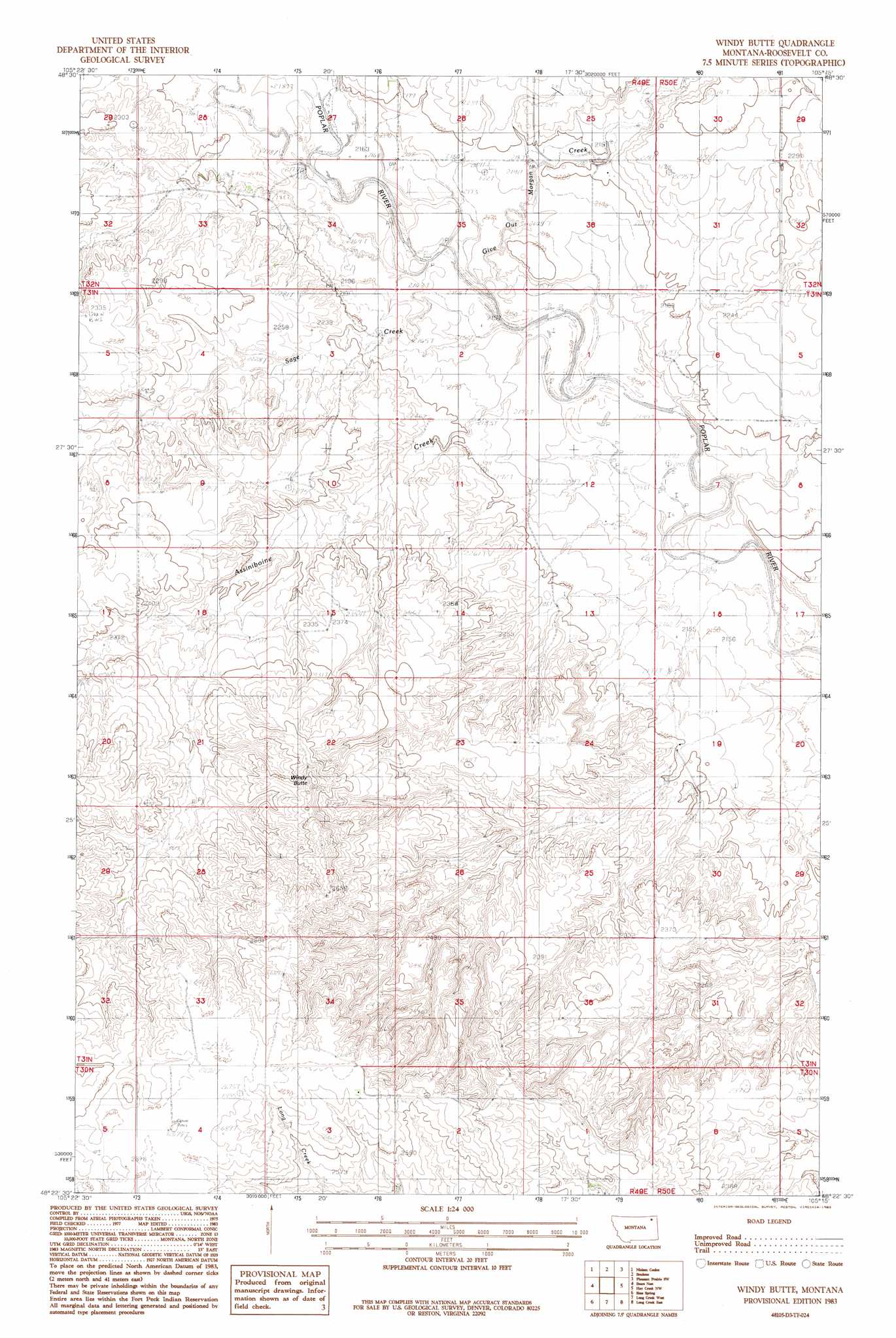
Windy Butte Topo Map Montana
To zoom in, hover over the map of Windy Butte
USGS Topo Quad 48105d3 - 1:24,000 scale
| Topo Map Name: | Windy Butte |
| USGS Topo Quad ID: | 48105d3 |
| Print Size: | ca. 21 1/4" wide x 27" high |
| Southeast Coordinates: | 48.375° N latitude / 105.25° W longitude |
| Map Center Coordinates: | 48.4375° N latitude / 105.3125° W longitude |
| U.S. State: | MT |
| Filename: | o48105d3.jpg |
| Download Map JPG Image: | Windy Butte topo map 1:24,000 scale |
| Map Type: | Topographic |
| Topo Series: | 7.5´ |
| Map Scale: | 1:24,000 |
| Source of Map Images: | United States Geological Survey (USGS) |
| Alternate Map Versions: |
Windy Butte MT 1983, updated 1983 Download PDF Buy paper map Windy Butte MT 2011 Download PDF Buy paper map Windy Butte MT 2014 Download PDF Buy paper map |
1:24,000 Topo Quads surrounding Windy Butte
Peerless 4 Ne |
Cabarett Coulee |
Line Coulee |
Pleasant Prairie Nw |
Pleasant Prairie Ne |
Peerless 4 Se |
Nielsen Coulee |
Bredette |
Pleasant Prairie Sw |
Pleasant Prairie |
Reed Springs |
Bears Nest |
Windy Butte |
Hay Creek Nw |
Hay Creek |
Tule Valley East |
Sims Spring |
Long Creek West |
Long Creek East |
Geddart Lake |
Wolf Point Ne |
Chelsea Nw |
Chelsea |
Badger Creek |
Poplar Ne |
> Back to 48105a1 at 1:100,000 scale
> Back to 48104a1 at 1:250,000 scale
> Back to U.S. Topo Maps home
Windy Butte topo map: Gazetteer
Windy Butte: Airports
J B Airport elevation 813m 2667′Windy Butte: Post Offices
Cuskerton Post Office (historical) elevation 680m 2230′Windy Butte: Streams
Assiniboine Creek elevation 656m 2152′Give Out Morgan Creek elevation 667m 2188′
Sage Creek elevation 656m 2152′
Windy Butte: Summits
Windy Butte elevation 773m 2536′Windy Butte: Wells
30N49E03ABDD01 Well elevation 814m 2670′31N49E11BACB01 Well elevation 672m 2204′
31N49E11BBD_01 Well elevation 672m 2204′
31N49E25BBCB01 Well elevation 691m 2267′
Windy Butte digital topo map on disk
Buy this Windy Butte topo map showing relief, roads, GPS coordinates and other geographical features, as a high-resolution digital map file on DVD:
Eastern Montana & Western North Dakota
Buy digital topo maps: Eastern Montana & Western North Dakota