Charlottesville Topo Map Virginia
To zoom in, hover over the map of Charlottesville
USGS Topo Map 38078a1 - 1:100,000 scale
| Topo Map Name: | Charlottesville |
| USGS Topo Quad ID: | 38078a1 |
| Print Size: | ca. 39" wide x 24" high |
| Southeast Coordinates: | 38° N latitude / 78° W longitude |
| Map Center Coordinates: | 38.25° N latitude / 78.5° W longitude |
| U.S. State: | VA |
| Filename: | 38078a1.jpg |
| Download Map JPG Image: | Charlottesville topo map 1:100,000 scale |
| Map Type: | Topographic |
| Topo Series: | 30´x60´ |
| Map Scale: | 1:100,000 |
| Source of Map Images: | United States Geological Survey (USGS) |
| Alternate Map Versions: |
Charlottesville VA 1986, updated 1986 Download PDF Buy paper map Charlottesville VA 1986, updated 1989 Download PDF Buy paper map Charlottesville VA 1986, updated 1989 Download PDF Buy paper map |
1:100,000 Topos surrounding Charlottesville
Elkins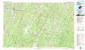 |
Front Royal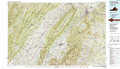 |
Washington West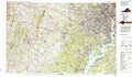 |
Staunton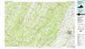 |
Charlottesville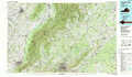 |
Fredericksburg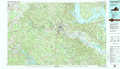 |
Buena Vista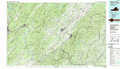 |
Dillwyn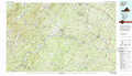 |
Richmond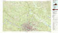 |
> Back to 38078a1 at 1:250,000 scale
> Back to U.S. Topo Maps home
1:24,000 Topo Quads covered by the spatial extent of this 100k map (Charlottesville)
|
Bridgewater 
|
Harrisonburg 
|
Elkton West 
|
Elkton East 
|
Fletcher 
|
Madison 
|
Brightwood 
|
Culpeper West 
|
|
Mount Sidney 
|
Grottoes 
|
Mcgaheysville 
|
Swift Run Gap 
|
Stanardsville 
|
Rochelle 
|
Madison Mills 
|
Rapidan 
|
|
Fort Defiance 
|
Crimora 
|
Browns Cove 
|
Free Union 
|
Earlysville 
|
Barboursville 
|
Gordonsville 
|
Orange 
|
|
Waynesboro West 
|
Waynesboro East 
|
Crozet 
|
Charlottesville West 
|
Charlottesville East 
|
Keswick 
|
Boswells Tavern 
|
Louisa 
|
