Earwood Creek Topo Map Texas
To zoom in, hover over the map of Earwood Creek
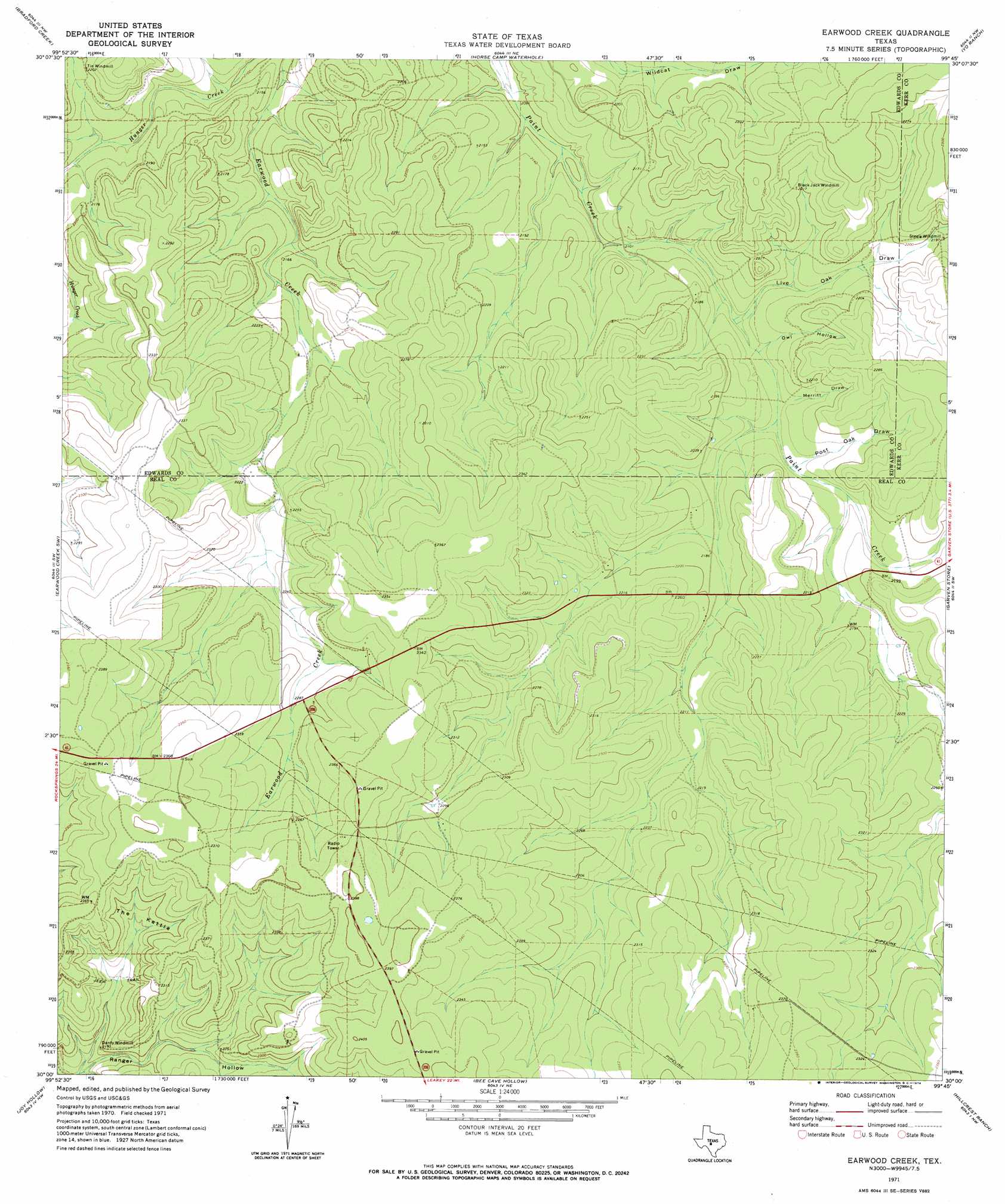
USGS Topo Quad 30099a7 - 1:24,000 scale
| Topo Map Name: | Earwood Creek |
| USGS Topo Quad ID: | 30099a7 |
| Print Size: | ca. 21 1/4" wide x 27" high |
| Southeast Coordinates: | 30° N latitude / 99.75° W longitude |
| Map Center Coordinates: | 30.0625° N latitude / 99.8125° W longitude |
| U.S. State: | TX |
| Filename: | o30099a7.jpg |
| Download Map JPG Image: | Earwood Creek topo map 1:24,000 scale |
| Map Type: | Topographic |
| Topo Series: | 7.5´ |
| Map Scale: | 1:24,000 |
| Source of Map Images: | United States Geological Survey (USGS) |
| Alternate Map Versions: |
Earwood Creek TX 1971, updated 1974 Download PDF Buy paper map Earwood Creek TX 2010 Download PDF Buy paper map Earwood Creek TX 2012 Download PDF Buy paper map Earwood Creek TX 2016 Download PDF Buy paper map |
1:24,000 Topo Quads surrounding Earwood Creek
Hill Ranch |
Telegraph |
Junction Se |
Allen Creek |
Mudge Draw |
Paint Rock Spring |
Bradford Creek |
Horse Camp Waterhole |
Y O Ranch |
Live Oak Ranch |
Devils Sinkhole |
Earwood Creek Sw |
Earwood Creek |
Garven Store |
Boneyard Draw |
Hackberry |
Joy Hollow |
Bee Cave Hollow |
Hillcrest Ranch |
Well Hollow |
Vance |
Jo Jan Van Camp |
Owl Hollow |
Circle Bluff |
Sabinal Canyon |
> Back to 30099a1 at 1:100,000 scale
> Back to 30098a1 at 1:250,000 scale
> Back to U.S. Topo Maps home
Earwood Creek topo map: Gazetteer
Earwood Creek: Basins
The Kettle elevation 690m 2263′Earwood Creek: Valleys
Live Oak Draw elevation 646m 2119′Merritt Draw elevation 652m 2139′
Owl Hollow elevation 649m 2129′
Post Oak Draw elevation 656m 2152′
Earwood Creek digital topo map on disk
Buy this Earwood Creek topo map showing relief, roads, GPS coordinates and other geographical features, as a high-resolution digital map file on DVD: