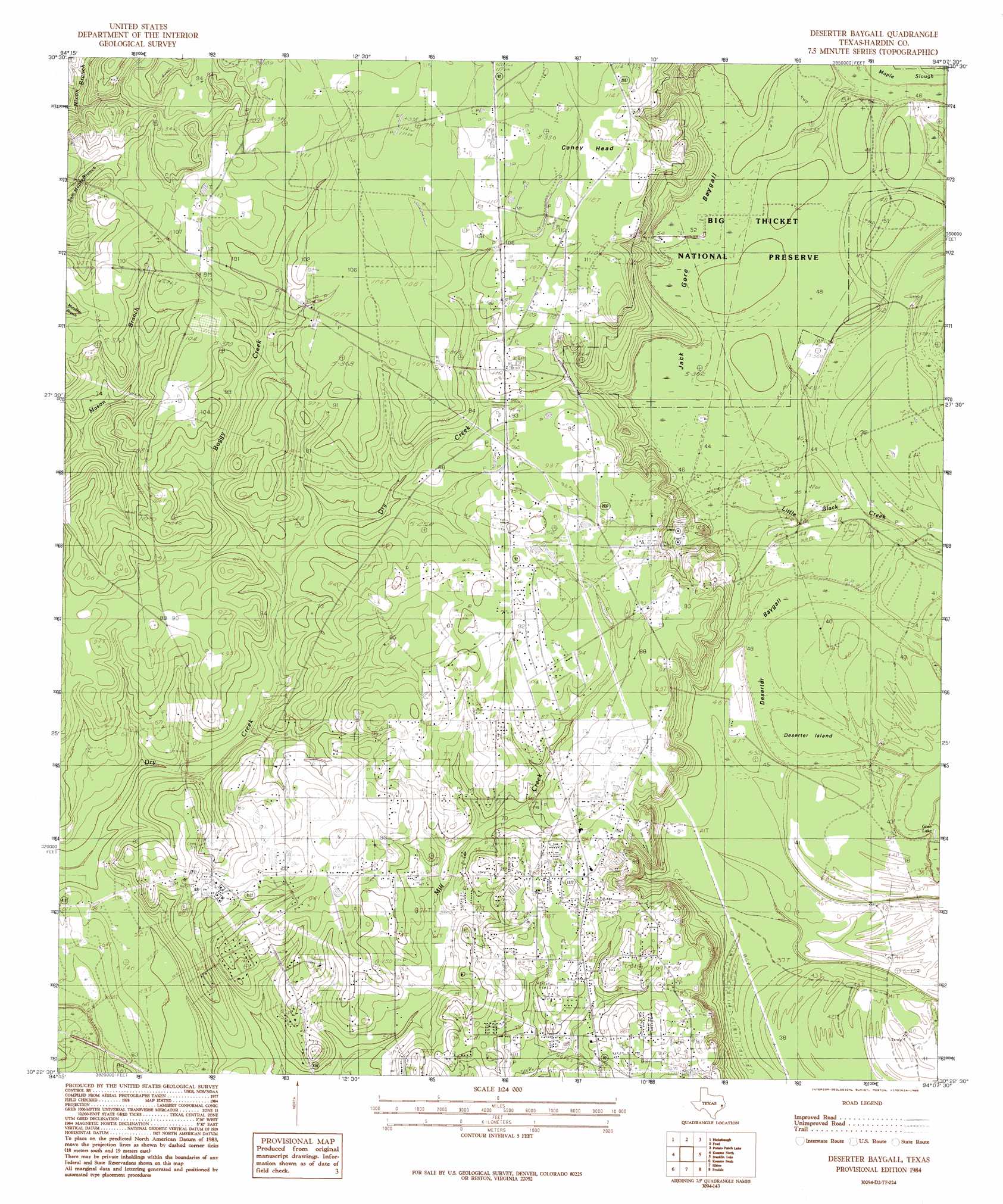
Deserter Baygall Topo Map Texas
To zoom in, hover over the map of Deserter Baygall
USGS Topo Quad 30094d2 - 1:24,000 scale
| Topo Map Name: | Deserter Baygall |
| USGS Topo Quad ID: | 30094d2 |
| Print Size: | ca. 21 1/4" wide x 27" high |
| Southeast Coordinates: | 30.375° N latitude / 94.125° W longitude |
| Map Center Coordinates: | 30.4375° N latitude / 94.1875° W longitude |
| U.S. State: | TX |
| Filename: | o30094d2.jpg |
| Download Map JPG Image: | Deserter Baygall topo map 1:24,000 scale |
| Map Type: | Topographic |
| Topo Series: | 7.5´ |
| Map Scale: | 1:24,000 |
| Source of Map Images: | United States Geological Survey (USGS) |
| Alternate Map Versions: |
Deserter Baygall TX 1984, updated 1985 Download PDF Buy paper map Deserter Baygall TX 2010 Download PDF Buy paper map Deserter Baygall TX 2013 Download PDF Buy paper map Deserter Baygall TX 2016 Download PDF Buy paper map |
1:24,000 Topo Quads surrounding Deserter Baygall
Hillister |
Kirkpatrick Lake |
Spurger |
Magnolia Springs |
Kirbyville |
Warren |
Hicksbaugh |
Fred |
Potato Patch Lake |
Call Junction |
Village Mills |
Kountze North |
Deserter Baygall |
Franklin Lake |
Buna |
Kountze Sw |
Kountze South |
Silsbee |
Evadale |
Gist |
Sour Lake |
Bevil Oaks |
Voth |
Pine Forest |
Texla |
> Back to 30094a1 at 1:100,000 scale
> Back to 30094a1 at 1:250,000 scale
> Back to U.S. Topo Maps home
Deserter Baygall topo map: Gazetteer
Deserter Baygall: Islands
Deserter Island elevation 11m 36′Deserter Baygall: Lakes
Gore Lake elevation 9m 29′Salt Water Pond elevation 22m 72′
Deserter Baygall: Oilfields
Beech Creek Oil Field elevation 28m 91′Gore Oil Field elevation 34m 111′
North Silsbee Oil Field elevation 35m 114′
Silsbee Oil Field elevation 23m 75′
South Hampton Oil and Gas Field elevation 25m 82′
West Silsbee Oil Field elevation 27m 88′
Deserter Baygall: Populated Places
Fresenius elevation 18m 59′Deserter Baygall: Summits
Caney Head elevation 37m 121′Deserter Baygall: Swamps
Deserter Baygall elevation 12m 39′Jack Gore Baygall elevation 15m 49′
Deserter Baygall digital topo map on disk
Buy this Deserter Baygall topo map showing relief, roads, GPS coordinates and other geographical features, as a high-resolution digital map file on DVD: