Kinston Topo Map Alabama
To zoom in, hover over the map of Kinston
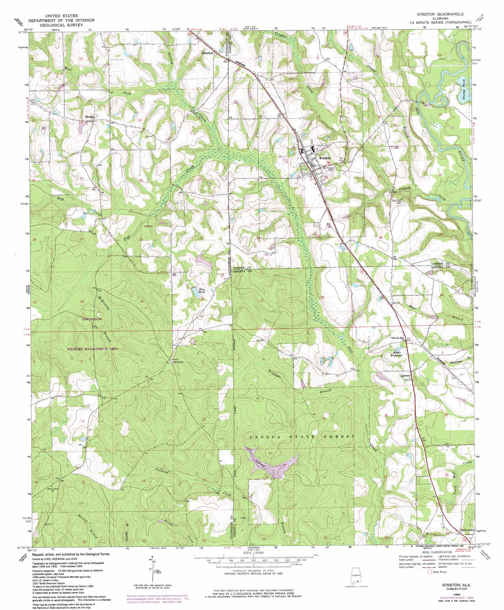
USGS Topo Quad 31086b2 - 1:24,000 scale
| Topo Map Name: | Kinston |
| USGS Topo Quad ID: | 31086b2 |
| Print Size: | ca. 21 1/4" wide x 27" high |
| Southeast Coordinates: | 31.125° N latitude / 86.125° W longitude |
| Map Center Coordinates: | 31.1875° N latitude / 86.1875° W longitude |
| U.S. State: | AL |
| Filename: | o31086b2.jpg |
| Download Map JPG Image: | Kinston topo map 1:24,000 scale |
| Map Type: | Topographic |
| Topo Series: | 7.5´ |
| Map Scale: | 1:24,000 |
| Source of Map Images: | United States Geological Survey (USGS) |
| Alternate Map Versions: |
Kinston AL 1969, updated 1971 Download PDF Buy paper map Kinston AL 1969, updated 1986 Download PDF Buy paper map Kinston AL 2011 Download PDF Buy paper map Kinston AL 2014 Download PDF Buy paper map |
1:24,000 Topo Quads surrounding Kinston
Gantt |
Dozier |
Danleys Crossroads |
Elba |
New Brockton |
Andalusia |
Opp West |
Opp East |
Ino |
Goodman |
Libertyville |
Onycha |
Kinston |
Sellersville |
Coffee Springs |
Watkins Bridge |
Florala |
Hacoda |
Samson |
Geneva West |
Laurel Hill |
Paxton |
Gaskin |
Darlington |
Hobbs Crossroads |
> Back to 31086a1 at 1:100,000 scale
> Back to 31086a1 at 1:250,000 scale
> Back to U.S. Topo Maps home
Kinston topo map: Gazetteer
Kinston: Crossings
Hollys Ferry (historical) elevation 39m 127′Kinston: Dams
Harold Wise Dam elevation 73m 239′Kinston: Forests
Geneva State Forest elevation 64m 209′Kinston: Lakes
Stump Pond elevation 44m 144′Kinston: Populated Places
Beulah elevation 90m 295′Earlytown elevation 69m 226′
Estothel elevation 88m 288′
Kinston elevation 82m 269′
Lowery elevation 68m 223′
Kinston: Post Offices
Kinston Post Office elevation 82m 269′Kinston: Reservoirs
Weeks Fishpond elevation 61m 200′Wise Pond elevation 75m 246′
Kinston: Streams
Caney Branch elevation 43m 141′Cripple Creek elevation 37m 121′
Dry Creek elevation 61m 200′
McKinney Branch elevation 63m 206′
Shotbag Creek elevation 57m 187′
Triangle Branch elevation 47m 154′
West Fork Shotbag Creek elevation 62m 203′
Kinston digital topo map on disk
Buy this Kinston topo map showing relief, roads, GPS coordinates and other geographical features, as a high-resolution digital map file on DVD:
Gulf Coast (LA, MS, AL, FL) & Southwestern Georgia
Buy digital topo maps: Gulf Coast (LA, MS, AL, FL) & Southwestern Georgia
 & Southwestern Georgia map DVD")