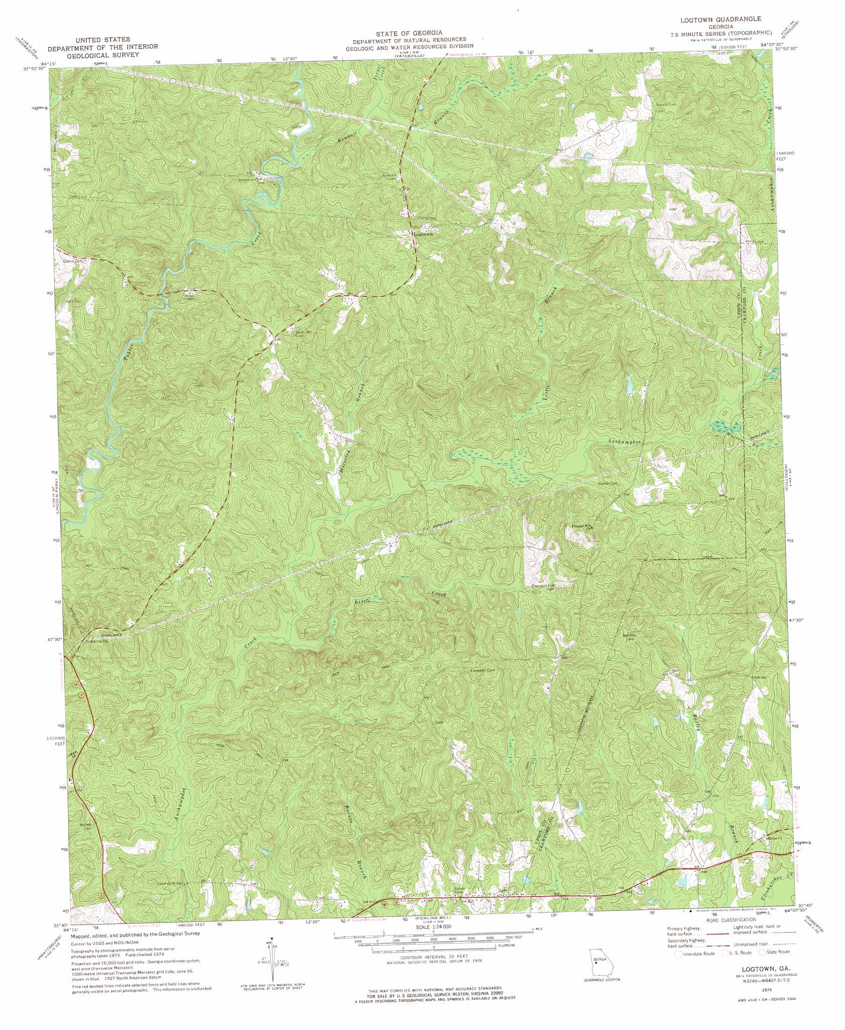
Logtown Topo Map Georgia
To zoom in, hover over the map of Logtown
USGS Topo Quad 32084g2 - 1:24,000 scale
| Topo Map Name: | Logtown |
| USGS Topo Quad ID: | 32084g2 |
| Print Size: | ca. 21 1/4" wide x 27" high |
| Southeast Coordinates: | 32.75° N latitude / 84.125° W longitude |
| Map Center Coordinates: | 32.8125° N latitude / 84.1875° W longitude |
| U.S. State: | GA |
| Filename: | o32084g2.jpg |
| Download Map JPG Image: | Logtown topo map 1:24,000 scale |
| Map Type: | Topographic |
| Topo Series: | 7.5´ |
| Map Scale: | 1:24,000 |
| Source of Map Images: | United States Geological Survey (USGS) |
| Alternate Map Versions: |
Logtown GA 1974, updated 1976 Download PDF Buy paper map Logtown GA 2011 Download PDF Buy paper map Logtown GA 2014 Download PDF Buy paper map |
1:24,000 Topo Quads surrounding Logtown
Concord |
Zebulon |
Barnesville |
Johnstonville |
Forsyth |
Sunset Village |
Thomaston |
Yatesville |
Strouds |
Smarr |
Roland |
Lincoln Park |
Logtown |
Culloden |
Moran |
Baldwinville |
Prattsburg |
Fickling Mill |
Roberta |
Knoxville |
Junction City |
Butler West |
Butler East |
Reynolds |
Fort Valley West |
> Back to 32084e1 at 1:100,000 scale
> Back to 32084a1 at 1:250,000 scale
> Back to U.S. Topo Maps home
Logtown topo map: Gazetteer
Logtown: Bridges
Auchumpkee Creek Covered Bridge elevation 123m 403′Logtown: Populated Places
Logtown elevation 206m 675′Salem elevation 156m 511′
Logtown: Streams
Horseley Branch elevation 134m 439′Israel Creek elevation 161m 528′
Kendall Branch elevation 153m 501′
Little Branch elevation 137m 449′
Little Creek elevation 132m 433′
Watson Branch elevation 146m 479′
Wrights Church Creek elevation 149m 488′
Logtown digital topo map on disk
Buy this Logtown topo map showing relief, roads, GPS coordinates and other geographical features, as a high-resolution digital map file on DVD:
Gulf Coast (LA, MS, AL, FL) & Southwestern Georgia
Buy digital topo maps: Gulf Coast (LA, MS, AL, FL) & Southwestern Georgia
 & Southwestern Georgia map DVD")