Mound Topo Map Louisiana
To zoom in, hover over the map of Mound
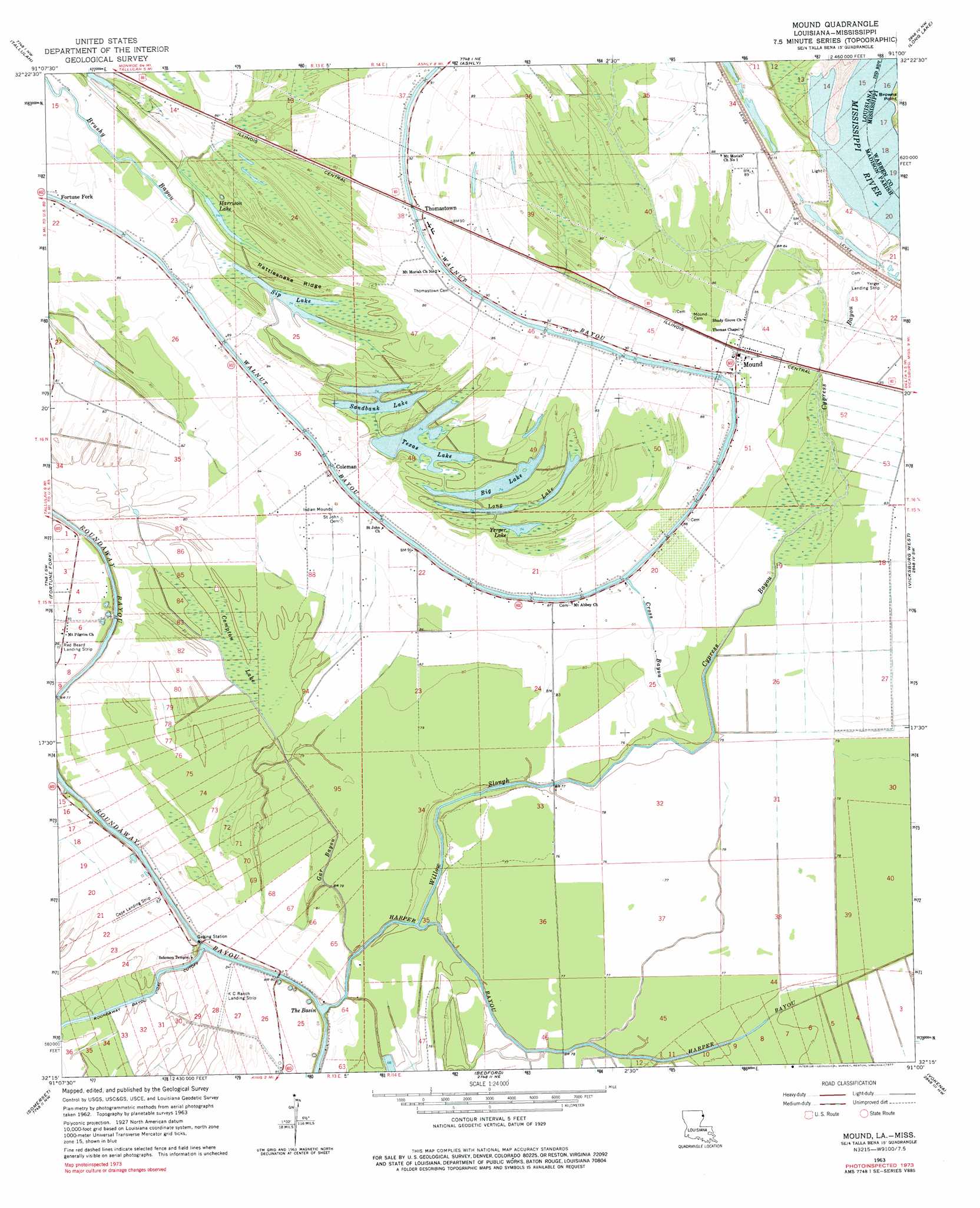
USGS Topo Quad 32091c1 - 1:24,000 scale
| Topo Map Name: | Mound |
| USGS Topo Quad ID: | 32091c1 |
| Print Size: | ca. 21 1/4" wide x 27" high |
| Southeast Coordinates: | 32.25° N latitude / 91° W longitude |
| Map Center Coordinates: | 32.3125° N latitude / 91.0625° W longitude |
| U.S. States: | LA, MS |
| Filename: | o32091c1.jpg |
| Download Map JPG Image: | Mound topo map 1:24,000 scale |
| Map Type: | Topographic |
| Topo Series: | 7.5´ |
| Map Scale: | 1:24,000 |
| Source of Map Images: | United States Geological Survey (USGS) |
| Alternate Map Versions: |
Mound LA 1909 Download PDF Buy paper map Mound LA 1909, updated 1961 Download PDF Buy paper map Mound LA 1963, updated 1964 Download PDF Buy paper map Mound LA 1963, updated 1977 Download PDF Buy paper map Mound LA 1998, updated 2003 Download PDF Buy paper map Mound LA 2012 Download PDF Buy paper map Mound LA 2015 Download PDF Buy paper map |
1:24,000 Topo Quads surrounding Mound
Panther Lake |
Sondheimer |
Eagle Bend |
Cane Bayou |
Floweree |
Tendal |
Tallulah |
Ashly |
Long Lake |
Redwood |
Waverly Se |
Fortune Fork |
Mound |
Vicksburg West |
Vicksburg East |
Westwood |
Somerset |
Bedford |
Yokena |
Big Black |
Saranac |
Newellton |
Grand Gulf |
Willows |
Carlisle |
> Back to 32091a1 at 1:100,000 scale
> Back to 32090a1 at 1:250,000 scale
> Back to U.S. Topo Maps home
Mound topo map: Gazetteer
Mound: Airports
Cape Landing Strip elevation 25m 82′K C Ranch Landing Strip elevation 24m 78′
Vicksburg Tallulah Regional Airport elevation 24m 78′
Yerger Landing Strip elevation 27m 88′
Mound: Bars
Nebraska Bar elevation 16m 52′Mound: Basins
The Basin elevation 21m 68′Mound: Bends
Roundaway-Bayou Vidal Cutoff elevation 20m 65′Mound: Crossings
Interchange 182 elevation 27m 88′Mound: Guts
Cross Bayou elevation 26m 85′Cypress Bayou elevation 21m 68′
Gar Bayou elevation 23m 75′
Harper Bayou elevation 22m 72′
Walnut Bayou elevation 27m 88′
Willow Slough elevation 21m 68′
Mound: Lakes
Big Lake elevation 23m 75′Christmas Lake (historical) elevation 22m 72′
Dry Lake (historical) elevation 23m 75′
Harrison Lake elevation 23m 75′
Long Lake elevation 23m 75′
Sandbank Lake elevation 23m 75′
Sip Lake elevation 23m 75′
Texas Lake elevation 23m 75′
Yerger Lake elevation 23m 75′
Mound: Populated Places
Coleman elevation 25m 82′Mound elevation 27m 88′
Thomastown elevation 27m 88′
Mound: Ridges
Rattlesnake Ridge elevation 25m 82′Mound: Swamps
Catfish Lake elevation 24m 78′Compton Lake elevation 23m 75′
Mound digital topo map on disk
Buy this Mound topo map showing relief, roads, GPS coordinates and other geographical features, as a high-resolution digital map file on DVD: