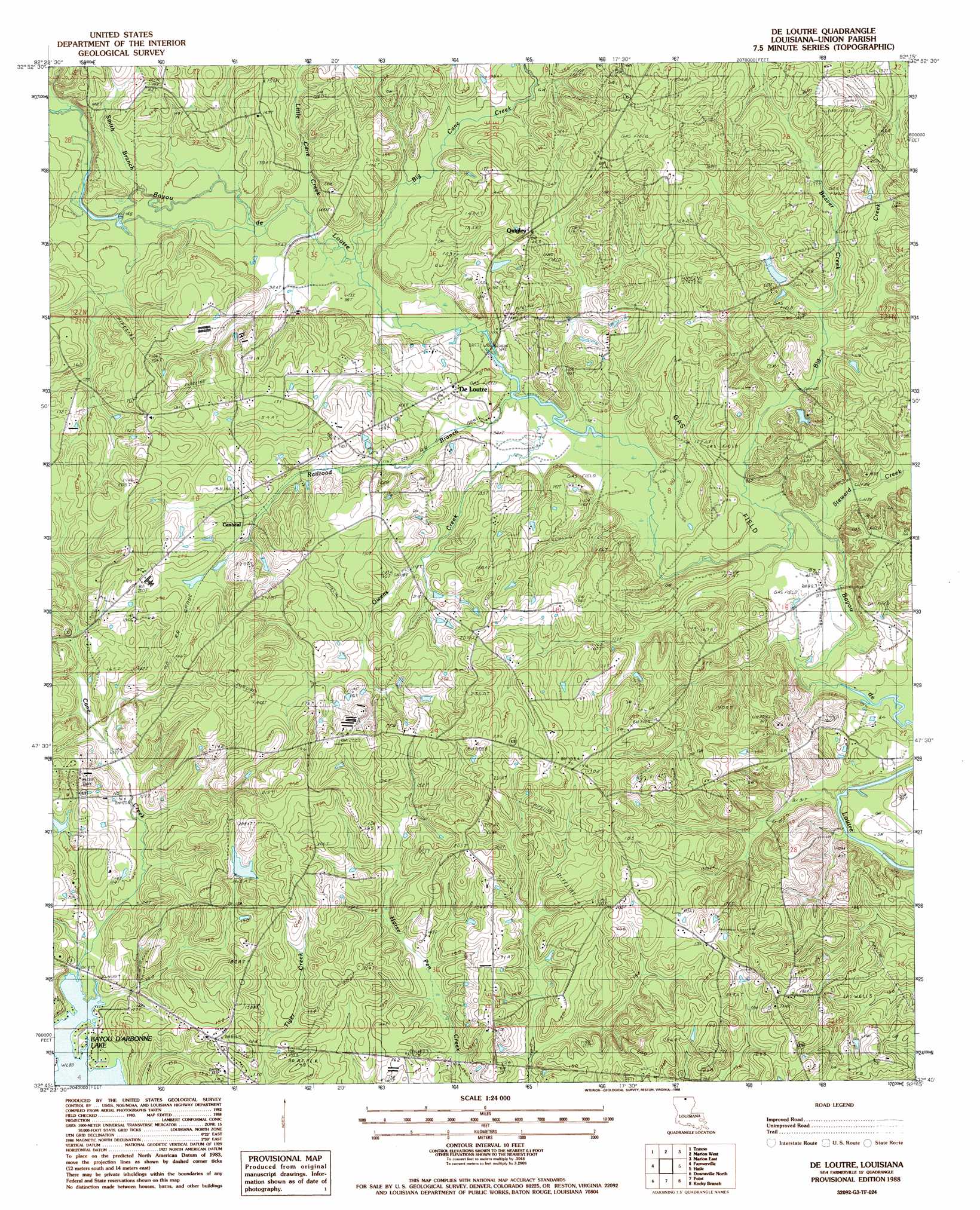
De Loutre Topo Map Louisiana
To zoom in, hover over the map of De Loutre
USGS Topo Quad 32092g3 - 1:24,000 scale
| Topo Map Name: | De Loutre |
| USGS Topo Quad ID: | 32092g3 |
| Print Size: | ca. 21 1/4" wide x 27" high |
| Southeast Coordinates: | 32.75° N latitude / 92.25° W longitude |
| Map Center Coordinates: | 32.8125° N latitude / 92.3125° W longitude |
| U.S. State: | LA |
| Filename: | o32092g3.jpg |
| Download Map JPG Image: | De Loutre topo map 1:24,000 scale |
| Map Type: | Topographic |
| Topo Series: | 7.5´ |
| Map Scale: | 1:24,000 |
| Source of Map Images: | United States Geological Survey (USGS) |
| Alternate Map Versions: |
De Loutre LA 1988, updated 1988 Download PDF Buy paper map De Loutre LA 2012 Download PDF Buy paper map De Loutre LA 2015 Download PDF Buy paper map |
1:24,000 Topo Quads surrounding De Loutre
Lockhart |
Gardner |
Strong |
Huttig |
Felsenthal Dam |
Spearsville |
Truxno |
Marion West |
Marion East |
Fish Lake |
Shiloh |
Farmerville |
De Loutre |
Haille |
Harrell Lake |
Cedarton |
Downsville North |
Point |
Rocky Branch |
Sterlington |
Ruston East |
Downsville South |
Calhoun |
West Monroe North |
Monroe North |
> Back to 32092e1 at 1:100,000 scale
> Back to 32092a1 at 1:250,000 scale
> Back to U.S. Topo Maps home
De Loutre topo map: Gazetteer
De Loutre: Crossings
Defees Ferry (historical) elevation 27m 88′De Loutre: Dams
Ouchley Pond Dam elevation 50m 164′De Loutre: Populated Places
Canbeal elevation 57m 187′De Loutre elevation 31m 101′
Quigley elevation 46m 150′
De Loutre: Reservoirs
Ouchleys Pond elevation 50m 164′De Loutre: Streams
Beaver Creek elevation 32m 104′Big Cane Creek elevation 27m 88′
Big Creek elevation 27m 88′
Little Cane Creek elevation 27m 88′
Owens Creek elevation 25m 82′
Railroad Branch elevation 27m 88′
Smith Branch elevation 29m 95′
Steward Creek elevation 25m 82′
De Loutre digital topo map on disk
Buy this De Loutre topo map showing relief, roads, GPS coordinates and other geographical features, as a high-resolution digital map file on DVD: