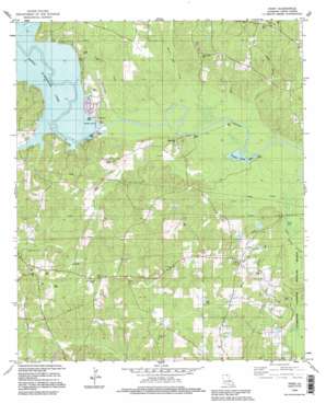
Point Topo Map Louisiana
To zoom in, hover over the map of Point
USGS Topo Quad 32092f3 - 1:24,000 scale
| Topo Map Name: | Point |
| USGS Topo Quad ID: | 32092f3 |
| Print Size: | ca. 21 1/4" wide x 27" high |
| Southeast Coordinates: | 32.625° N latitude / 92.25° W longitude |
| Map Center Coordinates: | 32.6875° N latitude / 92.3125° W longitude |
| U.S. State: | LA |
| Filename: | o32092f3.jpg |
| Download Map JPG Image: | Point topo map 1:24,000 scale |
| Map Type: | Topographic |
| Topo Series: | 7.5´ |
| Map Scale: | 1:24,000 |
| Source of Map Images: | United States Geological Survey (USGS) |
| Alternate Map Versions: |
Point LA 1982, updated 1982 Download PDF Buy paper map Point LA 1994, updated 1995 Download PDF Buy paper map Point LA 2012 Download PDF Buy paper map Point LA 2015 Download PDF Buy paper map |
1:24,000 Topo Quads surrounding Point
> Back to 32092e1 at 1:100,000 scale
> Back to 32092a1 at 1:250,000 scale
> Back to U.S. Topo Maps home
Point topo map: Gazetteer
Point: Airports
Farmerville Airport elevation 36m 118′Point: Dams
Bayles Pond Dam elevation 40m 131′Bayou Darbonne Dam elevation 24m 78′
Francis Creek Lake Dam elevation 17m 55′
Point: Lakes
Jones Lake elevation 17m 55′Point: Oilfields
Downsville Gas Field elevation 57m 187′Point: Populated Places
Moselys Bluff elevation 46m 150′Point elevation 49m 160′
Terrills elevation 61m 200′
Point: Reservoirs
Bayou D'Arbonne Lake elevation 24m 78′Francis Creek Lake elevation 17m 55′
Point: Streams
Briny Bridge Creek elevation 20m 65′Francis Creek elevation 18m 59′
Horse Pen Creek elevation 18m 59′
Lick Creek elevation 17m 55′
Rogers Creek elevation 19m 62′
Tiger Creek elevation 18m 59′
Tucker Creek elevation 18m 59′
Point digital topo map on disk
Buy this Point topo map showing relief, roads, GPS coordinates and other geographical features, as a high-resolution digital map file on DVD:


