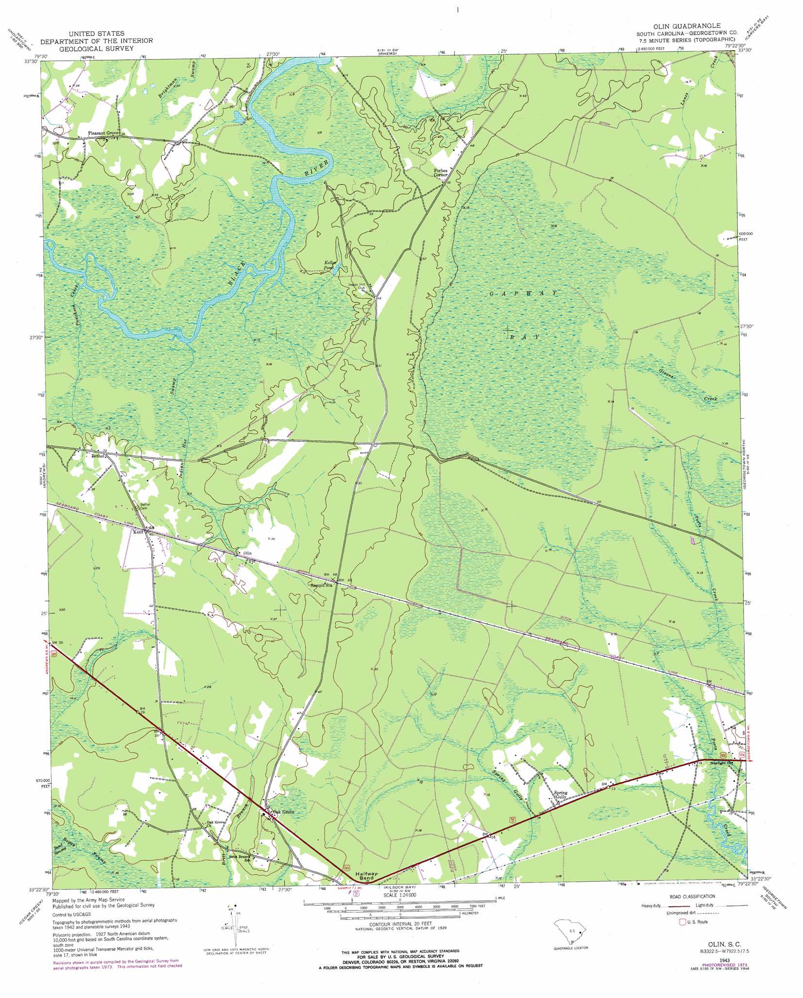
Olin Topo Map South Carolina
To zoom in, hover over the map of Olin
USGS Topo Quad 33079d4 - 1:24,000 scale
| Topo Map Name: | Olin |
| USGS Topo Quad ID: | 33079d4 |
| Print Size: | ca. 21 1/4" wide x 27" high |
| Southeast Coordinates: | 33.375° N latitude / 79.375° W longitude |
| Map Center Coordinates: | 33.4375° N latitude / 79.4375° W longitude |
| U.S. State: | SC |
| Filename: | o33079d4.jpg |
| Download Map JPG Image: | Olin topo map 1:24,000 scale |
| Map Type: | Topographic |
| Topo Series: | 7.5´ |
| Map Scale: | 1:24,000 |
| Source of Map Images: | United States Geological Survey (USGS) |
| Alternate Map Versions: |
Olin SC 1943, updated 1962 Download PDF Buy paper map Olin SC 1943, updated 1976 Download PDF Buy paper map Olin SC 2011 Download PDF Buy paper map Olin SC 2014 Download PDF Buy paper map |
1:24,000 Topo Quads surrounding Olin
Fowler |
Indiantown |
Henry |
Outland |
Yauhannah |
Kellehan Crossroads |
Warsaw |
Rhems |
Carvers Bay |
Plantersville |
Trio |
Andrews |
Olin |
Georgetown North |
Waverly Mills |
Jamestown |
Cedar Creek |
Kilsock Bay |
Georgetown South |
North Island |
Shulerville |
Honey Hill |
Santee |
Minim Island |
Santee Point |
> Back to 33079a1 at 1:100,000 scale
> Back to 33078a1 at 1:250,000 scale
> Back to U.S. Topo Maps home
Olin topo map: Gazetteer
Olin: Bends
Halfway Bend elevation 5m 16′Olin: Lakes
Kellys Pond elevation 6m 19′Olin: Populated Places
Bethel elevation 7m 22′Forbes Corner elevation 12m 39′
Kent elevation 12m 39′
Oak Grove elevation 13m 42′
Olin elevation 7m 22′
Pleasant Grove elevation 11m 36′
Spring Gully elevation 5m 16′
Olin: Streams
Bond Swamp elevation 6m 19′Indian Hut Swamp elevation 3m 9′
Puncheon Creek elevation 2m 6′
Olin: Swamps
Gapway Bay elevation 6m 19′Olin digital topo map on disk
Buy this Olin topo map showing relief, roads, GPS coordinates and other geographical features, as a high-resolution digital map file on DVD:
South Carolina, Western North Carolina & Northeastern Georgia
Buy digital topo maps: South Carolina, Western North Carolina & Northeastern Georgia