Sandridge Topo Map South Carolina
To zoom in, hover over the map of Sandridge
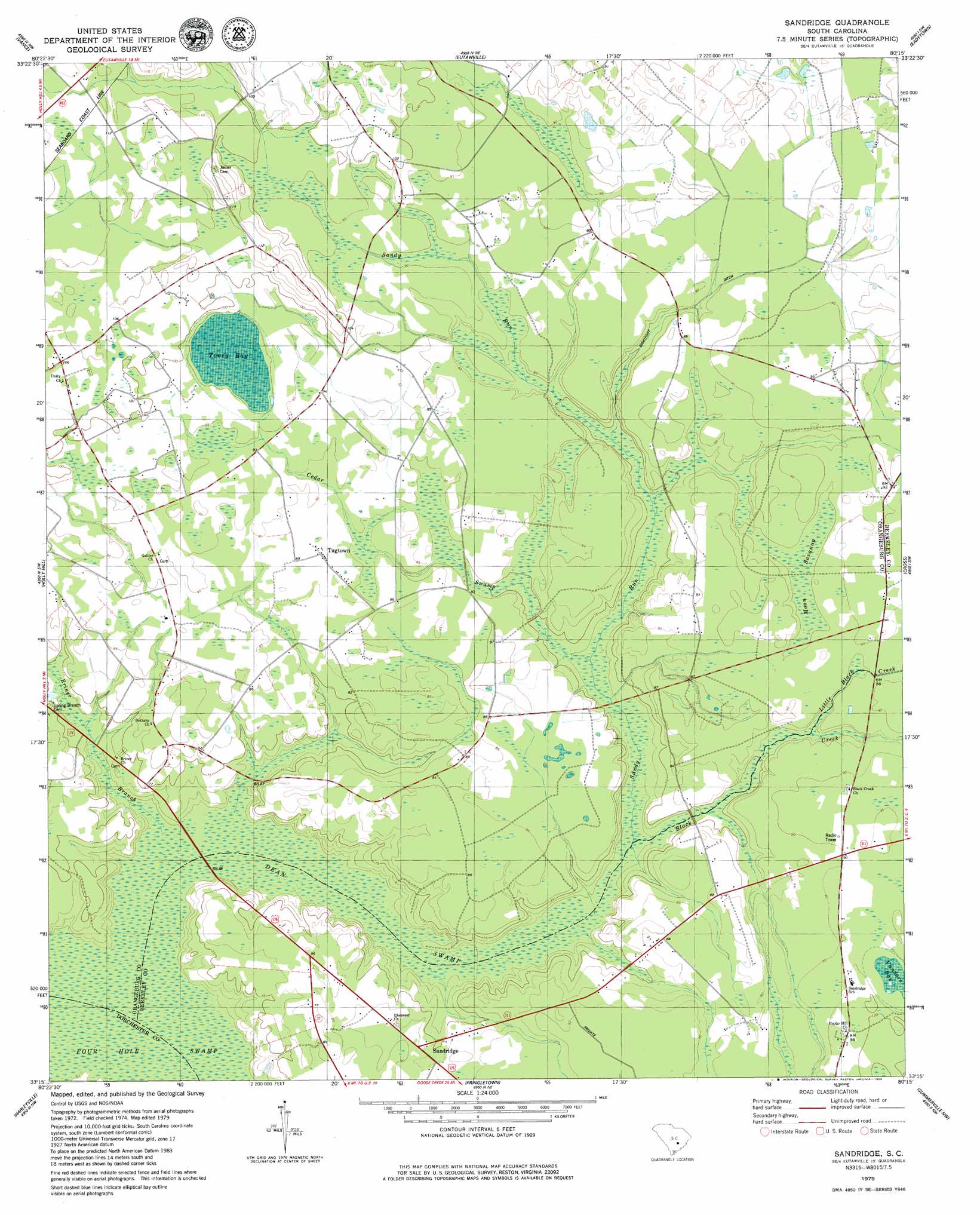
USGS Topo Quad 33080c3 - 1:24,000 scale
| Topo Map Name: | Sandridge |
| USGS Topo Quad ID: | 33080c3 |
| Print Size: | ca. 21 1/4" wide x 27" high |
| Southeast Coordinates: | 33.25° N latitude / 80.25° W longitude |
| Map Center Coordinates: | 33.3125° N latitude / 80.3125° W longitude |
| U.S. State: | SC |
| Filename: | o33080c3.jpg |
| Download Map JPG Image: | Sandridge topo map 1:24,000 scale |
| Map Type: | Topographic |
| Topo Series: | 7.5´ |
| Map Scale: | 1:24,000 |
| Source of Map Images: | United States Geological Survey (USGS) |
| Alternate Map Versions: |
Sandridge SC 1979, updated 1980 Download PDF Buy paper map Sandridge SC 2011 Download PDF Buy paper map Sandridge SC 2014 Download PDF Buy paper map |
1:24,000 Topo Quads surrounding Sandridge
Elloree |
Saint Paul |
Summerton |
Jordan |
Butlers Bay |
Felderville |
Vance |
Eutawville |
Eadytown |
Pineville |
Wadboo Swamp |
Holly Hill |
Sandridge |
Cross |
Chicora |
Saint George |
Harleyville |
Pringletown |
Summerville Nw |
Moncks Corner |
Canadys |
Maple Cane Swamp |
Ridgeville |
Summerville |
Mount Holly |
> Back to 33080a1 at 1:100,000 scale
> Back to 33080a1 at 1:250,000 scale
> Back to U.S. Topo Maps home
Sandridge topo map: Gazetteer
Sandridge: Airports
Crosswinds-Wilson Private Airport elevation 28m 91′Sandridge: Populated Places
Black Creek elevation 28m 91′Ebenezer elevation 24m 78′
Hussertown elevation 29m 95′
Sandridge elevation 24m 78′
Tugtown elevation 26m 85′
Sandridge: Streams
Black Creek elevation 18m 59′Briner Branch elevation 17m 55′
Cedar Swamp elevation 20m 65′
Dean Swamp elevation 17m 55′
Little Black Creek elevation 23m 75′
Sandy Run elevation 18m 59′
Sandridge: Swamps
Moon Savanna elevation 25m 82′Toney Bay elevation 28m 91′
Vandore Bay elevation 28m 91′
Sandridge digital topo map on disk
Buy this Sandridge topo map showing relief, roads, GPS coordinates and other geographical features, as a high-resolution digital map file on DVD:
South Carolina, Western North Carolina & Northeastern Georgia
Buy digital topo maps: South Carolina, Western North Carolina & Northeastern Georgia