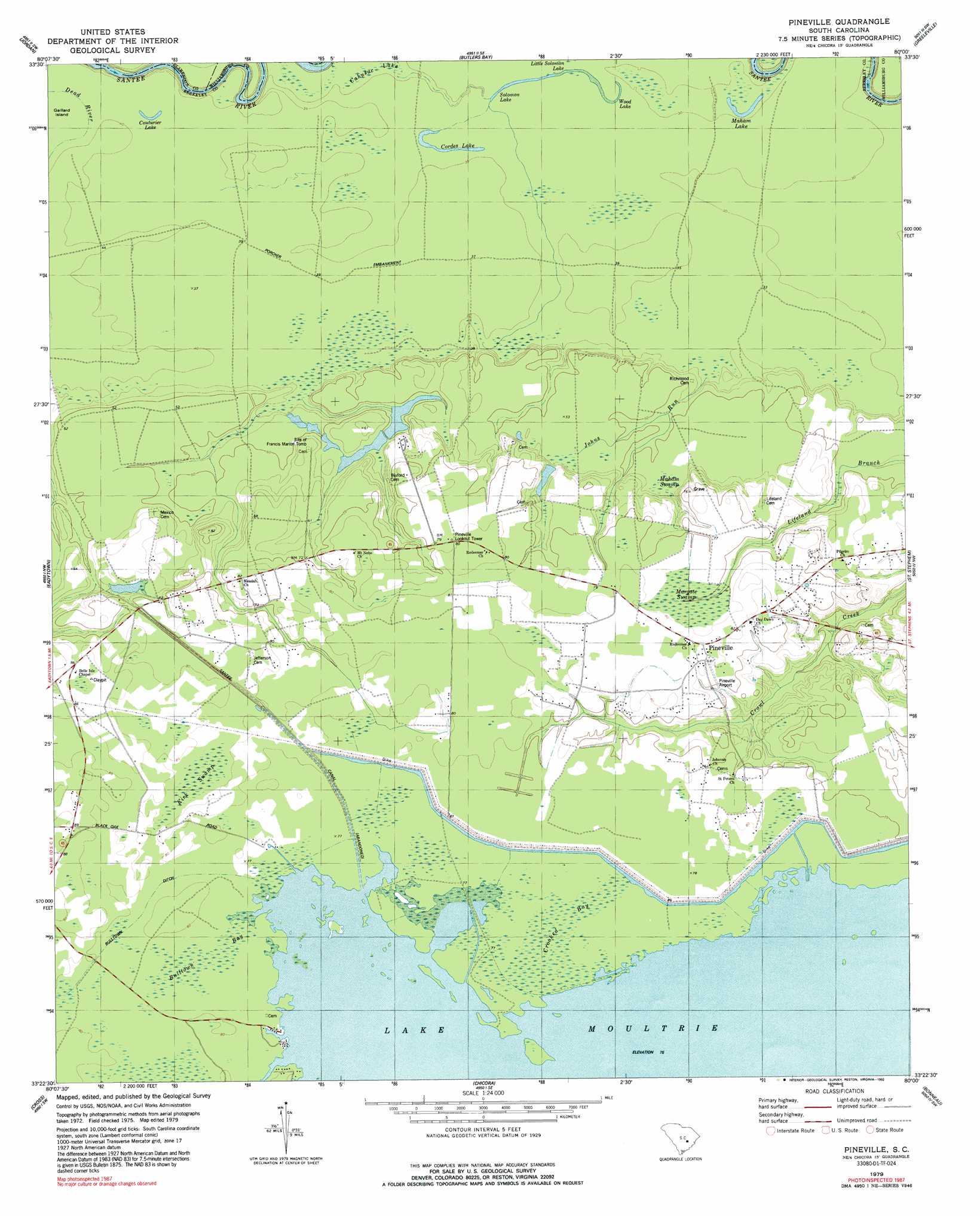
Pineville Topo Map South Carolina
To zoom in, hover over the map of Pineville
USGS Topo Quad 33080d1 - 1:24,000 scale
| Topo Map Name: | Pineville |
| USGS Topo Quad ID: | 33080d1 |
| Print Size: | ca. 21 1/4" wide x 27" high |
| Southeast Coordinates: | 33.375° N latitude / 80° W longitude |
| Map Center Coordinates: | 33.4375° N latitude / 80.0625° W longitude |
| U.S. State: | SC |
| Filename: | o33080d1.jpg |
| Download Map JPG Image: | Pineville topo map 1:24,000 scale |
| Map Type: | Topographic |
| Topo Series: | 7.5´ |
| Map Scale: | 1:24,000 |
| Source of Map Images: | United States Geological Survey (USGS) |
| Alternate Map Versions: |
Pineville SC 1979, updated 1992 Download PDF Buy paper map Pineville SC 2011 Download PDF Buy paper map Pineville SC 2014 Download PDF Buy paper map |
1:24,000 Topo Quads surrounding Pineville
Paxville |
Manning |
Foreston |
Workman |
Kingstree |
Summerton |
Jordan |
Butlers Bay |
Greeleyville |
Salters |
Eutawville |
Eadytown |
Pineville |
Saint Stephens |
Blakely |
Sandridge |
Cross |
Chicora |
Bonneau |
Wedboo Creek |
Pringletown |
Summerville Nw |
Moncks Corner |
Cordesville |
Bethera |
> Back to 33080a1 at 1:100,000 scale
> Back to 33080a1 at 1:250,000 scale
> Back to U.S. Topo Maps home
Pineville topo map: Gazetteer
Pineville: Canals
Bulltown Ditch elevation 24m 78′Santee Canal elevation 24m 78′
Pineville: Dams
Sinkler Dam (historical) elevation 12m 39′South Carolina Noname 14004 D-3508 Dam elevation 19m 62′
Pineville: Lakes
Cordes Lake elevation 9m 29′Couturier Lake elevation 11m 36′
Maham Lake elevation 9m 29′
Solomon Lake elevation 9m 29′
Wood Lake elevation 9m 29′
Pineville: Populated Places
Judge Town elevation 24m 78′Murrell (historical) elevation 24m 78′
Pineville elevation 24m 78′
Region Town (historical) elevation 24m 78′
Wing Road elevation 24m 78′
Pineville: Post Offices
Pineville Post Office elevation 24m 78′Pineville: Streams
Dead River elevation 11m 36′Johns Run elevation 10m 32′
Pineville: Swamps
Buckhall Bay (historical) elevation 23m 75′Bulltown Bay elevation 24m 78′
Cahusac Lake elevation 9m 29′
Crooked Bay elevation 24m 78′
Kirk Swamp elevation 24m 78′
Little Solomon Lake elevation 9m 29′
Maham Swamp elevation 16m 52′
Margate Swamp elevation 23m 75′
Pineville digital topo map on disk
Buy this Pineville topo map showing relief, roads, GPS coordinates and other geographical features, as a high-resolution digital map file on DVD:
South Carolina, Western North Carolina & Northeastern Georgia
Buy digital topo maps: South Carolina, Western North Carolina & Northeastern Georgia