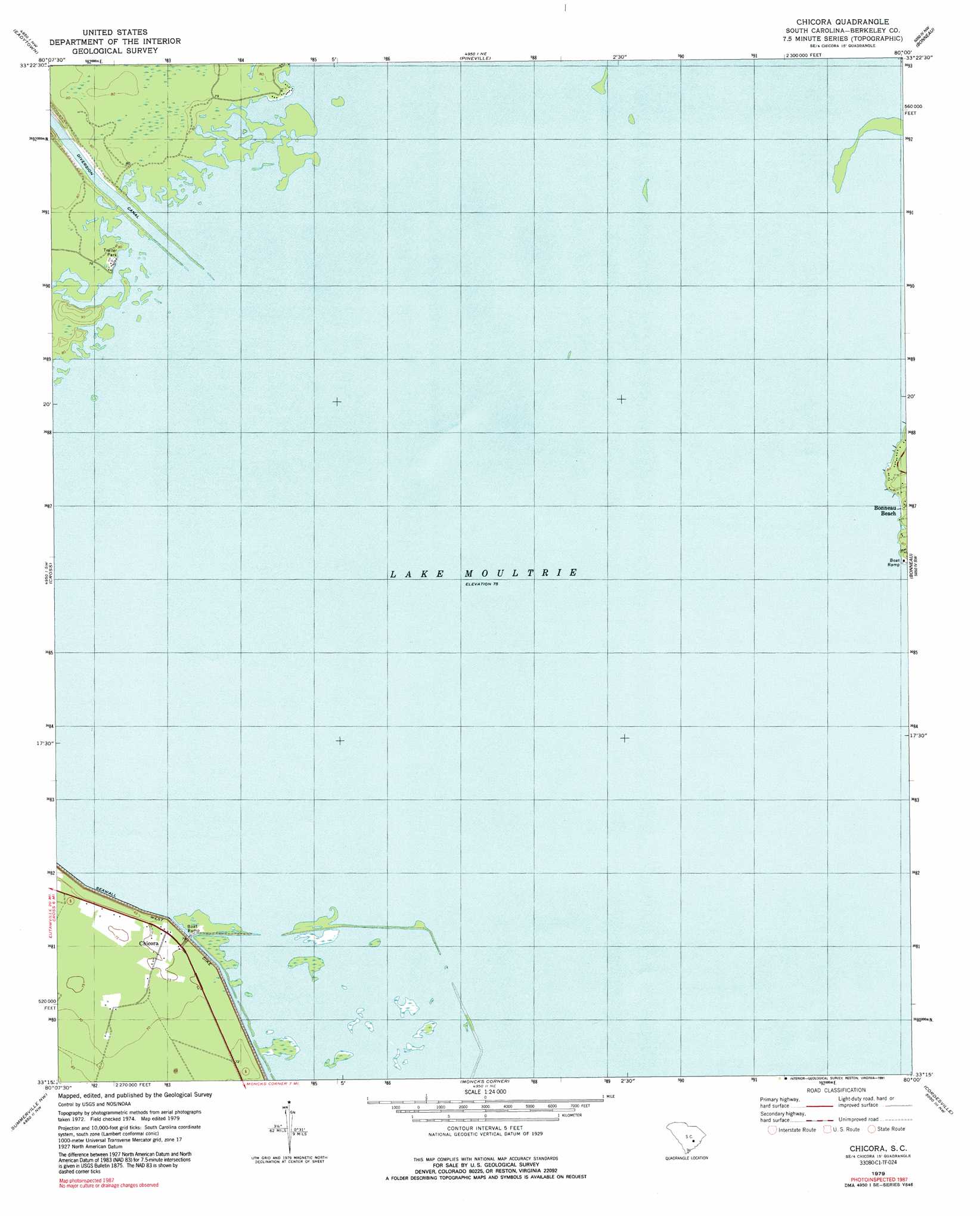
Chicora Topo Map South Carolina
To zoom in, hover over the map of Chicora
USGS Topo Quad 33080c1 - 1:24,000 scale
| Topo Map Name: | Chicora |
| USGS Topo Quad ID: | 33080c1 |
| Print Size: | ca. 21 1/4" wide x 27" high |
| Southeast Coordinates: | 33.25° N latitude / 80° W longitude |
| Map Center Coordinates: | 33.3125° N latitude / 80.0625° W longitude |
| U.S. State: | SC |
| Filename: | o33080c1.jpg |
| Download Map JPG Image: | Chicora topo map 1:24,000 scale |
| Map Type: | Topographic |
| Topo Series: | 7.5´ |
| Map Scale: | 1:24,000 |
| Source of Map Images: | United States Geological Survey (USGS) |
| Alternate Map Versions: |
Chicora SC 1979, updated 1991 Download PDF Buy paper map Chicora SC 2011 Download PDF Buy paper map Chicora SC 2014 Download PDF Buy paper map |
1:24,000 Topo Quads surrounding Chicora
Summerton |
Jordan |
Butlers Bay |
Greeleyville |
Salters |
Eutawville |
Eadytown |
Pineville |
Saint Stephens |
Blakely |
Sandridge |
Cross |
Chicora |
Bonneau |
Wedboo Creek |
Pringletown |
Summerville Nw |
Moncks Corner |
Cordesville |
Bethera |
Ridgeville |
Summerville |
Mount Holly |
Kittredge |
Huger |
> Back to 33080a1 at 1:100,000 scale
> Back to 33080a1 at 1:250,000 scale
> Back to U.S. Topo Maps home
Chicora topo map: Gazetteer
Chicora: Beaches
White Point Beach elevation 23m 75′Chicora: Canals
Moultrie Canal (historical) elevation 23m 75′Ophir Canal (historical) elevation 23m 75′
Chicora: Levees
West Dike elevation 25m 82′Chicora: Populated Places
Bonneau Beach elevation 24m 78′Chapel Hill (historical) elevation 23m 75′
Chicora elevation 23m 75′
Chicora: Streams
Bannister Down Branch (historical) elevation 23m 75′Fountain Branch (historical) elevation 23m 75′
Greenhill Branch (historical) elevation 23m 75′
Richardson Branch (historical) elevation 23m 75′
Waring Branch (historical) elevation 23m 75′
Chicora: Swamps
Ferguson Swamp (historical) elevation 23m 75′Fuller Bay (historical) elevation 22m 72′
Hog Swamp (historical) elevation 23m 75′
Moorfield Swamp (historical) elevation 23m 75′
Warwick Swamp (historical) elevation 23m 75′
Chicora digital topo map on disk
Buy this Chicora topo map showing relief, roads, GPS coordinates and other geographical features, as a high-resolution digital map file on DVD:
South Carolina, Western North Carolina & Northeastern Georgia
Buy digital topo maps: South Carolina, Western North Carolina & Northeastern Georgia