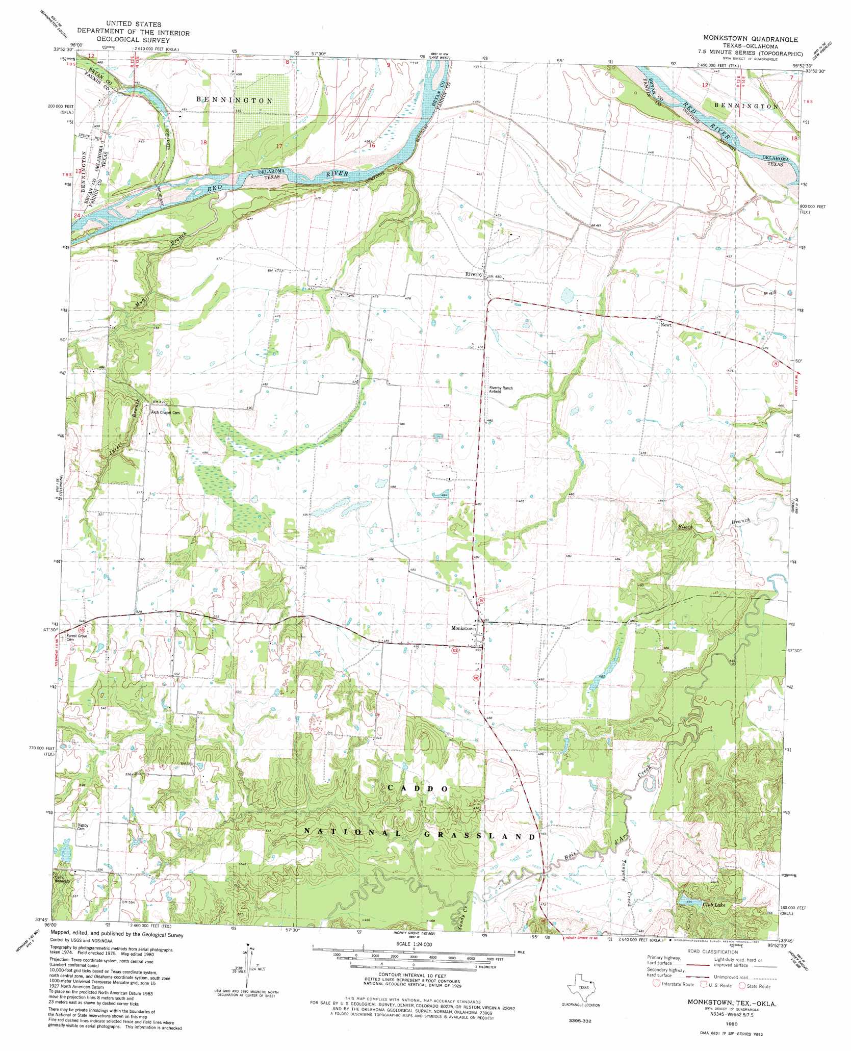
Monkstown Topo Map Texas
To zoom in, hover over the map of Monkstown
USGS Topo Quad 33095g8 - 1:24,000 scale
| Topo Map Name: | Monkstown |
| USGS Topo Quad ID: | 33095g8 |
| Print Size: | ca. 21 1/4" wide x 27" high |
| Southeast Coordinates: | 33.75° N latitude / 95.875° W longitude |
| Map Center Coordinates: | 33.8125° N latitude / 95.9375° W longitude |
| U.S. States: | TX, OK |
| Filename: | o33095g8.jpg |
| Download Map JPG Image: | Monkstown topo map 1:24,000 scale |
| Map Type: | Topographic |
| Topo Series: | 7.5´ |
| Map Scale: | 1:24,000 |
| Source of Map Images: | United States Geological Survey (USGS) |
| Alternate Map Versions: |
Monkstown TX 1980, updated 1981 Download PDF Buy paper map Monkstown TX 2010 Download PDF Buy paper map Monkstown TX 2013 Download PDF Buy paper map Monkstown TX 2016 Download PDF Buy paper map |
| FStopo: | US Forest Service topo Monkstown is available: Download FStopo PDF Download FStopo TIF |
1:24,000 Topo Quads surrounding Monkstown
Bokchito |
Bennington North |
Boswell Sw |
Boswell |
Soper |
Blue |
Bennington South |
Lake West |
New Oberlin |
Bluff |
Yuba |
Telephone |
Monkstown |
Direct |
Pat Mayse Lake West |
Lake Bonham |
Lamasco |
Selfs |
Tigertown |
Toco |
Bonham |
Dodd City |
Honey Grove |
Petty |
Roxton |
> Back to 33095e1 at 1:100,000 scale
> Back to 33094a1 at 1:250,000 scale
> Back to U.S. Topo Maps home
Monkstown topo map: Gazetteer
Monkstown: Airports
Riverby Ranch Airfield elevation 145m 475′Monkstown: Dams
Club Lake Dam elevation 151m 495′Monkstown: Lakes
Club Lake elevation 151m 495′Monkstown: Populated Places
Monkstown elevation 151m 495′Newt elevation 145m 475′
Riverby elevation 146m 479′
Monkstown: Reservoirs
Club Lake elevation 151m 495′Monkstown: Streams
Black Branch elevation 134m 439′Juret Branch elevation 137m 449′
Mud Branch elevation 139m 456′
Sandy Creek elevation 138m 452′
Tanyard Creek elevation 137m 449′
Monkstown digital topo map on disk
Buy this Monkstown topo map showing relief, roads, GPS coordinates and other geographical features, as a high-resolution digital map file on DVD: