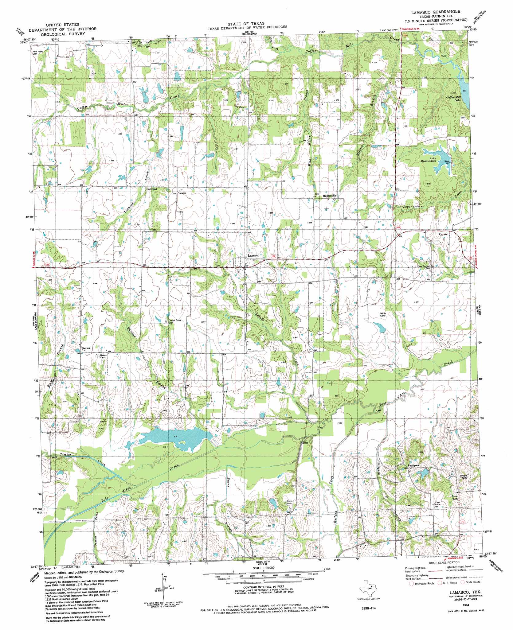
Lamasco Topo Map Texas
To zoom in, hover over the map of Lamasco
USGS Topo Quad 33096f1 - 1:24,000 scale
| Topo Map Name: | Lamasco |
| USGS Topo Quad ID: | 33096f1 |
| Print Size: | ca. 21 1/4" wide x 27" high |
| Southeast Coordinates: | 33.625° N latitude / 96° W longitude |
| Map Center Coordinates: | 33.6875° N latitude / 96.0625° W longitude |
| U.S. State: | TX |
| Filename: | o33096f1.jpg |
| Download Map JPG Image: | Lamasco topo map 1:24,000 scale |
| Map Type: | Topographic |
| Topo Series: | 7.5´ |
| Map Scale: | 1:24,000 |
| Source of Map Images: | United States Geological Survey (USGS) |
| Alternate Map Versions: |
Lamasco TX 1984, updated 1985 Download PDF Buy paper map Lamasco TX 2010 Download PDF Buy paper map Lamasco TX 2013 Download PDF Buy paper map Lamasco TX 2016 Download PDF Buy paper map |
| FStopo: | US Forest Service topo Lamasco is available: Download FStopo PDF Download FStopo TIF |
1:24,000 Topo Quads surrounding Lamasco
Roberta |
Blue |
Bennington South |
Lake West |
New Oberlin |
Kemp |
Yuba |
Telephone |
Monkstown |
Direct |
Mulberry |
Lake Bonham |
Lamasco |
Selfs |
Tigertown |
Ector |
Bonham |
Dodd City |
Honey Grove |
Petty |
Trenton |
Leonard |
Gober |
Ladonia |
Pecan Gap |
> Back to 33096e1 at 1:100,000 scale
> Back to 33096a1 at 1:250,000 scale
> Back to U.S. Topo Maps home
Lamasco topo map: Gazetteer
Lamasco: Dams
Lake Quail Haven Dam elevation 161m 528′Lamasco: Populated Places
Carson elevation 171m 561′Danner elevation 180m 590′
Dotson elevation 167m 547′
Hudsonville elevation 177m 580′
Lamasco elevation 179m 587′
Pettigrew elevation 180m 590′
Post Oak elevation 182m 597′
Lamasco: Reservoirs
Lake Quail Haven elevation 168m 551′Lamasco: Streams
Briscoe Branch elevation 152m 498′Bullard Creek elevation 152m 498′
Burns Branch elevation 156m 511′
Coffee Mill Creek elevation 151m 495′
Dry Fork elevation 158m 518′
Onstott Branch elevation 160m 524′
Pettigrew Branch elevation 151m 495′
Sandy Branch elevation 161m 528′
Sandy Creek elevation 153m 501′
Tanbark Creek elevation 164m 538′
Thomas Branch elevation 156m 511′
Timber Creek elevation 159m 521′
Wild Horse Branch elevation 156m 511′
Lamasco digital topo map on disk
Buy this Lamasco topo map showing relief, roads, GPS coordinates and other geographical features, as a high-resolution digital map file on DVD: