Kirksey Topo Map South Carolina
To zoom in, hover over the map of Kirksey
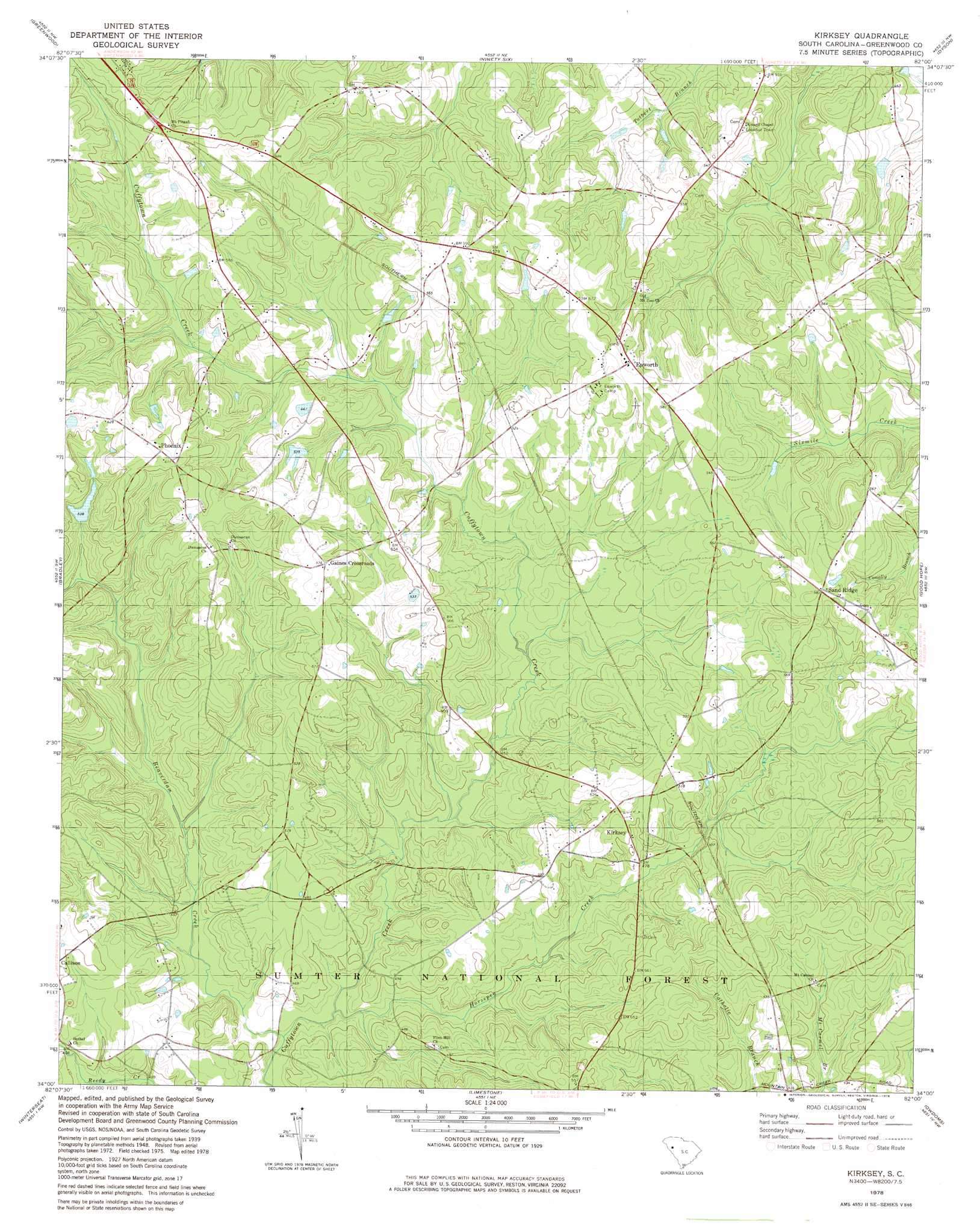
USGS Topo Quad 34082a1 - 1:24,000 scale
| Topo Map Name: | Kirksey |
| USGS Topo Quad ID: | 34082a1 |
| Print Size: | ca. 21 1/4" wide x 27" high |
| Southeast Coordinates: | 34° N latitude / 82° W longitude |
| Map Center Coordinates: | 34.0625° N latitude / 82.0625° W longitude |
| U.S. State: | SC |
| Filename: | o34082a1.jpg |
| Download Map JPG Image: | Kirksey topo map 1:24,000 scale |
| Map Type: | Topographic |
| Topo Series: | 7.5´ |
| Map Scale: | 1:24,000 |
| Source of Map Images: | United States Geological Survey (USGS) |
| Alternate Map Versions: |
Kirksey SC 1950 Download PDF Buy paper map Kirksey SC 1978, updated 1978 Download PDF Buy paper map Kirksey SC 2011 Download PDF Buy paper map Kirksey SC 2014 Download PDF Buy paper map |
| FStopo: | US Forest Service topo Kirksey is available: Download FStopo PDF Download FStopo TIF |
1:24,000 Topo Quads surrounding Kirksey
Shoals Junction |
Cokesbury |
Waterloo |
Cross Hill |
Bush River |
Abbeville East |
Greenwood |
Ninety Six |
Dyson |
Chappells |
Verdery |
Bradley |
Kirksey |
Good Hope |
Saluda North |
Mccormick |
Winterseat |
Limestone |
Owdoms |
Saluda South |
Plum Branch |
Parksville |
Red Hill |
Edgefield |
Johnston |
> Back to 34082a1 at 1:100,000 scale
> Back to 34082a1 at 1:250,000 scale
> Back to U.S. Topo Maps home
Kirksey topo map: Gazetteer
Kirksey: Dams
Metts Pond Dam D-1672 elevation 159m 521′South Carolina Noname 24019 D-1273 Dam elevation 163m 534′
Kirksey: Populated Places
Dominicks (historical) elevation 170m 557′Epworth elevation 174m 570′
Gaines Crossroads elevation 174m 570′
Kirksey elevation 152m 498′
Phoenix elevation 187m 613′
Rosa (historical) elevation 153m 501′
Sand Ridge elevation 177m 580′
Kirksey: Streams
Beaverdam Creek elevation 128m 419′Horsepen Creek elevation 128m 419′
Kirksey digital topo map on disk
Buy this Kirksey topo map showing relief, roads, GPS coordinates and other geographical features, as a high-resolution digital map file on DVD:
South Carolina, Western North Carolina & Northeastern Georgia
Buy digital topo maps: South Carolina, Western North Carolina & Northeastern Georgia