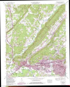
Gadsden West Topo Map Alabama
To zoom in, hover over the map of Gadsden West
USGS Topo Quad 34086a1 - 1:24,000 scale
| Topo Map Name: | Gadsden West |
| USGS Topo Quad ID: | 34086a1 |
| Print Size: | ca. 21 1/4" wide x 27" high |
| Southeast Coordinates: | 34° N latitude / 86° W longitude |
| Map Center Coordinates: | 34.0625° N latitude / 86.0625° W longitude |
| U.S. State: | AL |
| Filename: | o34086a1.jpg |
| Download Map JPG Image: | Gadsden West topo map 1:24,000 scale |
| Map Type: | Topographic |
| Topo Series: | 7.5´ |
| Map Scale: | 1:24,000 |
| Source of Map Images: | United States Geological Survey (USGS) |
| Alternate Map Versions: |
Gadsden AL 1959, updated 1961 Download PDF Buy paper map Gadsden AL 1959, updated 1970 Download PDF Buy paper map Gadsden West AL 1959, updated 1984 Download PDF Buy paper map Gadsden West AL 1959, updated 1985 Download PDF Buy paper map Gadsden West AL 1959, updated 1985 Download PDF Buy paper map Gadsden West AL 2011 Download PDF Buy paper map Gadsden West AL 2014 Download PDF Buy paper map |
1:24,000 Topo Quads surrounding Gadsden West
> Back to 34086a1 at 1:100,000 scale
> Back to 34086a1 at 1:250,000 scale
> Back to U.S. Topo Maps home
Gadsden West topo map: Gazetteer
Gadsden West: Bends
Hazel Bend elevation 178m 583′Gadsden West: Bridges
Bennettsville Bridge (historical) elevation 162m 531′Bruton Bridge elevation 177m 580′
Gilliland Bridge (historical) elevation 176m 577′
Rheas Bridge elevation 165m 541′
Gadsden West: Cliffs
The Brow elevation 243m 797′Gadsden West: Crossings
Interchange 183 elevation 162m 531′Interchange 188 elevation 178m 583′
Gadsden West: Falls
Noccalula Falls elevation 182m 597′Gadsden West: Gaps
Bruton Gap elevation 279m 915′Copeland Gap elevation 302m 990′
Cox Gap elevation 212m 695′
Wesson Gap elevation 264m 866′
Gadsden West: Parks
Central Recreation Area elevation 159m 521′Gadsden Kiwanis Park elevation 220m 721′
Gadsden Moragne Park elevation 155m 508′
Noccalula Park elevation 184m 603′
Sequoyah Park elevation 259m 849′
Gadsden West: Populated Places
Agricola elevation 242m 793′Alabama City elevation 168m 551′
Attalla elevation 167m 547′
Avery elevation 189m 620′
Bellevue elevation 245m 803′
Bennettsville (historical) elevation 166m 544′
Black Creek Falls (historical) elevation 222m 728′
Brans Chapel elevation 212m 695′
Cave Springs elevation 188m 616′
Copeland Gap elevation 303m 994′
Cox Gap elevation 191m 626′
Crudup elevation 197m 646′
Curtiston elevation 178m 583′
Gadsden elevation 167m 547′
Happy Hollow elevation 237m 777′
Lewin (historical) elevation 165m 541′
Maryville elevation 217m 711′
Monte Vista elevation 313m 1026′
Moragne elevation 177m 580′
Morton (historical) elevation 252m 826′
Noble Hill elevation 196m 643′
Norton elevation 173m 567′
Pleasant Hill elevation 188m 616′
Pull Tight (historical) elevation 167m 547′
Reece City elevation 183m 600′
Rhea (historical) elevation 168m 551′
Ridgeville elevation 197m 646′
Rockledge elevation 296m 971′
Scenic Heights elevation 305m 1000′
South Gadsden elevation 169m 554′
Stowers Hill elevation 175m 574′
The Highlands elevation 233m 764′
Tuckahoe Heights elevation 306m 1003′
Walnut Park elevation 164m 538′
Gadsden West: Post Offices
Attalla Post Office elevation 166m 544′Coxville Post Office elevation 191m 626′
Gadsden Post Office elevation 168m 551′
Greenwood Post Office (historical) elevation 185m 606′
Nina Post Office elevation 188m 616′
Gadsden West: Reservoirs
Clayton Fish Pond elevation 173m 567′Lake Rhea elevation 165m 541′
Gadsden West: Springs
Attalla Spring elevation 246m 807′Cooper Spring elevation 187m 613′
Gadsden West: Streams
Clear Creek elevation 164m 538′Fisher Creek elevation 182m 597′
Hughes Spring Branch elevation 155m 508′
Line Creek elevation 164m 538′
Little Wills Creek elevation 159m 521′
Rocky Creek elevation 180m 590′
Gadsden West: Summits
Avery Hill elevation 279m 915′Moragne Mountain elevation 296m 971′
Gadsden West: Valleys
Big Wills Valley elevation 163m 534′Bob Walden Hollow elevation 180m 590′
Little Sand Valley elevation 165m 541′
Little Wills Valley elevation 162m 531′
Spout Spring Hollow elevation 176m 577′
Gadsden West digital topo map on disk
Buy this Gadsden West topo map showing relief, roads, GPS coordinates and other geographical features, as a high-resolution digital map file on DVD:


