Glenwood Topo Map Arkansas
To zoom in, hover over the map of Glenwood
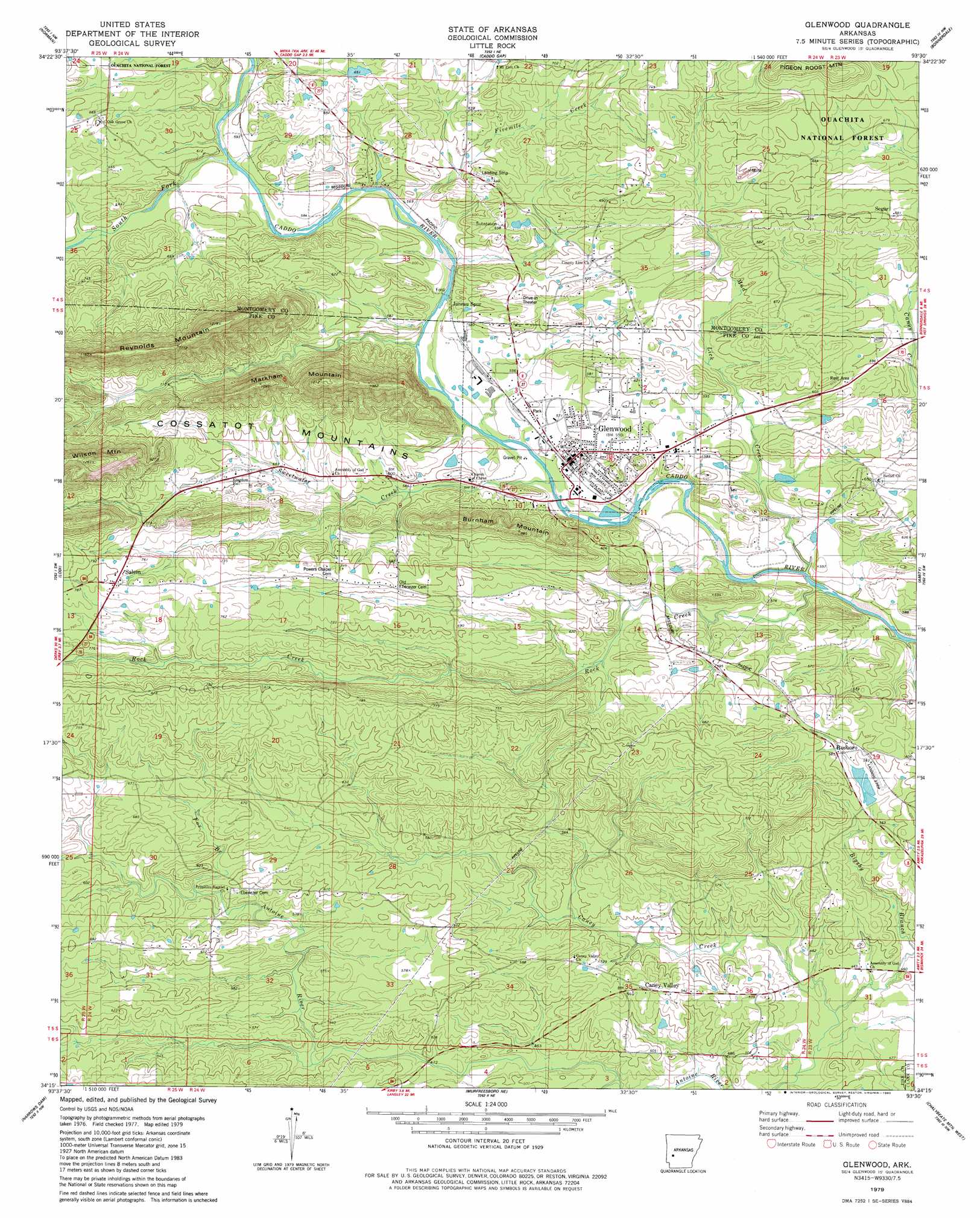
USGS Topo Quad 34093c5 - 1:24,000 scale
| Topo Map Name: | Glenwood |
| USGS Topo Quad ID: | 34093c5 |
| Print Size: | ca. 21 1/4" wide x 27" high |
| Southeast Coordinates: | 34.25° N latitude / 93.5° W longitude |
| Map Center Coordinates: | 34.3125° N latitude / 93.5625° W longitude |
| U.S. State: | AR |
| Filename: | o34093c5.jpg |
| Download Map JPG Image: | Glenwood topo map 1:24,000 scale |
| Map Type: | Topographic |
| Topo Series: | 7.5´ |
| Map Scale: | 1:24,000 |
| Source of Map Images: | United States Geological Survey (USGS) |
| Alternate Map Versions: |
Glenwood AR 1979, updated 1980 Download PDF Buy paper map Glenwood AR 2011 Download PDF Buy paper map Glenwood AR 2014 Download PDF Buy paper map |
| FStopo: | US Forest Service topo Glenwood is available: Download FStopo PDF Download FStopo TIF |
1:24,000 Topo Quads surrounding Glenwood
Oden |
Mount Ida |
Reed Mountain |
Mcgraw Mountain |
Crystal Springs |
Polk Creek Mountain |
Norman |
Caddo Gap |
Bonnerdale |
Pearcy |
Langley |
Lodi |
Glenwood |
Amity |
Point Cedar |
Center Point Ne |
Narrows Dam |
Murfreesboro Ne |
Chalybeate Mountain West |
Chalybeate Mountain East |
Nathan |
Murfreesboro |
Delight |
Antoine |
Okolona North |
> Back to 34093a1 at 1:100,000 scale
> Back to 34092a1 at 1:250,000 scale
> Back to U.S. Topo Maps home
Glenwood topo map: Gazetteer
Glenwood: Dams
Mill Pond Dam elevation 171m 561′Tigue Lake Dam elevation 200m 656′
Glenwood: Mines
Pigeon Roost Mine elevation 204m 669′Glenwood: Populated Places
Caney Valley elevation 173m 567′Glenwood elevation 173m 567′
Hickory Station (historical) elevation 213m 698′
Rock Creek (historical) elevation 166m 544′
Rosboro elevation 175m 574′
Salem elevation 241m 790′
Segur elevation 207m 679′
Glenwood: Reservoirs
Mill Pond elevation 171m 561′Tigue Lake elevation 200m 656′
Glenwood: Ridges
Reynolds Mountain elevation 353m 1158′Glenwood: Streams
Bigsby Branch elevation 143m 469′Fivemile Creek elevation 166m 544′
Fox Branch elevation 164m 538′
Little Antoine Creek elevation 136m 446′
Mud Lick Creek elevation 159m 521′
Rock Creek elevation 153m 501′
South Fork Caddo River elevation 175m 574′
Sweetwater Creek elevation 163m 534′
Glenwood: Summits
Burnham Mountain elevation 269m 882′Markham Mountain elevation 372m 1220′
Glenwood digital topo map on disk
Buy this Glenwood topo map showing relief, roads, GPS coordinates and other geographical features, as a high-resolution digital map file on DVD: