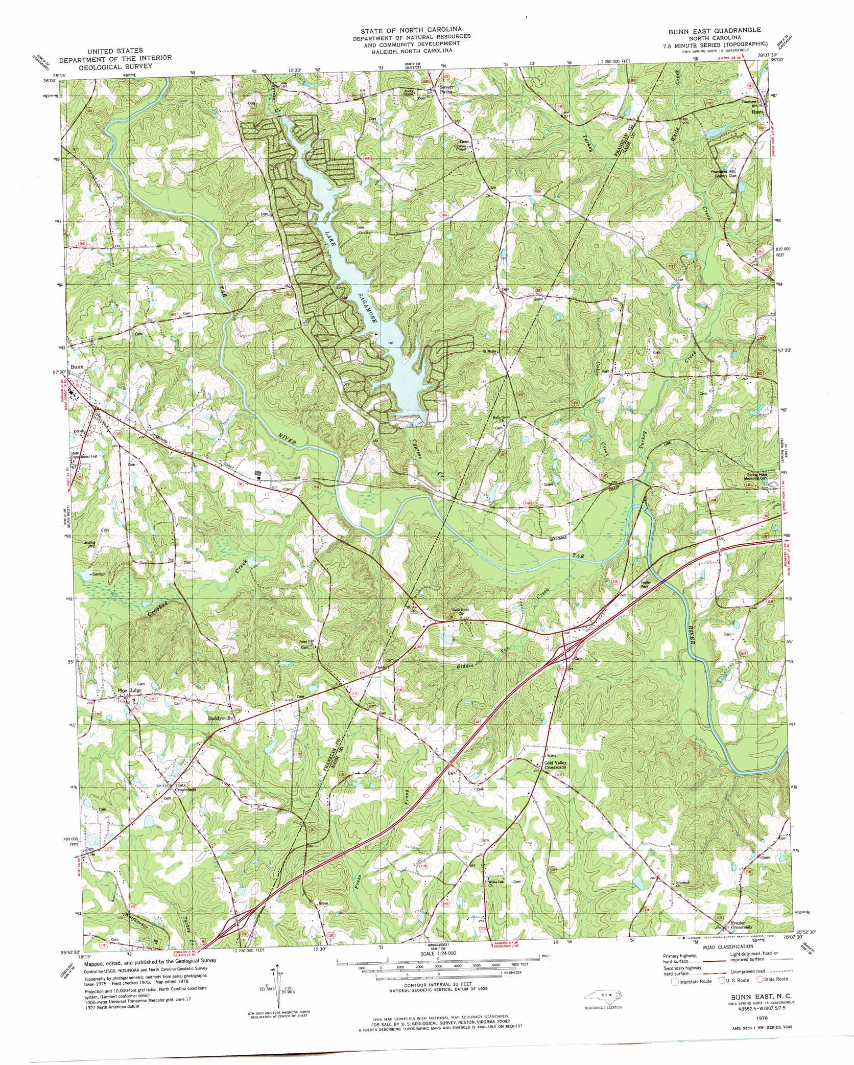
Bunn East Topo Map North Carolina
To zoom in, hover over the map of Bunn East
USGS Topo Quad 35078h2 - 1:24,000 scale
| Topo Map Name: | Bunn East |
| USGS Topo Quad ID: | 35078h2 |
| Print Size: | ca. 21 1/4" wide x 27" high |
| Southeast Coordinates: | 35.875° N latitude / 78.125° W longitude |
| Map Center Coordinates: | 35.9375° N latitude / 78.1875° W longitude |
| U.S. State: | NC |
| Filename: | o35078h2.jpg |
| Download Map JPG Image: | Bunn East topo map 1:24,000 scale |
| Map Type: | Topographic |
| Topo Series: | 7.5´ |
| Map Scale: | 1:24,000 |
| Source of Map Images: | United States Geological Survey (USGS) |
| Alternate Map Versions: |
Bunn East NC 1978, updated 1978 Download PDF Buy paper map Bunn East NC 2010 Download PDF Buy paper map Bunn East NC 2013 Download PDF Buy paper map Bunn East NC 2016 Download PDF Buy paper map |
1:24,000 Topo Quads surrounding Bunn East
Kittrell |
Ingleside |
Gold Sand |
Centerville |
Essex |
Franklinton |
Louisburg |
Justice |
Castalia |
Red Oak |
Rolesville |
Bunn West |
Bunn East |
Spring Hope |
Nashville |
Knightdale |
Zebulon |
Middlesex |
Bailey |
Winstead Crossroads |
Clayton |
Flowers |
Stancils Chapel |
Lucama |
Wilson |
> Back to 35078e1 at 1:100,000 scale
> Back to 35078a1 at 1:250,000 scale
> Back to U.S. Topo Maps home
Bunn East topo map: Gazetteer
Bunn East: Bridges
Anderson Bridge elevation 47m 154′Mullins Bridge elevation 47m 154′
Webbs Bridge elevation 46m 150′
Bunn East: Dams
Barbees Pond Dam elevation 78m 255′Bass Pond Dam elevation 59m 193′
Brantleys Pond Dam elevation 50m 164′
Jeffries Pond Dam elevation 59m 193′
Lake Royale Dam elevation 50m 164′
Mullens Pond Dam elevation 60m 196′
Bunn East: Lakes
Lake Sagamore elevation 57m 187′Bunn East: Populated Places
Daddysville elevation 91m 298′Frazier Crossroads elevation 84m 275′
Gold Valley Crossroads elevation 83m 272′
Pine Ridge elevation 93m 305′
Seven Paths elevation 95m 311′
Tants Crossroads elevation 96m 314′
Bunn East: Reservoirs
Barbees Pond elevation 78m 255′Bass Pond elevation 59m 193′
Brantleys Pond elevation 50m 164′
Jeffries Pond elevation 59m 193′
Lake Royale elevation 57m 187′
Lake Sagamore elevation 57m 187′
Mullens Pond elevation 60m 196′
Bunn East: Streams
Biddie Toe Creek elevation 48m 157′Coker Creek elevation 47m 154′
Crooked Creek elevation 46m 150′
Cypress Creek elevation 47m 154′
Turkey Creek elevation 46m 150′
White Creek elevation 59m 193′
Bunn East digital topo map on disk
Buy this Bunn East topo map showing relief, roads, GPS coordinates and other geographical features, as a high-resolution digital map file on DVD:
South Carolina, Western North Carolina & Northeastern Georgia
Buy digital topo maps: South Carolina, Western North Carolina & Northeastern Georgia