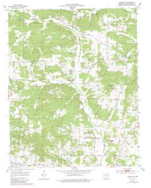
Charlotte Topo Map Arkansas
To zoom in, hover over the map of Charlotte
USGS Topo Quad 35091g4 - 1:24,000 scale
| Topo Map Name: | Charlotte |
| USGS Topo Quad ID: | 35091g4 |
| Print Size: | ca. 21 1/4" wide x 27" high |
| Southeast Coordinates: | 35.75° N latitude / 91.375° W longitude |
| Map Center Coordinates: | 35.8125° N latitude / 91.4375° W longitude |
| U.S. State: | AR |
| Filename: | o35091g4.jpg |
| Download Map JPG Image: | Charlotte topo map 1:24,000 scale |
| Map Type: | Topographic |
| Topo Series: | 7.5´ |
| Map Scale: | 1:24,000 |
| Source of Map Images: | United States Geological Survey (USGS) |
| Alternate Map Versions: |
Charlotte AR 1954, updated 1955 Download PDF Buy paper map Charlotte AR 1954, updated 1982 Download PDF Buy paper map Charlotte AR 2011 Download PDF Buy paper map Charlotte AR 2014 Download PDF Buy paper map |
1:24,000 Topo Quads surrounding Charlotte
> Back to 35091e1 at 1:100,000 scale
> Back to 35090a1 at 1:250,000 scale
> Back to U.S. Topo Maps home
Charlotte topo map: Gazetteer
Charlotte: Dams
Pascoe J Stafford Lake Dam elevation 90m 295′Charlotte: Populated Places
Cedar Grove elevation 113m 370′Charlotte elevation 105m 344′
Dota elevation 97m 318′
Pleasant Hill elevation 101m 331′
Walnut Grove elevation 111m 364′
Charlotte: Post Offices
Walnut Grove Post Office (historical) elevation 109m 357′Charlotte: Reservoirs
Pascoe J Stafford Lake elevation 90m 295′Charlotte: Springs
Baxter Spring elevation 152m 498′Charlotte: Streams
Baker Branch elevation 85m 278′Carter Branch elevation 93m 305′
Chalk Branch elevation 86m 282′
Dry Fork Dota Creek elevation 102m 334′
Charlotte digital topo map on disk
Buy this Charlotte topo map showing relief, roads, GPS coordinates and other geographical features, as a high-resolution digital map file on DVD:


