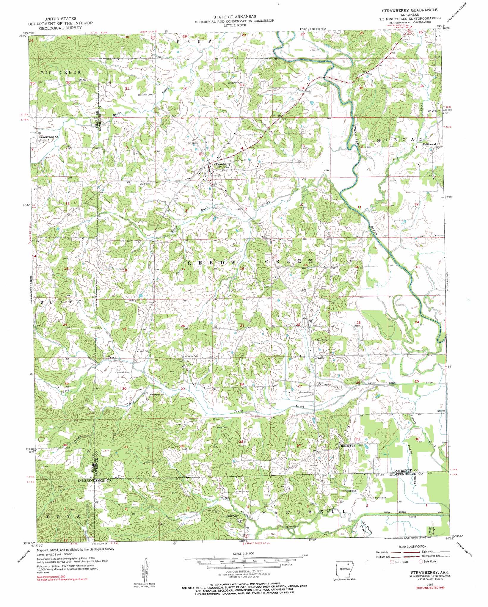
Strawberry Topo Map Arkansas
To zoom in, hover over the map of Strawberry
USGS Topo Quad 35091h3 - 1:24,000 scale
| Topo Map Name: | Strawberry |
| USGS Topo Quad ID: | 35091h3 |
| Print Size: | ca. 21 1/4" wide x 27" high |
| Southeast Coordinates: | 35.875° N latitude / 91.25° W longitude |
| Map Center Coordinates: | 35.9375° N latitude / 91.3125° W longitude |
| U.S. State: | AR |
| Filename: | o35091h3.jpg |
| Download Map JPG Image: | Strawberry topo map 1:24,000 scale |
| Map Type: | Topographic |
| Topo Series: | 7.5´ |
| Map Scale: | 1:24,000 |
| Source of Map Images: | United States Geological Survey (USGS) |
| Alternate Map Versions: |
Strawberry AR 1955, updated 1956 Download PDF Buy paper map Strawberry AR 1955, updated 1990 Download PDF Buy paper map Strawberry AR 2011 Download PDF Buy paper map Strawberry AR 2014 Download PDF Buy paper map |
1:24,000 Topo Quads surrounding Strawberry
Ash Flat |
Sitka |
Ravenden |
Imboden |
Noland |
Evening Shade |
Poughkeepsie |
Smithville |
Eaton |
Black Rock |
Cave City |
Grange |
Strawberry |
Strangers Home |
Alicia |
Sulphur Rock |
Charlotte |
Cord |
Swifton West |
Swifton East |
Salado |
Newark |
Jacksonport |
Tuckerman |
Grubbs |
> Back to 35091e1 at 1:100,000 scale
> Back to 35090a1 at 1:250,000 scale
> Back to U.S. Topo Maps home
Strawberry topo map: Gazetteer
Strawberry: Canals
Caney Creek Ditch elevation 73m 239′Curia Creek Ditch elevation 70m 229′
Strawberry: Dams
Runyans Lake Dam elevation 119m 390′Strawberry: Populated Places
Driftwood elevation 83m 272′Lockheart (historical) elevation 72m 236′
Saffell elevation 84m 275′
Strawberry elevation 103m 337′
Strawberry: Reservoirs
Runyans Lake elevation 119m 390′Strawberry: Streams
Caney Slough elevation 73m 239′Curia Creek elevation 69m 226′
Little Creek elevation 73m 239′
Morgan Creek elevation 78m 255′
Piney Creek elevation 84m 275′
Steep Bank Creek elevation 72m 236′
Strawberry digital topo map on disk
Buy this Strawberry topo map showing relief, roads, GPS coordinates and other geographical features, as a high-resolution digital map file on DVD: