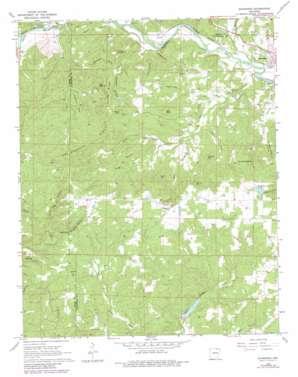
Ravenden Topo Map Arkansas
To zoom in, hover over the map of Ravenden
USGS Topo Quad 36091b3 - 1:24,000 scale
| Topo Map Name: | Ravenden |
| USGS Topo Quad ID: | 36091b3 |
| Print Size: | ca. 21 1/4" wide x 27" high |
| Southeast Coordinates: | 36.125° N latitude / 91.25° W longitude |
| Map Center Coordinates: | 36.1875° N latitude / 91.3125° W longitude |
| U.S. State: | AR |
| Filename: | o36091b3.jpg |
| Download Map JPG Image: | Ravenden topo map 1:24,000 scale |
| Map Type: | Topographic |
| Topo Series: | 7.5´ |
| Map Scale: | 1:24,000 |
| Source of Map Images: | United States Geological Survey (USGS) |
| Alternate Map Versions: |
Ravenden AR 1968, updated 1969 Download PDF Buy paper map Ravenden AR 1968, updated 1977 Download PDF Buy paper map Ravenden AR 1968, updated 1982 Download PDF Buy paper map Ravenden AR 2011 Download PDF Buy paper map Ravenden AR 2014 Download PDF Buy paper map |
1:24,000 Topo Quads surrounding Ravenden
> Back to 36091a1 at 1:100,000 scale
> Back to 36090a1 at 1:250,000 scale
> Back to U.S. Topo Maps home
Ravenden topo map: Gazetteer
Ravenden: Cliffs
Watts Bluff elevation 111m 364′Ravenden: Dams
Carl Phillips Lake Dam elevation 178m 583′Cooper Creek Site Two Dam elevation 162m 531′
Ravenden: Populated Places
Frisbee (historical) elevation 197m 646′Opposition (historical) elevation 146m 479′
Ravenden elevation 104m 341′
Ravenden: Reservoirs
Cooper Creek Site Two Reservoir elevation 162m 531′Little Joe Lake elevation 178m 583′
Ravenden: Ridges
Graveyard Ridge elevation 180m 590′Van Wagoner Ridge elevation 201m 659′
Young Ridge elevation 160m 524′
Ravenden: Springs
Wautauga Spring elevation 142m 465′Ravenden: Streams
Bates Creek elevation 95m 311′Browns Creek elevation 89m 291′
Camp Branch elevation 123m 403′
East Prong Wells Creek elevation 112m 367′
Gattis Creek elevation 99m 324′
Jeff Creek elevation 90m 295′
Oliver Creek elevation 90m 295′
Opposition Creek elevation 95m 311′
Upton Creek elevation 98m 321′
Wells Creek elevation 85m 278′
Ravenden: Summits
Bald Knob elevation 200m 656′Big Lick Hill elevation 202m 662′
Cave Hill elevation 208m 682′
Field Mountain elevation 171m 561′
Goat Shed Mountain elevation 196m 643′
Mount Olive elevation 201m 659′
Panther Hill elevation 196m 643′
Ravenden: Valleys
Amos Hollow elevation 94m 308′Ball Hollow elevation 93m 305′
Buzzard Hollow elevation 104m 341′
Buzzard Roost Canyon elevation 114m 374′
Captain Sanders Hollow elevation 136m 446′
Homestead Hollow elevation 110m 360′
Mill Hollow elevation 94m 308′
Opossum Hollow elevation 94m 308′
Wild Hog Hollow elevation 141m 462′
Ravenden digital topo map on disk
Buy this Ravenden topo map showing relief, roads, GPS coordinates and other geographical features, as a high-resolution digital map file on DVD:


