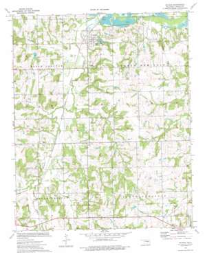
Sparks Topo Map Oklahoma
To zoom in, hover over the map of Sparks
USGS Topo Quad 35096e7 - 1:24,000 scale
| Topo Map Name: | Sparks |
| USGS Topo Quad ID: | 35096e7 |
| Print Size: | ca. 21 1/4" wide x 27" high |
| Southeast Coordinates: | 35.5° N latitude / 96.75° W longitude |
| Map Center Coordinates: | 35.5625° N latitude / 96.8125° W longitude |
| U.S. State: | OK |
| Filename: | o35096e7.jpg |
| Download Map JPG Image: | Sparks topo map 1:24,000 scale |
| Map Type: | Topographic |
| Topo Series: | 7.5´ |
| Map Scale: | 1:24,000 |
| Source of Map Images: | United States Geological Survey (USGS) |
| Alternate Map Versions: |
Sparks OK 1974, updated 1977 Download PDF Buy paper map Sparks OK 2009 Download PDF Buy paper map Sparks OK 2012 Download PDF Buy paper map Sparks OK 2016 Download PDF Buy paper map |
1:24,000 Topo Quads surrounding Sparks
> Back to 35096e1 at 1:100,000 scale
> Back to 35096a1 at 1:250,000 scale
> Back to U.S. Topo Maps home
Sparks topo map: Gazetteer
Sparks: Dams
Oknoname 08103 Dam elevation 256m 839′Quapaw Creek Site 1 Dam elevation 260m 853′
Quapaw Creek Site 2 Dam elevation 254m 833′
Quapaw Creek Site 3 Dam elevation 264m 866′
Quapaw Creek Site 4 Dam elevation 266m 872′
Quapaw Creek Site 40 Dam elevation 254m 833′
Quapaw Creek Site 42 Dam elevation 251m 823′
Quapaw Creek Site 43 Dam elevation 261m 856′
Quapaw Creek Site 44 Dam elevation 247m 810′
Quapaw Creek Site 5c Dam elevation 264m 866′
Quapaw Creek Site 6 Dam elevation 282m 925′
Quapaw Creek Site 7 Dam elevation 273m 895′
Sparks: Populated Places
Payson elevation 275m 902′Sparks elevation 260m 853′
Sparks: Reservoirs
Oknoname 08103 Reservoir elevation 256m 839′Quapaw Creek Site 1 Reservoir elevation 260m 853′
Quapaw Creek Site 2 Reservoir elevation 254m 833′
Quapaw Creek Site 3 Reservoir elevation 264m 866′
Quapaw Creek Site 4 Reservoir elevation 266m 872′
Quapaw Creek Site 40 Reservoir elevation 254m 833′
Quapaw Creek Site 42 Reservoir elevation 251m 823′
Quapaw Creek Site 43 Reservoir elevation 261m 856′
Quapaw Creek Site 44 Reservoir elevation 247m 810′
Quapaw Creek Site 5c Reservoir elevation 264m 866′
Quapaw Creek Site 6 Reservoir elevation 282m 925′
Quapaw Creek Site 7 Reservoir elevation 273m 895′
Sparks: Streams
Breakfast Creek elevation 247m 810′Clear Creek elevation 250m 820′
Hogshooter Creek elevation 244m 800′
Little Sand Creek elevation 250m 820′
Sand Creek elevation 254m 833′
Spring Creek elevation 248m 813′
Sparks digital topo map on disk
Buy this Sparks topo map showing relief, roads, GPS coordinates and other geographical features, as a high-resolution digital map file on DVD:


