Peoria Topo Map Oklahoma
To zoom in, hover over the map of Peoria
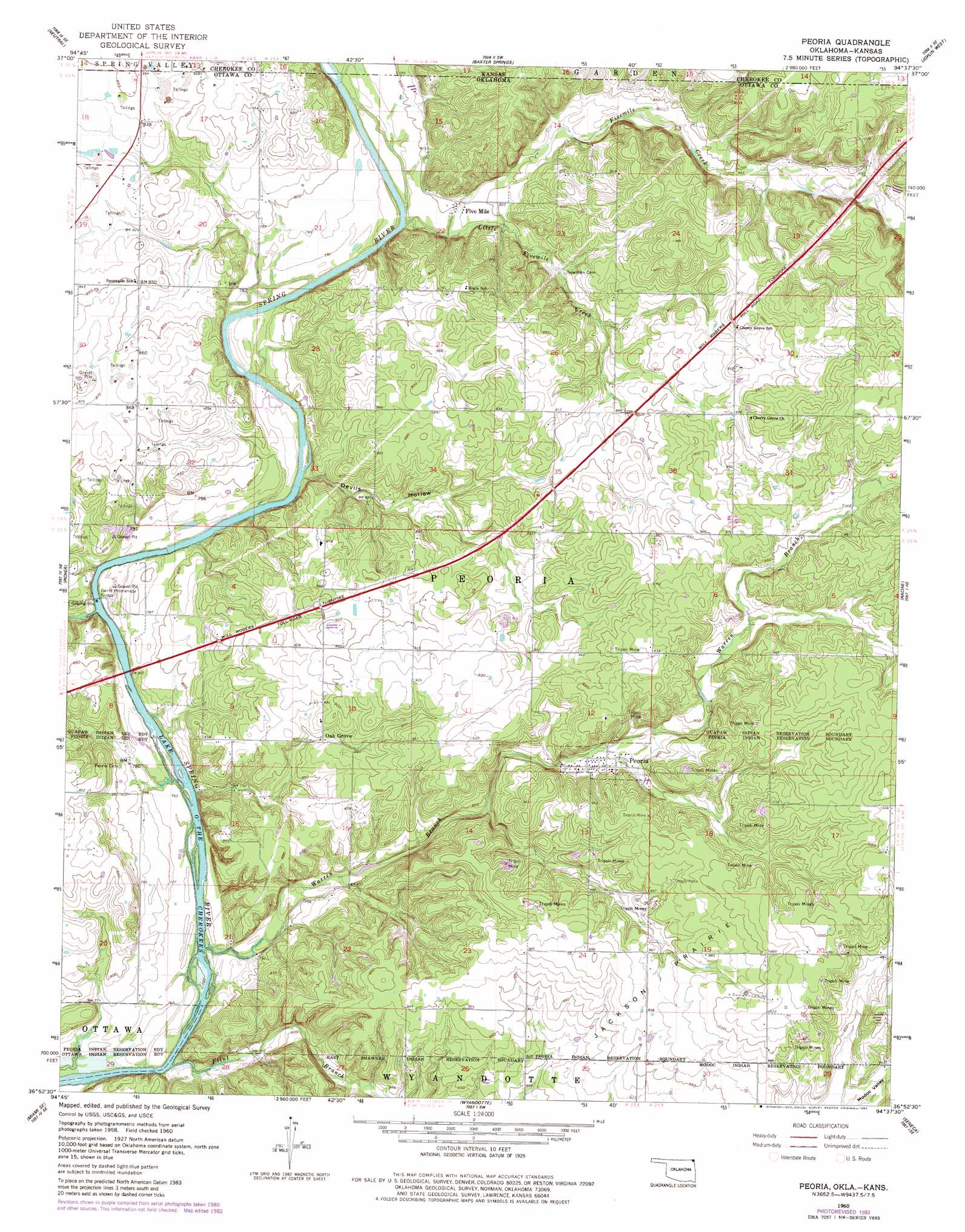
USGS Topo Quad 36094h6 - 1:24,000 scale
| Topo Map Name: | Peoria |
| USGS Topo Quad ID: | 36094h6 |
| Print Size: | ca. 21 1/4" wide x 27" high |
| Southeast Coordinates: | 36.875° N latitude / 94.625° W longitude |
| Map Center Coordinates: | 36.9375° N latitude / 94.6875° W longitude |
| U.S. States: | OK, KS |
| Filename: | o36094h6.jpg |
| Download Map JPG Image: | Peoria topo map 1:24,000 scale |
| Map Type: | Topographic |
| Topo Series: | 7.5´ |
| Map Scale: | 1:24,000 |
| Source of Map Images: | United States Geological Survey (USGS) |
| Alternate Map Versions: |
Peoria OK 1960, updated 1963 Download PDF Buy paper map Peoria OK 1960, updated 1982 Download PDF Buy paper map Peoria OK 2010 Download PDF Buy paper map Peoria OK 2012 Download PDF Buy paper map Peoria OK 2016 Download PDF Buy paper map |
1:24,000 Topo Quads surrounding Peoria
Hallowell |
Columbus |
Crestline |
Carl Junction |
Webb City |
Melrose |
Neutral |
Baxter Springs |
Joplin West |
Joplin East |
Miami Nw |
Picher |
Peoria |
Racine |
Tipton Ford |
Miami Sw |
Miami Se |
Wyandotte |
Seneca |
Neosho West |
Afton |
Afton Ne |
Cayuga |
Tiff City |
Anderson |
> Back to 36094e1 at 1:100,000 scale
> Back to 36094a1 at 1:250,000 scale
> Back to U.S. Topo Maps home
Peoria topo map: Gazetteer
Peoria: Bridges
Devils Promenade Bridge elevation 227m 744′Peoria: Populated Places
Five Mile elevation 245m 803′Oak Grove elevation 265m 869′
Peoria elevation 268m 879′
Peoria: Streams
Fivemile Creek elevation 240m 787′Fivemile Creek elevation 240m 787′
Flint Branch elevation 231m 757′
Little Fivemile Creek elevation 248m 813′
Warren Branch elevation 229m 751′
Peoria: Valleys
Devils Hollow elevation 232m 761′Peoria digital topo map on disk
Buy this Peoria topo map showing relief, roads, GPS coordinates and other geographical features, as a high-resolution digital map file on DVD: