Tipton Ford Topo Map Missouri
To zoom in, hover over the map of Tipton Ford
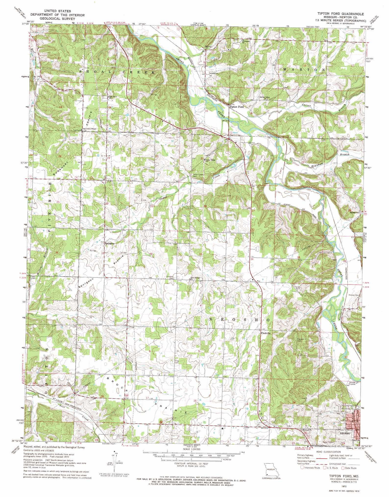
USGS Topo Quad 36094h4 - 1:24,000 scale
| Topo Map Name: | Tipton Ford |
| USGS Topo Quad ID: | 36094h4 |
| Print Size: | ca. 21 1/4" wide x 27" high |
| Southeast Coordinates: | 36.875° N latitude / 94.375° W longitude |
| Map Center Coordinates: | 36.9375° N latitude / 94.4375° W longitude |
| U.S. State: | MO |
| Filename: | o36094h4.jpg |
| Download Map JPG Image: | Tipton Ford topo map 1:24,000 scale |
| Map Type: | Topographic |
| Topo Series: | 7.5´ |
| Map Scale: | 1:24,000 |
| Source of Map Images: | United States Geological Survey (USGS) |
| Alternate Map Versions: |
Tipton Ford MO 1972, updated 1973 Download PDF Buy paper map Tipton Ford MO 2012 Download PDF Buy paper map Tipton Ford MO 2015 Download PDF Buy paper map |
1:24,000 Topo Quads surrounding Tipton Ford
Crestline |
Carl Junction |
Webb City |
Carthage |
Avilla |
Baxter Springs |
Joplin West |
Joplin East |
Fidelity |
Reeds |
Peoria |
Racine |
Tipton Ford |
Granby |
Newtonia |
Wyandotte |
Seneca |
Neosho West |
Neosho East |
Stella |
Cayuga |
Tiff City |
Anderson |
Mcnatt |
Bethpage |
> Back to 36094e1 at 1:100,000 scale
> Back to 36094a1 at 1:250,000 scale
> Back to U.S. Topo Maps home
Tipton Ford topo map: Gazetteer
Tipton Ford: Areas
Brock Prairie elevation 351m 1151′Burkhart Prairie elevation 348m 1141′
Spurgeon Prairie elevation 336m 1102′
Tipton Ford: Populated Places
Fredville elevation 345m 1131′Spurgeon elevation 321m 1053′
Tipton Ford elevation 288m 944′
Tipton Ford: Streams
Baynham Branch elevation 287m 941′Carver Branch elevation 284m 931′
Cedar Creek elevation 286m 938′
Tipton Ford digital topo map on disk
Buy this Tipton Ford topo map showing relief, roads, GPS coordinates and other geographical features, as a high-resolution digital map file on DVD: