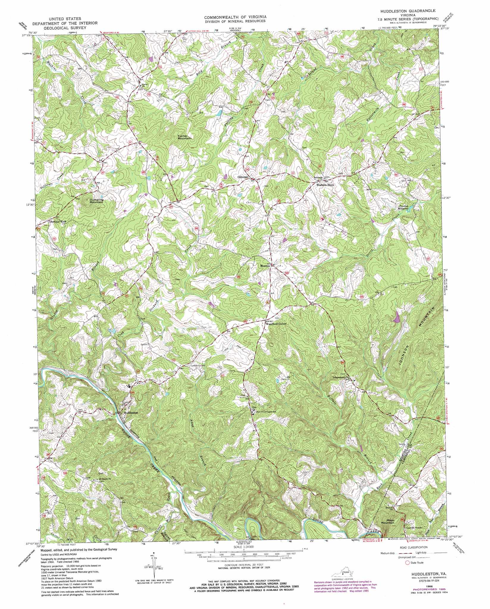
Huddleston Topo Map Virginia
To zoom in, hover over the map of Huddleston
USGS Topo Quad 37079b4 - 1:24,000 scale
| Topo Map Name: | Huddleston |
| USGS Topo Quad ID: | 37079b4 |
| Print Size: | ca. 21 1/4" wide x 27" high |
| Southeast Coordinates: | 37.125° N latitude / 79.375° W longitude |
| Map Center Coordinates: | 37.1875° N latitude / 79.4375° W longitude |
| U.S. State: | VA |
| Filename: | o37079b4.jpg |
| Download Map JPG Image: | Huddleston topo map 1:24,000 scale |
| Map Type: | Topographic |
| Topo Series: | 7.5´ |
| Map Scale: | 1:24,000 |
| Source of Map Images: | United States Geological Survey (USGS) |
| Alternate Map Versions: |
Huddleston VA 1966, updated 1968 Download PDF Buy paper map Huddleston VA 1966, updated 1986 Download PDF Buy paper map Huddleston VA 2010 Download PDF Buy paper map Huddleston VA 2013 Download PDF Buy paper map Huddleston VA 2016 Download PDF Buy paper map |
1:24,000 Topo Quads surrounding Huddleston
Montvale |
Peaks Of Otter |
Sedalia |
Boonsboro |
Lynchburg |
Irving |
Bedford |
Goode |
Forest |
City Farm |
Goodview |
Moneta |
Huddleston |
Lynch Station |
Castle Craig |
Moneta Sw |
Smith Mountain Dam |
Leesville |
Altavista |
Straightstone |
Penhook |
Sandy Level |
Pittsville |
Gretna |
Mount Airy |
> Back to 37079a1 at 1:100,000 scale
> Back to 37078a1 at 1:250,000 scale
> Back to U.S. Topo Maps home
Huddleston topo map: Gazetteer
Huddleston: Populated Places
Chestnut Fork elevation 276m 905′Gillespie elevation 288m 944′
Huddleston elevation 182m 597′
Mentow elevation 288m 944′
Woodford Corner elevation 293m 961′
Huddleston: Reservoirs
Preston Millpond elevation 220m 721′Huddleston: Streams
Amos Branch elevation 176m 577′Back Creek elevation 165m 541′
Bold Branch elevation 212m 695′
Buffalo Branch elevation 174m 570′
Buttermilk Creek elevation 192m 629′
Carter Mill Creek elevation 174m 570′
Crab Orchard Creek elevation 176m 577′
Glader Branch elevation 176m 577′
Island Branch elevation 179m 587′
Stony Fork elevation 177m 580′
Huddleston: Summits
Dumpling Mountain elevation 334m 1095′Moon Mountain elevation 295m 967′
Turner Mountain elevation 320m 1049′
Huddleston digital topo map on disk
Buy this Huddleston topo map showing relief, roads, GPS coordinates and other geographical features, as a high-resolution digital map file on DVD:
Western Virginia & Southern West Virginia
Buy digital topo maps: Western Virginia & Southern West Virginia