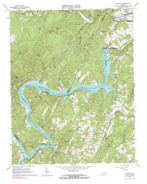
Leesville Topo Map Virginia
To zoom in, hover over the map of Leesville
USGS Topo Quad 37079a4 - 1:24,000 scale
| Topo Map Name: | Leesville |
| USGS Topo Quad ID: | 37079a4 |
| Print Size: | ca. 21 1/4" wide x 27" high |
| Southeast Coordinates: | 37° N latitude / 79.375° W longitude |
| Map Center Coordinates: | 37.0625° N latitude / 79.4375° W longitude |
| U.S. State: | VA |
| Filename: | o37079a4.jpg |
| Download Map JPG Image: | Leesville topo map 1:24,000 scale |
| Map Type: | Topographic |
| Topo Series: | 7.5´ |
| Map Scale: | 1:24,000 |
| Source of Map Images: | United States Geological Survey (USGS) |
| Alternate Map Versions: |
Leesville VA 1966, updated 1967 Download PDF Buy paper map Leesville VA 1966, updated 1984 Download PDF Buy paper map Leesville VA 1966, updated 1984 Download PDF Buy paper map Leesville VA 2010 Download PDF Buy paper map Leesville VA 2013 Download PDF Buy paper map Leesville VA 2016 Download PDF Buy paper map |
1:24,000 Topo Quads surrounding Leesville
> Back to 37079a1 at 1:100,000 scale
> Back to 37078a1 at 1:250,000 scale
> Back to U.S. Topo Maps home
Leesville topo map: Gazetteer
Leesville: Bridges
Toler Bridge elevation 184m 603′Leesville: Capes
Coles Quarter elevation 218m 715′Leesville: Dams
Leesville Dam elevation 191m 626′Leesville Dam elevation 164m 538′
Meyer Dam elevation 240m 787′
Leesville: Populated Places
Brights elevation 267m 875′Browntown elevation 264m 866′
Leesville elevation 176m 577′
Mount Airy elevation 263m 862′
Leesville: Reservoirs
Leesville Lake elevation 164m 538′Leesville Reservoir elevation 191m 626′
Swine Lake elevation 240m 787′
Leesville: Streams
Cedar Branch elevation 186m 610′Clay Branch elevation 184m 603′
Cliff Creek elevation 184m 603′
Goose Creek elevation 163m 534′
Howell Creek elevation 184m 603′
Jasper Creek elevation 184m 603′
Kemp Creek elevation 186m 610′
Long Branch elevation 184m 603′
McDaniels Creek elevation 170m 557′
Meadow Branch elevation 184m 603′
Mill Creek elevation 184m 603′
Muddy Run elevation 184m 603′
Myers Creek elevation 184m 603′
Old Womans Creek elevation 184m 603′
Pigg River elevation 184m 603′
Plum Tree Branch elevation 163m 534′
Rocky Branch elevation 185m 606′
Rorer Creek elevation 184m 603′
Stony Creek elevation 184m 603′
Terrapin Creek elevation 184m 603′
Wooding Branch elevation 164m 538′
Leesville: Summits
Bald Knob elevation 269m 882′Flint Hill elevation 289m 948′
King George Mountain elevation 259m 849′
Stone Road Mountain elevation 315m 1033′
Leesville digital topo map on disk
Buy this Leesville topo map showing relief, roads, GPS coordinates and other geographical features, as a high-resolution digital map file on DVD:
Western Virginia & Southern West Virginia
Buy digital topo maps: Western Virginia & Southern West Virginia


