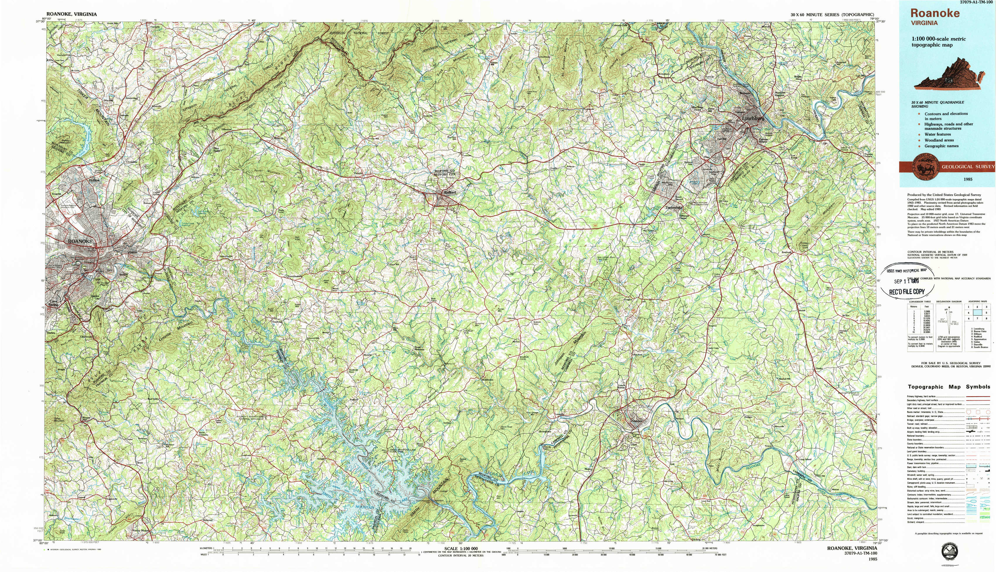
Roanoke Topo Map Virginia
To zoom in, hover over the map of Roanoke
USGS Topo Map 37079a1 - 1:100,000 scale
| Topo Map Name: | Roanoke |
| USGS Topo Quad ID: | 37079a1 |
| Print Size: | ca. 39" wide x 24" high |
| Southeast Coordinates: | 37° N latitude / 79° W longitude |
| Map Center Coordinates: | 37.25° N latitude / 79.5° W longitude |
| U.S. State: | VA |
| Filename: | 37079a1.jpg |
| Download Map JPG Image: | Roanoke topo map 1:100,000 scale |
| Map Type: | Topographic |
| Topo Series: | 30´x60´ |
| Map Scale: | 1:100,000 |
| Source of Map Images: | United States Geological Survey (USGS) |
| Alternate Map Versions: |
Roanoke VA 1985, updated 1986 Download PDF Buy paper map Roanoke VA 1985, updated 1989 Download PDF Buy paper map |
1:100,000 Topos surrounding Roanoke
Lewisburg |
Buena Vista |
Dillwyn |
Radford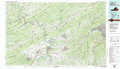 |
Roanoke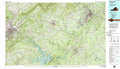 |
Appomattox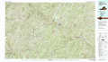 |
Galax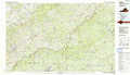 |
Danville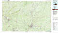 |
South Boston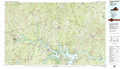 |
> Back to 37078a1 at 1:250,000 scale
> Back to U.S. Topo Maps home
1:24,000 Topo Quads covered by the spatial extent of this 100k map (Roanoke)
|
Daleville 
|
Villamont 
|
Montvale 
|
Peaks Of Otter 
|
Sedalia 
|
Boonsboro 
|
Lynchburg 
|
Kelly 
|
|
Roanoke 
|
Stewartsville 
|
Irving 
|
Bedford 
|
Goode 
|
Forest 
|
City Farm 
|
Rustburg 
|
|
Garden City 
|
Hardy 
|
Goodview 
|
Moneta 
|
Huddleston 
|
Lynch Station 
|
Castle Craig 
|
Gladys 
|
|
Boones Mill 
|
Redwood 
|
Moneta Sw 
|
Smith Mountain Dam 
|
Leesville 
|
Altavista 
|
Straightstone 
|
Long Island 
|