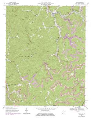
Gary Topo Map West Virginia
To zoom in, hover over the map of Gary
USGS Topo Quad 37081c5 - 1:24,000 scale
| Topo Map Name: | Gary |
| USGS Topo Quad ID: | 37081c5 |
| Print Size: | ca. 21 1/4" wide x 27" high |
| Southeast Coordinates: | 37.25° N latitude / 81.5° W longitude |
| Map Center Coordinates: | 37.3125° N latitude / 81.5625° W longitude |
| U.S. States: | WV, VA |
| Filename: | o37081c5.jpg |
| Download Map JPG Image: | Gary topo map 1:24,000 scale |
| Map Type: | Topographic |
| Topo Series: | 7.5´ |
| Map Scale: | 1:24,000 |
| Source of Map Images: | United States Geological Survey (USGS) |
| Alternate Map Versions: |
Gary WV 1967, updated 1971 Download PDF Buy paper map Gary WV 1967, updated 1978 Download PDF Buy paper map Gary WV 2001, updated 2003 Download PDF Buy paper map Gary WV 2011 Download PDF Buy paper map Gary WV 2014 Download PDF Buy paper map Gary WV 2016 Download PDF Buy paper map |
1:24,000 Topo Quads surrounding Gary
> Back to 37081a1 at 1:100,000 scale
> Back to 37080a1 at 1:250,000 scale
> Back to U.S. Topo Maps home
Gary topo map: Gazetteer
Gary: Gaps
Maxwell Gap elevation 740m 2427′Gary: Populated Places
Alpheus elevation 433m 1420′Elbert elevation 467m 1532′
Filbert elevation 525m 1722′
Gary elevation 430m 1410′
Newhall elevation 480m 1574′
Ream elevation 468m 1535′
Thorpe elevation 438m 1437′
Venus elevation 444m 1456′
Gary: Post Offices
Cucumber Post Office elevation 474m 1555′Newhall Post Office elevation 480m 1574′
Gary: Streams
Adkin Branch elevation 428m 1404′Belcher Branch elevation 430m 1410′
Cucumber Creek elevation 483m 1584′
Dauss Fork elevation 585m 1919′
Dog Fork elevation 490m 1607′
Duskins Branch elevation 499m 1637′
Harmon Branch elevation 441m 1446′
Left Fork Mill Creek elevation 459m 1505′
Left Fork Sandlick Creek elevation 464m 1522′
Leslie Branch elevation 447m 1466′
Long Branch elevation 478m 1568′
Open Fork elevation 515m 1689′
Right Fork Sandlick Creek elevation 444m 1456′
Sandlick Creek elevation 428m 1404′
Split Fork elevation 502m 1646′
Split Tree Branch elevation 518m 1699′
Turnhole Branch elevation 435m 1427′
Upper Trace Fork elevation 463m 1519′
Gary digital topo map on disk
Buy this Gary topo map showing relief, roads, GPS coordinates and other geographical features, as a high-resolution digital map file on DVD:
Western Virginia & Southern West Virginia
Buy digital topo maps: Western Virginia & Southern West Virginia


