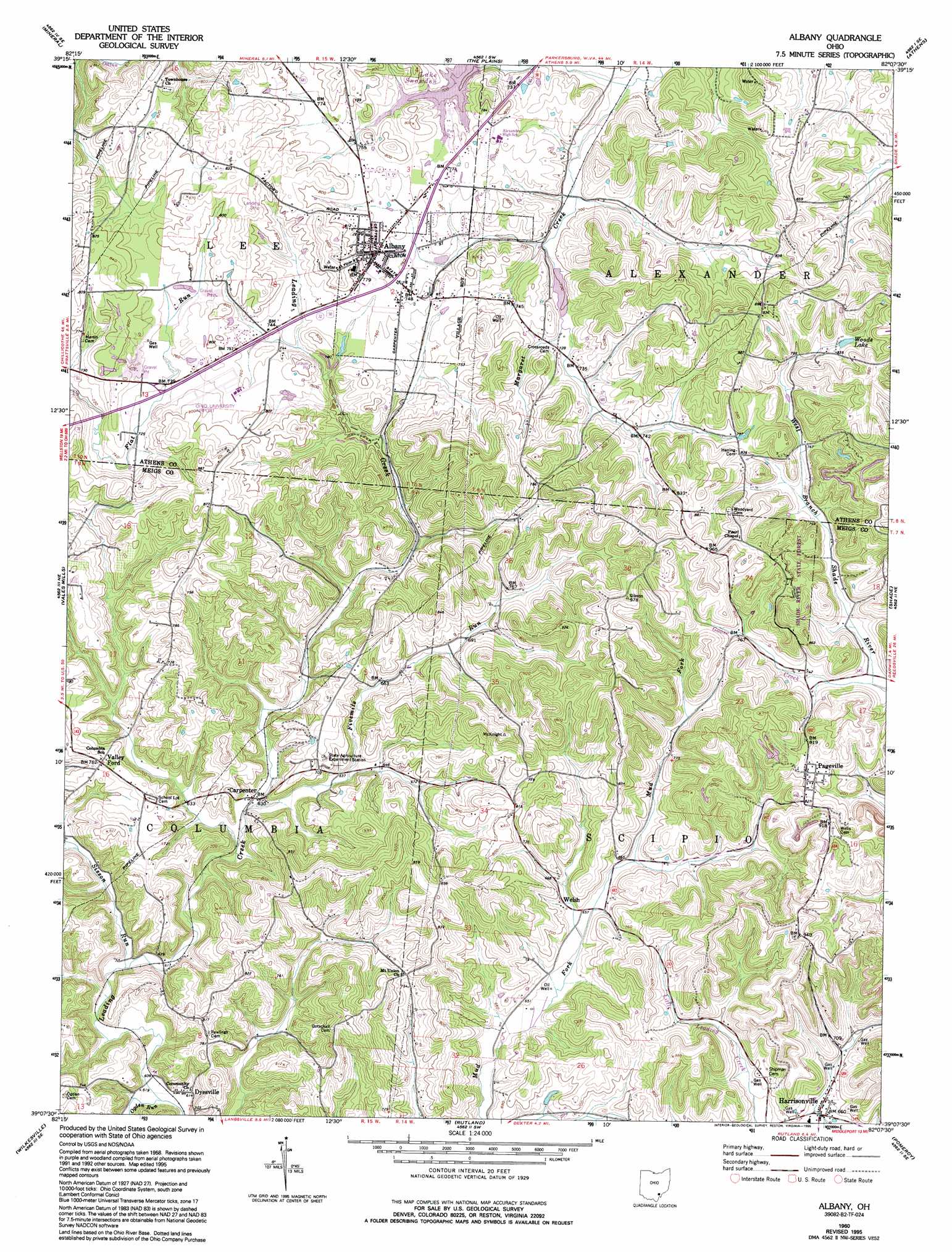
Albany Topo Map Ohio
To zoom in, hover over the map of Albany
USGS Topo Quad 39082b2 - 1:24,000 scale
| Topo Map Name: | Albany |
| USGS Topo Quad ID: | 39082b2 |
| Print Size: | ca. 21 1/4" wide x 27" high |
| Southeast Coordinates: | 39.125° N latitude / 82.125° W longitude |
| Map Center Coordinates: | 39.1875° N latitude / 82.1875° W longitude |
| U.S. State: | OH |
| Filename: | o39082b2.jpg |
| Download Map JPG Image: | Albany topo map 1:24,000 scale |
| Map Type: | Topographic |
| Topo Series: | 7.5´ |
| Map Scale: | 1:24,000 |
| Source of Map Images: | United States Geological Survey (USGS) |
| Alternate Map Versions: |
Albany OH 1960, updated 1961 Download PDF Buy paper map Albany OH 1960, updated 1970 Download PDF Buy paper map Albany OH 1960, updated 1976 Download PDF Buy paper map Albany OH 1960, updated 1995 Download PDF Buy paper map Albany OH 2010 Download PDF Buy paper map Albany OH 2013 Download PDF Buy paper map Albany OH 2016 Download PDF Buy paper map |
1:24,000 Topo Quads surrounding Albany
New Plymouth |
Union Furnace |
Nelsonville |
Jacksonville |
Amesville |
Zaleski |
Mineral |
The Plains |
Athens |
Stewart |
Mcarthur |
Vales Mills |
Albany |
Shade |
Alfred |
Mulga |
Wilkesville |
Rutland |
Pomeroy |
Chester |
Rio Grande |
Vinton |
Addison |
Cheshire |
New Haven |
> Back to 39082a1 at 1:100,000 scale
> Back to 39082a1 at 1:250,000 scale
> Back to U.S. Topo Maps home
Albany topo map: Gazetteer
Albany: Airports
Ohio University Airport elevation 232m 761′Albany: Dams
Margaret Creek Watershed Project Number One Dam elevation 217m 711′Albany: Lakes
Woods Lake elevation 256m 839′Albany: Populated Places
Albany elevation 231m 757′Carpenter elevation 191m 626′
Dyesville elevation 189m 620′
Harrisonville elevation 202m 662′
Pageville elevation 247m 810′
Valley Ford elevation 228m 748′
Welsh elevation 198m 649′
Albany: Post Offices
Albany Post Office elevation 231m 757′Carpenter Post Office (historical) elevation 189m 620′
Dyesville Post Office (historical) elevation 186m 610′
Harrisonville Post Office elevation 203m 666′
Valleyford Post Office (historical) elevation 229m 751′
Welsh Post Office (historical) elevation 201m 659′
Albany: Reservoirs
Lake Snowden elevation 219m 718′Albany: Streams
Fivemile Run elevation 189m 620′Goose Creek elevation 221m 725′
North Branch Margaret Creek elevation 204m 669′
Ogden Run elevation 182m 597′
Sisson Run elevation 185m 606′
Albany digital topo map on disk
Buy this Albany topo map showing relief, roads, GPS coordinates and other geographical features, as a high-resolution digital map file on DVD:
 map DVD")