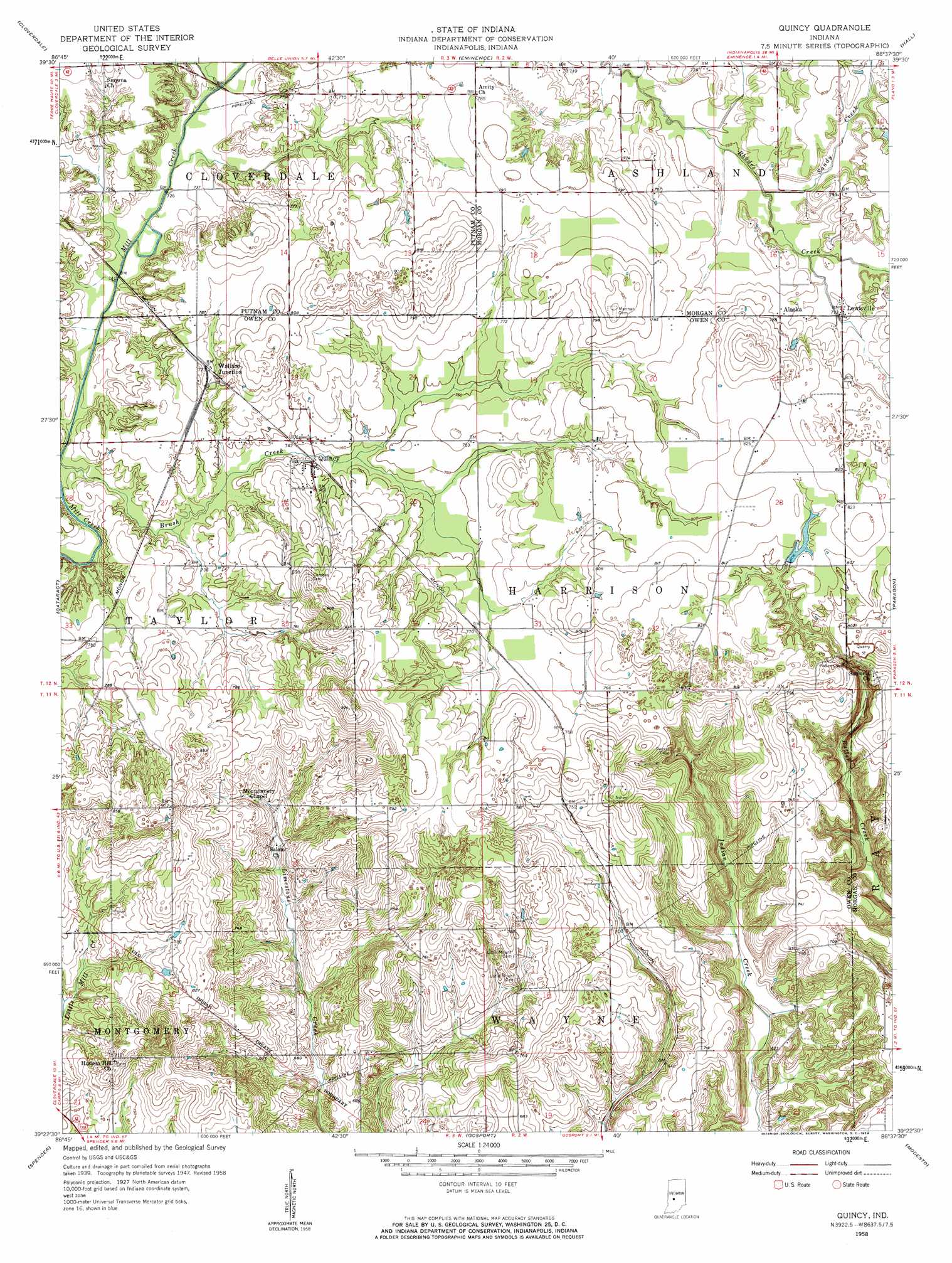
Quincy Topo Map Indiana
To zoom in, hover over the map of Quincy
USGS Topo Quad 39086d6 - 1:24,000 scale
| Topo Map Name: | Quincy |
| USGS Topo Quad ID: | 39086d6 |
| Print Size: | ca. 21 1/4" wide x 27" high |
| Southeast Coordinates: | 39.375° N latitude / 86.625° W longitude |
| Map Center Coordinates: | 39.4375° N latitude / 86.6875° W longitude |
| U.S. State: | IN |
| Filename: | o39086d6.jpg |
| Download Map JPG Image: | Quincy topo map 1:24,000 scale |
| Map Type: | Topographic |
| Topo Series: | 7.5´ |
| Map Scale: | 1:24,000 |
| Source of Map Images: | United States Geological Survey (USGS) |
| Alternate Map Versions: |
Quincy IN 1949 Download PDF Buy paper map Quincy IN 1958, updated 1959 Download PDF Buy paper map Quincy IN 1958, updated 1959 Download PDF Buy paper map Quincy IN 2010 Download PDF Buy paper map Quincy IN 2013 Download PDF Buy paper map Quincy IN 2016 Download PDF Buy paper map |
1:24,000 Topo Quads surrounding Quincy
Clinton Falls |
Greencastle |
Coatesville |
Clayton |
Plainfield |
Reelsville |
Cloverdale |
Eminence |
Hall |
Mooresville West |
Poland |
Cataract |
Quincy |
Paragon |
Martinsville |
Patricksburg |
Spencer |
Gosport |
Modesto |
Hindustan |
Arney |
Freedom |
Whitehall |
Bloomington |
Unionville |
> Back to 39086a1 at 1:100,000 scale
> Back to 39086a1 at 1:250,000 scale
> Back to U.S. Topo Maps home
Quincy topo map: Gazetteer
Quincy: Airports
Shenandoah Flying Field Airport elevation 226m 741′Quincy: Dams
Ellis Lake Dam elevation 249m 816′Maxine Lake Dam elevation 240m 787′
Quincy: Populated Places
Alaska elevation 240m 787′Lewisville elevation 235m 770′
Quincy elevation 225m 738′
Wallace Junction elevation 235m 770′
Quincy: Reservoirs
Lake Maxine elevation 240m 787′Quincy: Streams
Brush Creek elevation 220m 721′Higgins Branch elevation 220m 721′
Sandy Branch elevation 228m 748′
Quincy digital topo map on disk
Buy this Quincy topo map showing relief, roads, GPS coordinates and other geographical features, as a high-resolution digital map file on DVD:
Northern Illinois, Northern Indiana & Southwestern Michigan
Buy digital topo maps: Northern Illinois, Northern Indiana & Southwestern Michigan