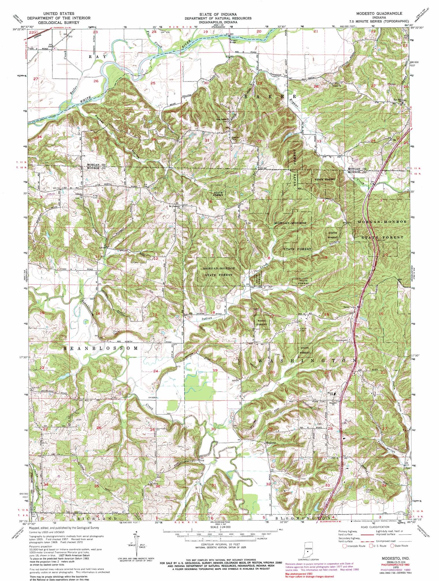
Modesto Topo Map Indiana
To zoom in, hover over the map of Modesto
USGS Topo Quad 39086c5 - 1:24,000 scale
| Topo Map Name: | Modesto |
| USGS Topo Quad ID: | 39086c5 |
| Print Size: | ca. 21 1/4" wide x 27" high |
| Southeast Coordinates: | 39.25° N latitude / 86.5° W longitude |
| Map Center Coordinates: | 39.3125° N latitude / 86.5625° W longitude |
| U.S. State: | IN |
| Filename: | o39086c5.jpg |
| Download Map JPG Image: | Modesto topo map 1:24,000 scale |
| Map Type: | Topographic |
| Topo Series: | 7.5´ |
| Map Scale: | 1:24,000 |
| Source of Map Images: | United States Geological Survey (USGS) |
| Alternate Map Versions: |
Modesto IN 1957, updated 1958 Download PDF Buy paper map Modesto IN 1957, updated 1968 Download PDF Buy paper map Modesto IN 1970, updated 1972 Download PDF Buy paper map Modesto IN 1970, updated 1981 Download PDF Buy paper map Modesto IN 1970, updated 1989 Download PDF Buy paper map Modesto IN 1998, updated 2002 Download PDF Buy paper map Modesto IN 2010 Download PDF Buy paper map Modesto IN 2013 Download PDF Buy paper map Modesto IN 2016 Download PDF Buy paper map |
1:24,000 Topo Quads surrounding Modesto
Cloverdale |
Eminence |
Hall |
Mooresville West |
Mooresville East |
Cataract |
Quincy |
Paragon |
Martinsville |
Cope |
Spencer |
Gosport |
Modesto |
Hindustan |
Morgantown |
Freedom |
Whitehall |
Bloomington |
Unionville |
Belmont |
Solsberry |
Stanford |
Clear Creek |
Allens Creek |
Elkinsville |
> Back to 39086a1 at 1:100,000 scale
> Back to 39086a1 at 1:250,000 scale
> Back to U.S. Topo Maps home
Modesto topo map: Gazetteer
Modesto: Bridges
Paragon Bridge elevation 171m 561′Modesto: Dams
Henke Lake Dam elevation 184m 603′Paragon Lake Dam elevation 188m 616′
Modesto: Forests
Morgan-Monroe State Forest elevation 241m 790′Modesto: Populated Places
Modesto elevation 188m 616′Wayport elevation 239m 784′
Modesto: Reservoirs
Henke Lake elevation 184m 603′Paragon Lake elevation 188m 616′
Modesto: Streams
Bryant Creek elevation 171m 561′Butler Creek elevation 171m 561′
Fall Creek elevation 173m 567′
Indian Creek elevation 171m 561′
Modesto: Valleys
Fox Hollow elevation 185m 606′Payne Hollow elevation 188m 616′
Pocket Hollow elevation 171m 561′
Modesto digital topo map on disk
Buy this Modesto topo map showing relief, roads, GPS coordinates and other geographical features, as a high-resolution digital map file on DVD:
Northern Illinois, Northern Indiana & Southwestern Michigan
Buy digital topo maps: Northern Illinois, Northern Indiana & Southwestern Michigan